Rural Municipality of Arlington No. 79
| Arlington No. 79, Saskatchewan | |
|---|---|
| Rural Municipality | |
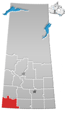
 Location of Arlington No. 79 in Saskatchewan | |
| Coordinates: 49°23′24″N 109°15′00″W / 49.390°N 109.250°WCoordinates: 49°23′24″N 109°15′00″W / 49.390°N 109.250°W | |
| Country | Canada |
| Province | Saskatchewan |
| Region | Southwest Saskatchewan |
| Census division | 4 |
| Government[1] | |
| • Governing body | Arlington No. 79 Council |
| • Municipal seat | Shaunavon |
| • Reeve | Donald L. Lundberg |
| • Administrator | Richard E. Goulet |
| Population (2006) | |
| • Total | 413 |
| • Density | 0.5/km2 (1/sq mi) |
| • Dwellings | 128 |
| Time zone | UTC-6 (UTC) |
| Area code(s) | 306 |
| Highways |
Highway 13 Highway 613 Highway 633 Highway 724 |
| Waterways |
Lawrence Lake Jones Creek Swift Current Creek Eastend Coulee Rock Creek |
| Website | mds.gov.sk.ca |
Arlington No. 79 is a rural municipality in the Canadian province of Saskatchewan, located in the southwestern region of the province east of Shaunavon. The seat of the municipality is located in Shaunavon due to such a small population.
Demographics
According to the Canada 2006 Census, the Rural municipality had a population of 413 in 128 dwellings, an 11.3% increase from 2001. On a surface of 846.79 km² it has a density of 0.5 inhabitants/km².[2]
Communities
The following communities are located in this municipality:
Hamlets
Transportation
The following is a list of Saskatchewan highways and provincial roads, and communities that the highways pass through, within the municipality of Arlington.
| Highway | Starting point | Communities of RM of Reno along the way | Ending Point |
|---|---|---|---|
| Highway 13 | Alberta Highway 501 | Dollard | Manitoba Highway 3 |
| Highway 613 | Highway 724 | Dollard | Highway 18 |
| Highway 633 | Tompkins | South Fork | Saskatchewan Highway 13 |
| Highway 724 | Highway 614 | Highway 37 | |
See also
References
- ↑ Official website http://www.mds.gov.sk.ca/apps/Pub/MDS/muniDetails.aspx?cat=10&mun=2311
- ↑ 2006 Community Profiles http://www12.statcan.ca/english/census06/data/profiles/community/Details/Page.cfm?B1=All&Code1=4704038&Code2=47&Custom=&Data=Count&Geo1=CSD&Geo2=PR&Lang=E&SearchPR=01&SearchText=Arlingto+No.+79&SearchType=Begins
External links
This article is issued from
Wikipedia.
The text is licensed under Creative Commons - Attribution - Sharealike.
Additional terms may apply for the media files.