Piapot, Saskatchewan
| Piapot | |
|---|---|
| Hamlet | |
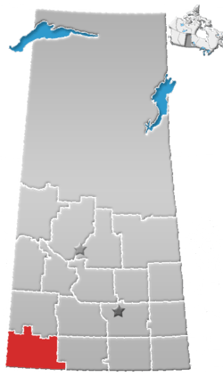
 Location of Piapot in Saskatchewan  Piapot, Saskatchewan (Canada) | |
| Coordinates: 49°59′20″N 109°07′16″W / 49.989°N 109.121°W | |
| Country | Canada |
| Province | Saskatchewan |
| Region | Saskatchewan |
| Census division | 4 |
| Rural Municipality | Piapot |
| Post office Founded | N/A |
| UnIncorporated | N/A |
| Previously Incorporated (Town) | 1908 |
| Government | |
| • Mayor | N/A |
| • Town Manager | N/A |
| • Governing body | Rural Municipality of Piapot |
| Area | |
| • Total | 0.74 km2 (0.29 sq mi) |
| Population (2016) | |
| • Total | 50 |
| • Density | 67.9/km2 (176/sq mi) |
| Time zone | CST |
| Postal code | S0N 1Y0 |
| Area code(s) | 306 |
| Highways |
Highway 614 Highway 1 |
| Railways | Canadian Pacific Railway |
| [1][2][3][4] | |
Piapot (/ˈpaɪəpɒt/) is a hamlet within the Rural Municipality of Piapot No. 110, Saskatchewan, Canada. Listed as a designated place by Statistics Canada, the hamlet had a population of 50 in the Canada 2016 Census.[5]
Once a thriving community, it has seen a steady decline since the 1950s and in the present day it resembles a ghost town. The hotel and saloon closed in 2006 but reopened in May 2008, embracing western heritage and culture. The Piapot Saloon and Guesthouse offers an escape from everyday life in the spirit of the original settlers as well as a gift shop and old western saloon. The only other business that is open to the public is the post office.
Demographics
| Canada census – Piapot, Saskatchewan community profile | |||
|---|---|---|---|
| 2016 | 2011 | ||
| Population: | 50 (- 9.1% from 2011) | 55 (+ 22.2% from 2006) | |
| Land area: | 0.74 km2 (0.29 sq mi) | 0.74 km2 (0.29 sq mi) | |
| Population density: | 67.9/km2 (176/sq mi) | 74.7/km2 (193/sq mi) | |
| Median age: | 51.0 (M: 56.0, F: 46.5) | 47.5 (M: 50.2, F: 44.0) | |
| Total private dwellings: | 37 | 33 | |
| Median household income: | $NA | ||
| References: 2016[6] 2011[7] earlier[8] | |||
See also
References
- ↑ National Archives, Archivia Net, Post Offices and Postmasters
- ↑ Government of Saskatchewan, MRD Home, Municipal Directory System, archived from the original on November 21, 2008
- ↑ Canadian Textiles Institute. (2005), CTI Determine your provincial constituency, archived from the original on 2007-09-11
- ↑ Commissioner of Canada Elections, Chief Electoral Officer of Canada (2005), Elections Canada On-line
- ↑ Canada 2016 Census: Designated places in Saskatchewan
- ↑ "2016 Community Profiles". Canada 2016 Census. Statistics Canada. February 21, 2017.
- ↑ "2011 Community Profiles". Canada 2011 Census. Statistics Canada. July 5, 2013.
- ↑ "2001 Community Profiles". Canada 2001 Census. Statistics Canada. February 17, 2012.
External links
Places adjacent to Piapot, Saskatchewan | ||||||||||
|---|---|---|---|---|---|---|---|---|---|---|
| ||||||||||
| Subdivisions | |
|---|---|
| Communities | |
| Cities | |
| Topics |
|
| |
This article is issued from
Wikipedia.
The text is licensed under Creative Commons - Attribution - Sharealike.
Additional terms may apply for the media files.