Instow, Saskatchewan
| Instow | |
|---|---|
| Unincorporated community | |
 Instow  Instow | |
| Coordinates: 49°22′26″N 109°16′45″W / 49.37402°N 109.27925°W | |
| Country | Canada |
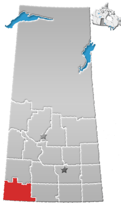
| Province | Saskatchewan |
| Region | Southwest |
| Census division | 4 |
| Rural Municipality | Bone Creek |
| Established | 1914 |
| Incorporated (Village) | 1923 |
| Dissolved | January 1, 1951 |
| Government | |
| • Governing body | Bone Creek No. 108 [1] |
| • Reeve | Ben Lewans |
| • Administrator | Rhonda Bellefeuille |
| • MP | David L. Anderson |
| • MLA | Wayne Elhard |
| Area | |
| • Total | 0.00 km2 (0.00 sq mi) |
| Population (2006) | |
| • Total | 0 |
| • Density | 0.0/km2 (0/sq mi) |
| Time zone | CST |
| Postal code | S0N 2M0 |
| Area code(s) | 306 |
| Highways | Highway 13 |
| Railway | Canadian Pacific Railway |
| [2][3][4][5] | |
Instow is an unincorporated community within the Rural Municipality of Bone Creek No. 108, Saskatchewan, Canada. The community is located on Highway 13 also known as the historic Red Coat Trail, about 10 km northeast of the town of Shaunavon.
Demographics
Instow, like so many other small farming communities throughout Saskatchewan, has struggled to maintain a sturdy population causing Instow to become a complete ghost town with few to no residents. Prior to January 1, 2002, Instow was incorporated under village status, but was dissolved into an unincorporated community under the jurisdiction of the Rural municipality of Bone Creek on that date.[6]
In 2006, Instow had a population of 1 living in 1 dwellings, a 0% decrease from 2001. The village had a land area of 0 km2 (0 sq mi) and a population density of 0/km2 (0/sq mi).
History
Early years
Instow was once a small community founded in 1914 with the building of the Canadian Pacific Railway. C. Herbert, the first post master and founder of the small community, decided to name it after the small town of Instow, England, where he was originally from. During Instow’s boom years in 1923 the town grew to a peak of 60 citizens and was incorporated to village status. After incorporation, streetlights were installed throughout the village, a well, sidewalks, a skating rink, a seven-metre snow slide for winter sports and a ball diamond were built. The village even had a its very own fire engine, two general stores, a restaurant, a bank, a livery barn, a lumberyard, a community hall, an implement agency, a post office, a garage, a telephone office, a blacksmith, a pool hall, and a total of 5 grain elevators.
Decline
In 1951 Instow’s Village Council decided it would be best for the village to dissolve into an unincorporated community due to the rapid decline in its population. The community was struck once again with the closure of the post office in 1963. Over time many of the buildings in Instow have either been moved, demolished or simply rotted away, leaving nothing to very little of the community remaining remaining.[7]
See also
References
- ↑ Bone Creek No. 108
- ↑ National Archives, Archivia Net, Post Offices and Postmasters, archived from the original on 2006-10-06
- ↑ Government of Saskatchewan, MRD Home, Municipal Directory System, archived from the original on November 21, 2008
- ↑ Canadian Textiles Institute. (2005), CTI Determine your provincial constituency, archived from the original on 2007-09-11
- ↑ Commissioner of Canada Elections, Chief Electoral Officer of Canada (2005), Elections Canada On-line, archived from the original on 2007-04-21
- ↑ "Covered population 2002" (PDF). Saskatchewan Health. Retrieved 2008-04-17.
- ↑
Places adjacent to Instow, Saskatchewan | |
|---|---|
| Subdivisions | |
|---|---|
| Communities | |
| Cities | |
| Topics |
|
| |
Coordinates: 49°13′19″N 109°10′12″W / 49.222°N 109.170°W