Yampa, Colorado
Yampa is a statutory town in Routt County, Colorado, United States. The population was 429 at the 2010 census.
Town of Yampa, Colorado | |
|---|---|
.JPG) Moffat Avenue in Yampa. | |
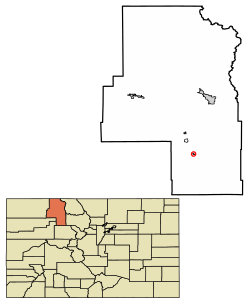 Location of Yampa in Routt County, Colorado. | |
| Coordinates: 40°9′12″N 106°54′30″W | |
| Country | |
| State | |
| County[1] | Routt County |
| Incorporated | February 25, 1907[2] |
| Government | |
| • Type | Statutory Town[1] |
| Area | |
| • Total | 0.24 sq mi (0.62 km2) |
| • Land | 0.24 sq mi (0.62 km2) |
| • Water | 0.00 sq mi (0.00 km2) |
| Elevation | 7,881 ft (2,402 m) |
| Population (2010) | |
| • Total | 429 |
| • Estimate (2018)[5] | 464 |
| • Density | 1,854.77/sq mi (716.87/km2) |
| Time zone | UTC-7 (Mountain (MST)) |
| • Summer (DST) | UTC-6 (MDT) |
| ZIP code[6] | 80483 (PO Box) |
| Area code(s) | 970 |
| FIPS code | 08-86475 |
| GNIS feature ID | 0173064 |
| Website | www |
Geography
Yampa is at 40°9′12″N 106°54′30″W (40.153250, -106.908437).[7]
According to the United States Census Bureau, the town has a total area of 0.2 square miles (0.52 km2), all of it land.
Climate
Yampa has a humid continental climate (Köppen climate classification Dfb), with warm summers and long, cold, snowy winters. Due to altitude and dryness, the diurnal temperature variation is large throughout the year, especially in summer, and the growing season is short, typically averaging just 80 days.[8]
| Climate data for Yampa, Colorado (1981–2010 normals) | |||||||||||||
|---|---|---|---|---|---|---|---|---|---|---|---|---|---|
| Month | Jan | Feb | Mar | Apr | May | Jun | Jul | Aug | Sep | Oct | Nov | Dec | Year |
| Average high °F (°C) | 31.2 (−0.4) |
34.3 (1.3) |
41.7 (5.4) |
51.5 (10.8) |
61.4 (16.3) |
71.3 (21.8) |
77.4 (25.2) |
75.7 (24.3) |
68.2 (20.1) |
56.1 (13.4) |
40.8 (4.9) |
31.2 (−0.4) |
53.4 (11.9) |
| Daily mean °F (°C) | 19.2 (−7.1) |
21.5 (−5.8) |
29.2 (−1.6) |
37.8 (3.2) |
47.0 (8.3) |
55.4 (13.0) |
61.8 (16.6) |
60.4 (15.8) |
52.7 (11.5) |
41.7 (5.4) |
28.8 (−1.8) |
19.7 (−6.8) |
39.7 (4.3) |
| Average low °F (°C) | 7.1 (−13.8) |
8.8 (−12.9) |
16.7 (−8.5) |
24.1 (−4.4) |
32.5 (0.3) |
39.6 (4.2) |
46.2 (7.9) |
45.2 (7.3) |
37.2 (2.9) |
27.2 (−2.7) |
16.7 (−8.5) |
8.1 (−13.3) |
25.9 (−3.4) |
| Average precipitation inches (mm) | 1.24 (31) |
1.13 (29) |
1.31 (33) |
1.55 (39) |
1.43 (36) |
1.32 (34) |
1.71 (43) |
1.71 (43) |
1.55 (39) |
1.31 (33) |
1.35 (34) |
1.22 (31) |
16.73 (425) |
| Average snowfall inches (cm) | 22.3 (57) |
18.6 (47) |
18.3 (46) |
14.7 (37) |
3.5 (8.9) |
0.3 (0.76) |
0 (0) |
0 (0) |
0.8 (2.0) |
6.7 (17) |
19.9 (51) |
21.3 (54) |
125.3 (318) |
| Average precipitation days (≥ 0.01 in) | 11 | 9 | 10 | 10 | 10 | 8 | 10 | 11 | 9 | 9 | 10 | 11 | 115 |
| Average snowy days (≥ 0.1 in) | 11 | 9 | 9 | 6 | 2 | 0 | 0 | 0 | 1 | 3 | 9 | 10 | 60 |
| Source: NOAA [9] | |||||||||||||
City name
Yampa is the Northern Ute word for the Perideridia root, which was an important food source.
Demographics
As of the census[10] of 2000, there were 443 people, 187 households, and 121 families residing in the town. The population density was 1,916.7 inhabitants per square mile (740.0/km2). There were 211 housing units at an average density of 912.9 per square mile (352.5/km2). The racial makeup of the town was 96.39% White, 0.23% African American, 1.13% Native American, 0.23% Pacific Islander, 0.90% from other races, and 1.13% from two or more races. Hispanic or Latino of any race were 4.51% of the population.
| Historical population | |||
|---|---|---|---|
| Census | Pop. | %± | |
| 1910 | 332 | — | |
| 1920 | 200 | −39.8% | |
| 1930 | 310 | 55.0% | |
| 1940 | 426 | 37.4% | |
| 1950 | 421 | −1.2% | |
| 1960 | 312 | −25.9% | |
| 1970 | 286 | −8.3% | |
| 1980 | 472 | 65.0% | |
| 1990 | 317 | −32.8% | |
| 2000 | 443 | 39.7% | |
| 2010 | 429 | −3.2% | |
| Est. 2018 | 464 | [5] | 8.2% |
| U.S. Decennial Census[11] | |||
There were 187 households out of which 35.3% had children under the age of 18 living with them, 55.1% were married couples living together, 5.3% had a female householder with no husband present, and 34.8% were non-families. 29.4% of all households were made up of individuals and 5.9% had someone living alone who was 65 years of age or older. The average household size was 2.37 and the average family size was 2.94.
In the town, the population was spread out with 26.4% under the age of 18, 6.8% from 18 to 24, 28.7% from 25 to 44, 30.5% from 45 to 64, and 7.7% who were 65 years of age or older. The median age was 38 years. For every 100 females, there were 118.2 males. For every 100 females age 18 and over, there were 118.8 males.
The median income for a household in the town was $37,500, and the median income for a family was $45,000. Males had a median income of $37,000 versus $20,625 for females. The per capita income for the town was $21,141. About 5.7% of families and 8.4% of the population were below the poverty line, including 7.6% of those under age 18 and 10.3% of those age 65 or over.
See also
- Colorado cities and towns
- Colorado counties
- Colorado municipalities
- Index of Colorado-related articles
- Outline of Colorado
- Routt County, Colorado
- State of Colorado
- Yampa River
References
- "Active Colorado Municipalities". State of Colorado, Department of Local Affairs. Archived from the original on 2009-12-12. Retrieved 2007-09-01.
- "Colorado Municipal Incorporations". State of Colorado, Department of Personnel & Administration, Colorado State Archives. 2004-12-01. Retrieved 2007-09-02.
- "2016 U.S. Gazetteer Files". United States Census Bureau. Retrieved Jul 25, 2017.
- "US Board on Geographic Names". United States Geological Survey. 2007-10-25. Retrieved 2008-01-31.
- "Population and Housing Unit Estimates". Retrieved March 21, 2020.
- "ZIP Code Lookup". United States Postal Service. Archived from the original (JavaScript/HTML) on 2010-11-22. Retrieved 2008-01-10.
- "US Gazetteer files: 2010, 2000, and 1990". United States Census Bureau. 2011-02-12. Retrieved 2011-04-23.
- Team, National Weather Service Corporate Image Web. "National Weather Service Climate". w2.weather.gov. Retrieved 2016-05-31.
- "NowData - NOAA Online Weather Data". National Oceanic and Atmospheric Administration. Retrieved May 31, 2016.
- "U.S. Census website". United States Census Bureau. Retrieved 2008-01-31.
- "Census of Population and Housing". Census.gov. Retrieved June 4, 2015.
External links
Municipalities and communities of Routt County, Colorado, United States | ||
|---|---|---|
| City | 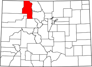 Map of Colorado highlighting Routt County | |
| Towns | ||
| CDP | ||
| Unincorporated communities | ||
| Ghost towns | ||

| Authority control |
|
|---|