Rural Municipality of Churchbridge No. 211
The Rural Municipality of Churchbridge No. 211 (2016 population: 619) is a rural municipality (RM) in the Canadian province of Saskatchewan within Census Division No. 5 and SARM Division No. 1. It is located in the east-central portion of the province.
Churchbridge No. 211 | |
|---|---|
| Rural Municipality of Churchbridge No. 211 | |
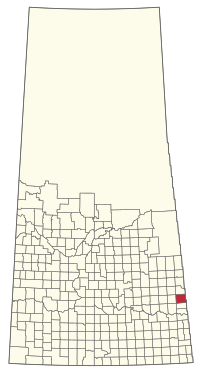 Location of the RM of Churchbridge No. 211 in Saskatchewan | |
| Coordinates: 50.999°N 101.751°W[1] | |
| Country | Canada |
| Province | Saskatchewan |
| Census division | 5 |
| SARM division | 1 |
| Formed[2] | January 1, 1913 |
| Government | |
| • Reeve | Neil Mehrer |
| • Governing body | RM of Churchbridge No. 211 Council |
| • Administrator | Brenda Goulden |
| • Office location | Churchbridge |
| Area (2016)[4] | |
| • Land | 958.57 km2 (370.11 sq mi) |
| Population (2016)[4] | |
| • Total | 619 |
| • Density | 0.6/km2 (2/sq mi) |
| Time zone | CST |
| • Summer (DST) | CST |
| Area code(s) | 306 and 639 |
History
The RM of Churchbridge No. 211 incorporated as a rural municipality on January 1, 1913.[2]
Geography
Communities and localities
The following urban municipalities are surrounded by the RM.
- MacNutt
The following unincorporated communities are within the RM.
- Beresina
Demographics
In the 2016 Census of Population conducted by Statistics Canada, the RM of Churchbridge No. 211 recorded a population of 619 living in 240 of its 268 total private dwellings, a -8% change from its 2011 population of 673. With a land area of 958.57 km2 (370.11 sq mi), it had a population density of 0.6/km2 (1.7/sq mi) in 2016.[4]
In the 2011 Census of Population, the RM of Churchbridge No. 211 recorded a population of 673, a -0.9% change from its 2006 population of 679. With a land area of 958.98 km2 (370.26 sq mi), it had a population density of 0.7/km2 (1.8/sq mi) in 2011.[10]
Government
The RM of Churchbridge No. 211 is governed by an elected municipal council and an appointed administrator that meets on the second Tuesday of every month.[3] The reeve of the RM is Neil Mehrer while its administrator is Brenda Goulden.[3] The RM's office is located in Churchbridge.[3]
References
- "Pre-packaged CSV files - CGN, Canada/Province/Territory (cgn_sk_csv_eng.zip)". Government of Canada. July 24, 2019. Retrieved May 23, 2020.
- "Rural Municipality Incorporations (Alphabetical)". Saskatchewan Ministry of Municipal Affairs. Archived from the original on April 21, 2011. Retrieved May 9, 2020.
- "Municipality Details: RM of Churchbridge No. 211". Government of Saskatchewan. Retrieved May 21, 2020.
- "Population and dwelling counts, for Canada, provinces and territories, and census subdivisions (municipalities), 2016 and 2011 censuses – 100% data (Saskatchewan)". Statistics Canada. February 8, 2017. Retrieved May 1, 2020.
- "Saskatchewan Genealogy Association". Retrieved March 28, 2008.
- Huang, Yj; Powers, R; Montelione, Gt (February 2005). "Statistics". Statistics Canada. Government of Canada. pp. 1665–74. doi:10.1021/ja047109h. PMID 15701001. Retrieved March 28, 2008.
- "Churchbridge No. 211". Sask biz. Government of Saskatchewan. Retrieved March 28, 2008.
- "Saskatchewan Census Population" (PDF). Saskatchewan Bureau of Statistics. Archived from the original (PDF) on September 24, 2015. Retrieved May 9, 2020.
- "Saskatchewan Census Population". Saskatchewan Bureau of Statistics. Retrieved May 9, 2020.
- "Population and dwelling counts, for Canada, provinces and territories, and census subdivisions (municipalities), 2011 and 2006 censuses (Saskatchewan)". Statistics Canada. June 3, 2019. Retrieved May 1, 2020.
Places adjacent to Rural Municipality of Churchbridge No. 211 | ||||||||||
|---|---|---|---|---|---|---|---|---|---|---|
| ||||||||||
| Cities | 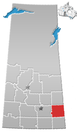 | ||||
|---|---|---|---|---|---|
| Towns | |||||
| Villages | |||||
| Resort villages | |||||
| Rural municipalities | |||||
| First Nations |
| ||||
| Indian reserves | |||||
| Unincorporated communities |
| ||||