Rural Municipality of Pinto Creek No. 75
The Rural Municipality of Pinto Creek No. 75 (2016 population: 283) is a rural municipality (RM) in the Canadian province of Saskatchewan within Census Division No. 3 and SARM Division No. 3. It is located in the southern portion of the province.
Pinto Creek No. 75 | |
|---|---|
| Rural Municipality of Pinto Creek No. 75 | |
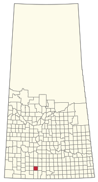 Location of the RM of Pinto Creek No. 75 in Saskatchewan | |
| Coordinates: 49.639°N 107.036°W[1] | |
| Country | Canada |
| Province | Saskatchewan |
| Census division | 3 |
| SARM division | 3 |
| Federal riding | Cypress Hills—Grasslands |
| Provincial riding | Wood River |
| Formed[2] | January 1, 1913 |
| Government | |
| • Reeve | Brian Corcoran |
| • Governing body | RM of Pinto Creek No. 75 Council |
| • Administrator | Roxanne Empey |
| • Office location | Kincaid |
| Area (2016)[4] | |
| • Land | 845.49 km2 (326.45 sq mi) |
| Population (2016)[4] | |
| • Total | 283 |
| • Density | 0.3/km2 (0.8/sq mi) |
| Time zone | CST |
| • Summer (DST) | CST |
| Postal code | S0H 2J0 |
| Area code(s) | 306 and 639 |
History
The RM of Pinto Creek No. 75 incorporated as a rural municipality on January 1, 1913.[2] It is named after Pinto Creek that flows through the RM.
Geography
Communities and localities
The following urban municipalities are surrounded by the RM.
- Hazenmore
- Kincaid
The following unincorporated communities are within the RM.
- Special service areas
Demographics
In the 2016 Census of Population conducted by Statistics Canada, the RM of Pinto Creek No. 75 recorded a population of 283 living in 93 of its 115 total private dwellings, a 18.4% change from its 2011 population of 239. With a land area of 845.49 km2 (326.45 sq mi), it had a population density of 0.3/km2 (0.9/sq mi) in 2016.[4]
In the 2011 Census of Population, the RM of Pinto Creek No. 75 recorded a population of 239, a 0% change from its 2006 population of 239. With a land area of 845.49 km2 (326.45 sq mi), it had a population density of 0.3/km2 (0.7/sq mi) in 2011.[7]
Government
The RM of Pinto Creek No. 75 is governed by an elected municipal council and an appointed administrator that meets on the first Thursday of every month.[3] The reeve of the RM is Brian Corcoran while its administrator is Roxanne Empey.[3] The RM's office is located in Kincaid.[3]
References
- "Pre-packaged CSV files - CGN, Canada/Province/Territory (cgn_sk_csv_eng.zip)". Government of Canada. July 24, 2019. Retrieved May 23, 2020.
- "Rural Municipality Incorporations (Alphabetical)". Saskatchewan Ministry of Municipal Affairs. Archived from the original on April 21, 2011. Retrieved May 9, 2020.
- "Municipality Details: RM of Pinto Creek No. 75". Government of Saskatchewan. Retrieved May 21, 2020.
- "Population and dwelling counts, for Canada, provinces and territories, and census subdivisions (municipalities), 2016 and 2011 censuses – 100% data (Saskatchewan)". Statistics Canada. February 8, 2017. Retrieved May 1, 2020.
- "Saskatchewan Census Population" (PDF). Saskatchewan Bureau of Statistics. Archived from the original (PDF) on September 24, 2015. Retrieved May 9, 2020.
- "Saskatchewan Census Population". Saskatchewan Bureau of Statistics. Retrieved May 9, 2020.
- "Population and dwelling counts, for Canada, provinces and territories, and census subdivisions (municipalities), 2011 and 2006 censuses (Saskatchewan)". Statistics Canada. June 3, 2019. Retrieved May 1, 2020.
| Towns | 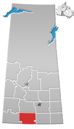 | ||||||
|---|---|---|---|---|---|---|---|
| Villages | |||||||
| Rural municipalities | |||||||
| First Nations |
| ||||||
| Indian reserves | |||||||
| Unincorporated communities |
| ||||||