Arcola, Virginia
Arcola is a census-designated place in Loudoun County, Virginia. The population as of the 2010 United States Census was 233.[1]
Arcola, Virginia | |
|---|---|
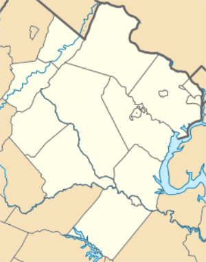 Arcola, Virginia Location within the Commonwealth of Virginia  Arcola, Virginia Arcola, Virginia (Virginia)  Arcola, Virginia Arcola, Virginia (the United States) | |
| Coordinates: 38°57′6″N 77°32′3″W | |
| Country | |
| State | |
| County | |
| Time zone | UTC−5 (Eastern (EST)) |
| • Summer (DST) | UTC−4 (EDT) |
Leesburg is situated 14 miles (23 km) northwest of Arcola; the national capital, Washington, D.C., lies 33 miles (53 km) to the east.
History
The genesis of Arcola was a small spring next to a gum tree that fed into the south fork of Broad Run, suitably called Gum Springs. During the colonial era a distillery, kiln and small church were established at the spring.
When Cameron Parish was established from the Truro Parish its glebe was established just northwest of the spring. The glebelands were sold off in 1802 when the Virginia General Assembly divested all Anglican glebes.
In 1801 the United States Post Office established a branch at the village, naming it Springfield. The branch closed in 1819. Thirteen years later the Post Office once again saw fit to locate a branch in the vicinity, but the success of the Little River Turnpike (present day U.S. Route 50) dictated that it would be located on that road south of the village and known on local maps as simply "Arcola P.O." (situated near the present day intersection of U.S. Route 50 and Hwy 616/Fleetwood Rd). The branch was named Arcola in honor of the Arcola Farm on which it was built. That branch stayed open until 1868 when the office was located back within the confines of the village. The village itself, however, remained identified on local maps as "Gum Spring" during most of the 19th century.
In the 1850s Arcola had a brush with the big time when the construction of the Loudoun Branch of the Manassas Gap Railroad was completed on the northern border of the village. Unfortunately the Panic of 1857 and Civil War stopped the railroad from ever being used. During the Gettysburg Campaign of June–July 1863, troops from the Union Army of Potomac's 11th and 1st Corps marched and camped in and around the town of "Gum Spring" according to dispatches (present day Arcola), as they meandered toward Leesburg, Va and further into Maryland.
Unlike many other Loudoun villages, Arcola continued to grow well into the twentieth century. In 1876 the population was 30, in 1911 it was 90 and by 1976 it was 135.
Del. John Franklin Ryan (1848–1936), former representative in the Virginia House of Delegates, is buried in the Darnes Cemetery in Arcola.
The Arcola Elementary School, Arcola Slave Quarters, and Fleetwood Farm are listed on the National Register of Historic Places.[2][3]
References
- Virginia Trend Report 2: State and Complete Places (Sub-state 2010 Census Data). Archived 2012-07-11 at Archive.today Missouri Census Data Center. Accessed 2011-03-08.
- "National Register Information System". National Register of Historic Places. National Park Service. July 9, 2010.
- "National Register of Historic Places Listings". Weekly List of Actions Taken on Properties: 6/03/13 through 6/07/13. National Park Service. 2013-06-14.
| Wikimedia Commons has media related to Arcola, Virginia. |
Municipalities and communities of Loudoun County, Virginia, United States | ||
|---|---|---|
| Towns | 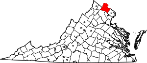 Map of Virginia highlighting Loudoun County | |
| CDPs | ||
| Unincorporated communities |
| |
| Former | ||