Loudoun Heights, Virginia
Loudoun Heights is an unincorporated village in Loudoun County, Virginia near Harpers Ferry, West Virginia. It is located in the Between the Hills region of the county along Harpers Ferry Road (VA 671) and is bounded to its northwest and northeast by the Harpers Ferry National Historical Park on the Potomac River. The Blue Ridge and Short Hill Mountain bound it to the west and east.
Loudoun Heights, Virginia | |
|---|---|
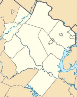 Loudoun Heights, Virginia Location within the state of Virginia  Loudoun Heights, Virginia Loudoun Heights, Virginia (Virginia)  Loudoun Heights, Virginia Loudoun Heights, Virginia (the United States) | |
| Coordinates: 39°18′47″N 77°43′4″W | |
| Country | |
| State | |
| County | |
| Time zone | UTC−5 (Eastern (EST)) |
| • Summer (DST) | UTC−4 (EDT) |
History
This high ground was occupied by Confederate general John George Walker during the Battle of Harpers Ferry, September 12-September 15, 1862. Loudoun Heights was also the site of a night attack made on January 10, 1864, by Col. John S. Mosby's Rangers against Major Henry A. Cole's 1st Potomac Home Brigade Maryland Volunteer Cavalry. Mosby's attack failed and ended a long run of engagements between Mosby's Rangers and Cole's Cavalry.
Municipalities and communities of Loudoun County, Virginia, United States | ||
|---|---|---|
| Towns | 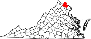 Map of Virginia highlighting Loudoun County | |
| CDPs | ||
| Unincorporated communities |
| |
| Former | ||