Pritchett, Colorado
Pritchett is a Statutory Town in Baca County, Colorado, United States. The population was 140 at the 2010 census.[7]
Town of Pritchett, Colorado | |
|---|---|
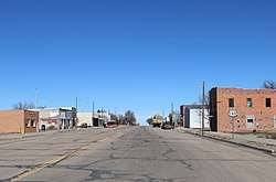 Looking north along Randolph Street (2019). | |
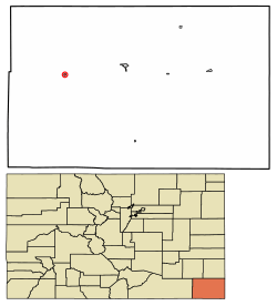 Location of Pritchett in Baca County, Colorado. | |
| Coordinates: 37°22′9″N 102°51′36″W | |
| Country | |
| State | |
| County[1] | Baca |
| Incorporated (town) | 1923[2] |
| Government | |
| • Type | Statutory Town[1] |
| Area | |
| • Total | 0.23 sq mi (0.60 km2) |
| • Land | 0.23 sq mi (0.60 km2) |
| • Water | 0.00 sq mi (0.00 km2) |
| Elevation | 4,833 ft (1,473 m) |
| Population (2010) | |
| • Total | 140 |
| • Estimate (2018)[5] | 132 |
| • Density | 570.82/sq mi (220.35/km2) |
| Time zone | UTC-7 (Mountain (MST)) |
| • Summer (DST) | UTC-6 (MDT) |
| ZIP code[6] | 81064 |
| Area code(s) | 719 |
| FIPS code | 08-61315 |
| GNIS feature ID | 0196216 |
A post office called Pritchett has been in operation since 1927.[8] The community was named after Henry S. Pritchett, a railroad official.[9]
Geography
Pritchett is located in western Baca County at 37°22′9″N 102°51′36″W (37.369081, -102.860122).[10] U.S. Route 160 passes through the town, leading east 16 miles (26 km) to Springfield, the county seat, and west 106 miles (171 km) to Trinidad.
According to the United States Census Bureau, the town has a total area of 0.2 square miles (0.52 km2), all of it land.
Demographics
| Historical population | |||
|---|---|---|---|
| Census | Pop. | %± | |
| 1930 | 451 | — | |
| 1940 | 495 | 9.8% | |
| 1950 | 286 | −42.2% | |
| 1960 | 247 | −13.6% | |
| 1970 | 170 | −31.2% | |
| 1980 | 183 | 7.6% | |
| 1990 | 153 | −16.4% | |
| 2000 | 137 | −10.5% | |
| 2010 | 140 | 2.2% | |
| Est. 2018 | 132 | [5] | −5.7% |
| U.S. Decennial Census[11] | |||
As of the census[12] of 2000, there were 137 people, 58 households, and 40 families residing in the town. The population density was 600.2 people per square mile (230.0/km²). There were 79 housing units at an average density of 346.1 per square mile (132.6/km²). The racial makeup of the town was 97.08% White, 2.19% Native American, and 0.73% from two or more races. Hispanic or Latino of any race were 1.46% of the population.
There were 58 households out of which 36.2% had children under the age of 18 living with them, 53.4% were married couples living together, 12.1% had a female householder with no husband present, and 31.0% were non-families. 27.6% of all households were made up of individuals and 19.0% had someone living alone who was 65 years of age or older. The average household size was 2.36 and the average family size was 2.93.
In the town, the population was spread out with 28.5% under the age of 18, 4.4% from 18 to 24, 27.0% from 25 to 44, 19.7% from 45 to 64, and 20.4% who were 65 years of age or older. The median age was 39 years. For every 100 females, there were 95.7 males. For every 100 females age 18 and over, there were 88.5 males.
The median income for a household in the town was $19,750, and the median income for a family was $25,625. Males had a median income of $17,917 versus $15,625 for females. The per capita income for the town was $10,876. There were 9.1% of families and 14.6% of the population living below the poverty line, including 16.0% of under eighteens and 3.2% of those over 64.
Popular culture
The film The Hi-Lo Country, a 1998 drama/western film directed by Stephen Frears, starring Billy Crudup, Woody Harrelson, Cole Hauser, Sam Elliott, Patricia Arquette, Penélope Cruz and Enrique Castillo, was filmed in part in the town of Pritchett.
See also
- Outline of Colorado
- State of Colorado
- Colorado cities and towns
- Colorado municipalities
- Colorado counties
- Colorado cities and towns
References
- "Active Colorado Municipalities". State of Colorado, Department of Local Affairs. Archived from the original on 2009-12-12. Retrieved 2007-09-01.
- "Colorado Municipal Incorporations". State of Colorado, Department of Personnel & Administration, Colorado State Archives. 2004-12-01. Retrieved 2007-09-02.
- "2016 U.S. Gazetteer Files". United States Census Bureau. Retrieved Jul 25, 2017.
- "US Board on Geographic Names". United States Geological Survey. 2007-10-25. Retrieved 2008-01-31.
- "Population and Housing Unit Estimates". Retrieved March 21, 2020.
- "ZIP Code Lookup" (JavaScript/HTML). United States Postal Service. Retrieved December 16, 2007.
- "Geographic Identifiers: 2010 Demographic Profile Data (G001): Pritchett town, Colorado". U.S. Census Bureau, American Factfinder. Archived from the original on February 12, 2020. Retrieved September 26, 2013.
- "Post offices". Jim Forte Postal History. Retrieved 8 July 2016.
- Dawson, John Frank. Place names in Colorado: why 700 communities were so named, 150 of Spanish or Indian origin. Denver, CO: The J. Frank Dawson Publishing Co. p. 42.
- "US Gazetteer files: 2010, 2000, and 1990". United States Census Bureau. 2011-02-12. Retrieved 2011-04-23.
- "Census of Population and Housing". Census.gov. Retrieved June 4, 2015.
- "U.S. Census website". United States Census Bureau. Retrieved 2008-01-31.
External links
| Wikimedia Commons has media related to Pritchett, Colorado. |
Municipalities and communities of Baca County, Colorado, United States | ||
|---|---|---|
| Towns | 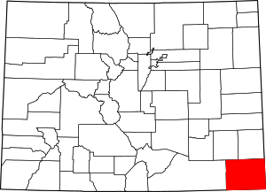 Map of Colorado highlighting Baca County | |
| Unincorporated communities | ||
