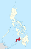
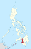
Mindanao
Mindanao (/mɪndəˈnaʊ/ (![]()
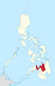
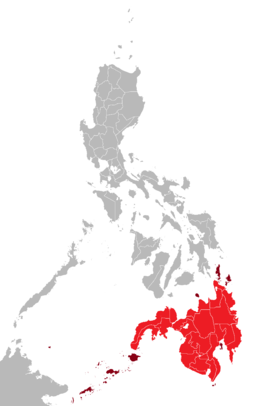 Mindanao mainland in red; its associated islands in maroon | |
.svg.png) Mindanao Location within the Philippines | |
| Geography | |
|---|---|
| Location | Philippines |
| Coordinates | 8°00′N 125°00′E |
| Archipelago | Philippines |
| Adjacent bodies of water | |
| Major islands | |
| Area | 97,530 km2 (37,660 sq mi)[1] |
| Area rank | 19th |
| Highest elevation | 2,954 m (9,692 ft) |
| Highest point | Mount Apo |
| Administration | |
| Regions | |
| Provinces | List
|
| Largest settlement | Davao City (pop. 1,632,991) |
| Demographics | |
| Demonym | Mindanaoan/Mindanawan/Mindanawon |
| Population | 25,537,691 (2018) (Mindanao island group) (2010)[2] |
| Pop. density | 243/km2 (629/sq mi) |
| Ethnic groups | List
|
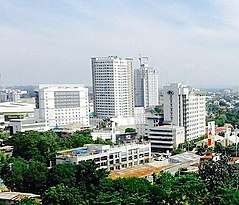
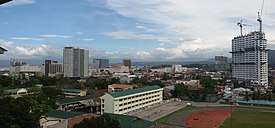
According to the 2015 Philippine Population Census, Davao City is the most populous city on the island, with 1,632,991 residents, followed by Zamboanga City (pop. 861,799), Cagayan de Oro City (pop. 675,950), General Santos City (pop. 594,446), Iligan City (pop. 342,618), Butuan City (pop. 337,063) and Cotabato City (pop. 299,438).[3] About 70% of residents identify as Christian and 20% as Muslim.[4] Mindanao is divided into six administrative regions: the Zamboanga Peninsula, Northern Mindanao, the Caraga region, the Davao region, Soccsksargen, and the Bangsamoro Autonomous Region in Muslim Mindanao (BARMM).
Native ethnic groups in Mindanao include the Lumads (namely the Subanons of the Zamboanga Peninsula;[5] the Bukidnon, the Ata Manobos, the Mamanwas, the Matigsalugs, the Agusan Manobos, the Talaandigs, the Kamigins, and the Higaonons of Northern Mindanao and the region of Caraga;[6][7] the T'bolis, the Tirurays, the B'laans, the Saranganis, and the Cotabato Manobos of the region of SOCCSKSARGEN; and the Obo, the Mandayas, the Giangans, the Tagabawas, the Kalagans, the Sangirese, and the Mansaka of the Davao region[8]) and the Moros (namely the Maguindanaos, the Maranaos, the Tausugs, the Yakans, the Iranuns, and the Sama, mainly concentrated within Bangsamoro). Joining them are the equally indigenous Visayan groups in coastal areas like the Butuanons, Surigaonons, and Kagay-anons of Northern Mindanao and the Caraga region as well as the Zamboangueños of the eponymous peninsula, along with descendants of modern settlers from the Visayas and Luzon (chiefly from the former), among them the Cebuanos and the Hiligaynons.
Mindanao is considered the major breadbasket of the Philippines,[9] with eight of the top 10 agri-commodities exported from the Philippines coming from there.[10]
Mindanao is known as "The Philippines' Land of Promise".[11]
Etymology
The name "Mindanao" is derived from the Spanish corruption of the name of the Maguindanao people, the dominant ruling ethnic group in the Sultanate of Maguindanao in southwestern Mindanao during the Spanish colonial period. The name itself means "people of the lake (Lanao)", though it is usually translated to "people of the flood plains" in modern sources.[12]
History
Prehistory
Archaeological findings on the island point to evidence of human activity dating back about ten thousand years. Around 1500 BC Austronesian people spread throughout the Philippines.
The Subanon are believed to have established themselves on Mindanao Island during the Neolithic Era, or New Stone Age, the period in the development of human technology beginning around 10,000 BC according to the ASPRO chronology (between 4,500 and 2,000 BC).[13] The evidence of old stone tools in Zamboanga del Norte may indicate a late Neolithic presence. Ceramic burial jars, both unglazed and glazed, as well as Chinese celadons, have been found in caves, together with shell bracelets, beads, and gold ornaments. Many of the ceramic objects are from the Yuan and Ming periods. Evidently, there was a long history of trade between the Subanon and the Chinese long before the latter's contact with Islam.
Rajahnates and Hindu-Buddhism
In the classic epoch of Philippine history (900 AD onwards), the people of Mindanao were heavily exposed to Hindu and Buddhist influence and beliefs from Indonesia and Malaysia. Indianized abugida scripts such as Kawi and Baybayin was introduced via Sulawesi and Java, and the cultural icons of the sarong (known as malong or patadyong), the pudong turban, silk, and batik and ikat weaving and dyeing methods were introduced. Artifacts found from this era include the Golden kinnara, Golden Tara, and the Ganesh pendant. These cultural traits passed from Mindanao into the Visayas and Luzon, but were subsequently lost or heavily modified after the Spanish arrival in the 16th century.
The Hindu-Buddhist cultural revolution was strongest in the coastal areas of the island, tending to become incorporated into local animist beliefs and customs among the tribes of the interior. The Rajahnate of Butuan, a fully Hindu kingdom mentioned in Chinese records as a tributary state in the 10th century, was concentrated along the northeastern coast of the island around Butuan.[14] The Darangen epic of the Maranao people harkens back to this era as the most complete local version of the Ramayana. The Maguindanao at this time also had strong Hindu beliefs, evidenced by the Ladya Lawana (Rajah Ravana) epic saga that survives to the present, albeit highly Islamized from the 17th century onward.
Sultanates and Islam
.png)
The spread of Islam in the Philippines began in the 14th century, mostly through the influence of Muslim merchants from the western Malay Archipelago. The first mosque in the Philippines was built in the mid-14th century in the town of Simunul, Tawi-Tawi.[14] Around the 16th century, the Muslim sultanates of Sulu, Lanao and Maguindanao were established from formerly Hindu-Buddhist Rajahnates.
As Islam gained influence in Mindanao, the natives of the Sultanates had to either convert to Islam or pay tribute to their new Muslim rulers. The largest of the Muslim polities in mainland Mindanao was the Sultanate of Maguindanao, which controlled the southern floodplains of the Rio Grande de Mindanao and most of the coastal area of the Illana Bay and the Moro Gulf. The name Mindanao was derived from this Sultanate. But most of Mindanao remained animist, especially the Lumad people in the interior. Most of the northern, eastern, and southern coastal regions inhabited by Visayans (Surigaonon and Butuanon) and other groups were later converted to Christianity by the Spanish.
Colonization era
Spanish Colonization and Christianity
In 1521 Antonio Pigafetta wrote an account of reaching 'Maingdano.' He was with Magellan on the first circumnavigation of the globe and sailing for the king of Spain.[15]
On 2 February 1543, Ruy López de Villalobos was the first Spaniard to reach Mindanao.[16] He called the island "Caesarea Caroli" after Charles V of the Holy Roman Empire (and I of Spain). Shortly after Spain's colonization of Cebu, it moved on to colonize Butuan and the surrounding Caraga region in northeast Mindanao and discovered significant Muslim presence on the island. Over time a number of tribes in Mindanao converted to Roman Catholicism and built settlements and forts throughout the coastal regions. These settlements endured despite attacks from neighboring Muslim Sultanates. The most heavily fortified of them, apart from a short period in 1662 when Spain sent soldiers from the city to Manila after a threat of invasion from the Chinese general Koxinga, was Zamboanga City.[17]
By the late 18th century Spain had geographic dominance over the island, having established settlements and forts in most of Mindanao, including Zamboanga City (which was then settled by Peruvian soldiers)[18] and Misamis Occidental to the northwest, Iligan City, Misamis Oriental, Bukidnon, and Camiguin Island to the north, Butuan and the Caraga region to the east, and Davao in the island's gulf coast. Spain continued to engage in battles with Muslim Sultanates until the end of the 19th century.[17]
American Occupation
In the Treaty of Paris in 1898 Spain sold the entire Philippine archipelago to the United States for $20 million. The 1900 Treaty of Washington and the 1930 Convention Between the United States and Great Britain clarified the borders between Mindanao and Borneo.
Philippine Commonwealth
In 1939 the Philippine government encouraged citizens from Luzon and Visayas to migrate to Mindanao. Consisting mostly of Ilocanos, Cebuanos, and Illongos. Filipino settlers streaming into Soccsksargen led to the displacement of the Blaan and Tboli tribes.
World War II
In April 1942 Mindanao, along with the rest of the Philippines, officially entered World War II after Japanese soldiers invaded key cities in the islands.[19] Many towns and cities were burned to the ground in Mindanao, most notably Davao City, Zamboanga City, Lanao, Cagayan de Oro, Iligan City, and Butuan.[20] In the months of April and May 1942, Japanese forces defeated US troops commanded by William F. Sharp and Guy Fort, in a battle that started at Malabang (a town close to Gandamatu Macadar, Lanao) and ended close to the town of Ganassi, Lanao. Davao City was among the earliest to be occupied by the invading Japanese forces. They immediately fortified the city as a bastion of the Japanese defense system.
Davao City was subjected by the returning forces of Gen. Macarthur to constant bombing, before the American Liberation Forces landed in Leyte in October 1944. Filipino soldiers and local guerrilla fighters were actively fighting Japanese forces until liberation at the conclusion of the Battle of Mindanao.[21]
Recent history
Insurgency and conflict
Violent conflicts in the southwestern regions of Mindanao that began in the 1960s led to the 1971 Manili Massacre, Pata Island Massacre, the founding of the Moro National Liberation Front (MNLF), Moro Islamic Liberation Front (MILF), and the formation of the Ilaga.[22]
Under President Ferdinand Marcos's administration, the government was said to have encouraged Christian settlers in Mindanao, displacing many locals. The forced land seizures by Luzon and Visayan settlers resulted in ongoing conflict as the original owners seek ancestral land reclamation.[23][24]
In March 2000 President Estrada declared an "All Out War" against the Moro Islamic Liberation Front (MILF) after it committed a series of terrorist attacks on government buildings, civilians, and foreigners. A number of livelihood intervention projects, from organisations such as USAID and the Emergency Livelihood Assistance Program (ELAP), aided in the reconstruction of areas affected by constant battles on the island.[25]
In December 2009, President Gloria Macapagal Arroyo officially placed Maguindanao under a state of martial law following the Maguindanao massacre.
Tropical Storm Sendong
Tropical storm Sendong (international name, Washi) made landfall on 15 December 2011 in Mindanao. The recorded 24-hour rainfall in Lumbia station of PAGASA reached 180.9 mm, causing the overflow of the Cagayan de Oro River. The storm killed 1,268 people, with 49 others listed as missing. Most of the casualties were from Cagayan de Oro and Iligan. Those who survived were rendered homeless, seeking shelter in evacuation centers.[26]
Marawi siege
In May 2017, President Rodrigo Duterte declared martial law on the entire island group of Mindanao following the Marawi siege by the Maute terrorist group. Thousands of civilians were killed by the terrorist group during the siege, and more than 180,000 people were forced to evacuate Marawi City.[27]
Economy
Mindanao's economy accounts for 14% of the country's gross domestic product. The region grew 4.9% in 2016 against Luzon's 5.5% and Visayas' 9.1%.
Agriculture, forestry and fishing make up more than 40% of Mindanao's market, being the country's largest supplier of major crops such as pineapples and bananas.[28]
There are 2 defined growth corridors in the island namely Metro Davao and Metro CDO. Other regional centers are: Zamboanga City, General Santos City, Butuan City, Cotabato City, Dipolog City, Jolo, Surigao City, Pagadian City, Koronadal City, and Tagum City.[29]
Being the top-performing economy in Mindanao, Davao Region has the 5th-biggest economy in the country and the second-fastest-growing economy next to Cordillera Autonomous Region.[30] While the region's economy is predominantly agri-based, it is now developing into a center for agro-industrial business, trade and tourism. Its competitive advantage is in agri-industry as its products, papayas, mangoes, bananas, pineapples, fresh asparagus, flowers, and fish products are exported internationally. The region can be a vital link to markets in other parts of Mindanao, Brunei Darussalam and parts of Malaysia and Indonesia.[31]
There is also a growing call center sector in the region, mostly centered in Davao City.
Upcoming developments
Some 2,130 government-led infrastructure projects worth P547.9 billion have also been lined up for Mindanao until 2022.
NEDA official said that 68% of that budget will be allotted for the transportation sector, while 16% will go to water resources, and 6% to social infrastructure.
Of this amount, 18 infrastructure projects have been identified as "flagship projects," five of them have already been approved by President Rodrigo R. Duterte.
The projects include the ₱35.26 billion Tagum-Davao-Digos Segment of the Mindanao Railway, the ₱40.57 billion Davao airport, the ₱14.62 billion Laguindingan airport, the ₱4.86 billion Panguil Bay Bridge Project, and the ₱5.44 billion Malitubog-Maridagao Irrigation Project, Phase II.
Projects in the pipeline are the second and third phases of the Mindanao Railway; the Agus-Pulangi plant rehabilitation; the Davao expressway; the Zamboanga Fish Port Complex rehabilitation; the Balo-i Plains Flood Control Project; Asbang Small Reservoir Irrigation Project; the Ambal Simuay Sub-Basin of the Mindanao River Basin Flood Control and River Protection Project; as well as the Road Network Development Project in Conflict-Affected Areas in Mindanao project.[29]
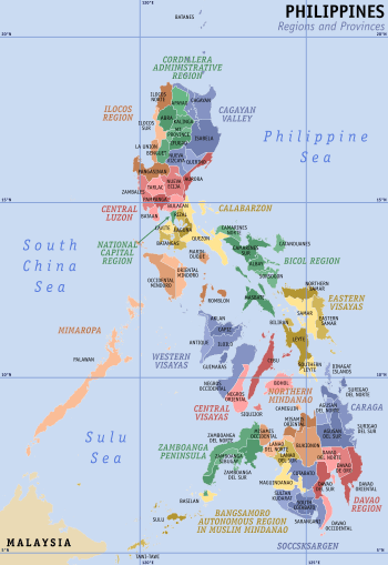
Administrative divisions
The island consists of 6 administrative regions,[32] 22 provinces, and 30 cities (27 provinces and 33 cities if associated islands are included).
| Location | Region (designation) |
Population (2010)[2] |
Area[lower-roman 1][33][34] | Density | Regional center (capital region) |
|
|---|---|---|---|---|---|---|
 |
Zamboanga Peninsula (Region IX) |
3,407,353 (3.7%) |
17,056.73 km2 (6,585.64 sq mi) |
200/km2 (520/sq mi) |
Pagadian City | |
 |
Northern Mindanao (Region X) |
4,297,323 (4.7%) |
20,496.02 km2 (7,913.56 sq mi) |
210/km2 (540/sq mi) |
Cagayan de Oro City | |
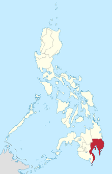 |
Davao Region (Region XI) |
4,468,563 (4.8%) |
20,357.42 km2 (7,860.04 sq mi) |
220/km2 (570/sq mi) |
Davao City | |
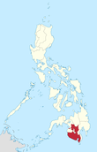 |
Soccsksargen (Region XII) |
4,109,571 (4.5%) |
22,513.30 km2 (8,692.43 sq mi) |
180/km2 (470/sq mi) |
Koronadal | |
 |
Caraga Region (Region XIII) |
2,429,224 (2.6%) |
21,478.35 km2 (8,292.84 sq mi) |
110/km2 (280/sq mi) |
Butuan | |
 |
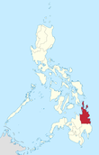
Bangsamoro Autonomous Region in Muslim Mindanao (BARMM) |
3,256,140 (3.5%) |
12,535.79 km2 (4,840.10 sq mi) |
260/km2 (670/sq mi) |
Cotabato City [lower-roman 5] | 5
|
| Region | 2010 census | Area | Density | Regional center | Component LGUs | |
Table notes
| ||||||
Largest cities and municipalities in Mindanao
The list of largest cities and municipalities in Mindanao in terms of population is shown in the table below.
Geography
Mindanao is the second-largest island in the Philippines at 97,530 square kilometers,[1] and is the eighth-most populous island in the world. The island of Mindanao is larger than 125 countries worldwide, including the Netherlands, South Korea, Austria, Portugal, Czech Republic, Hungary, and Ireland. The island is mountainous, and is home to Mount Apo, the highest mountain in the country. Mindanao is surrounded by four seas: the Sulu Sea to the west,[35] the Philippine Sea to the east, and the Celebes Sea to the south, and the Mindanao Sea to the north. Of all the islands of the Philippines, Mindanao shows the greatest variety of physiographic development. High, rugged, faulted mountains; almost isolated volcanic peaks; high rolling plateaus; and broad, level, swampy plains are found there.
The Mindanao island group is an arbitrary grouping of islands in southern Philippines which comprises the Mindanao mainland, the Sulu Archipelago (consisting of the islands of Basilan, Sulu, and Tawi-tawi), and the outlying islands of Camiguin, Dinagat, Siargao, and Samal. Platycerium grande is endemic to the island
Mountains
The mountains of Mindanao can be grouped into ten ranges, including both complex structural mountains and volcanoes. The structural mountains on the extreme eastern and western portions of the island show broad exposures of Mesozoic rock, and Ultrabasic rocks at the surface in many places along the east coast. Other parts of the island consist mainly of Cenozoic and Quaternary volcanic or sedimentary rocks.
In the eastern portion of the island, from Bilas Point in Surigao del Norte to Cape San Agustin in Davao Oriental, is a range of complex mountains known in their northern portion as the Diwata Mountains. This range is low and rolling in its central portion. A proposed road connecting Bislig on the east coast with the Agusan River would pass through 16 kilometers (9.9 mi) of broad saddle across the mountains at a maximum elevation of less than 250 meters (820 ft); while the existing east–west road from Lianga, 48 km (30 mi) north of Bislig, reaches a maximum elevation of only 450 m (1,480 ft). The Diwata Mountains, north of these low points, are considerably higher and more rugged, reaching an elevation of 2,012 m (6,601 ft) in Mount Hilong-Hilong, 17 miles (27 km) along the eastern portion of Cabadbaran City. The southern portion of this range is broader and even more rugged than the northern section. In Davao Oriental, several peaks rise above 2,600 m (8,530 ft) and one mountain rises to 2,910 m (9,547 ft).
The east-facing coastal regions of Davao and Surigao del Sur are marked by a series of small coastal lowlands separated from each other by rugged forelands which extend to the water's edge. Offshore are numerous coral reefs and tiny islets. This remote and forbidding coast is made doubly difficult to access during the months from October to March by the heavy surf driven before the northeast trade winds. A few miles offshore is found the Philippine Deep. This ocean trench, reaching measured depths of 34,696 feet (10,575 m), is the third-deepest trench, (after the Mariana Trench and Tonga Trench) on the earth's surface.
A second north–south mountain range extends from Talisayan in the north, to Tinaca Point in the southernmost point of Mindanao. This mountain range runs along the western borders of the Agusan del Norte, Agusan del Sur, and Davao provinces. This range is mainly structural in origin, but it also contains at least three active volcano peaks. The central and northern portions of this range contain several peaks between 2,000 and 2,600 m (6,600 and 8,500 ft), and here the belt of mountains is about 30 miles (48 km) across.
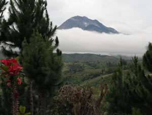
West of Davao City stand two inactive volcanoes: Mount Talomo at 2,893 meters (9,491 ft), and Mount Apo at 2,964 m (9,724 ft). Mount Apo is the highest point in the Philippines. South of Mount Apo, this central mountain belt is somewhat lower than it is to the north, with peaks averaging only 1,100 to 1,800 m (3,600 to 5,900 ft).
In Western Mindanao, a range of complex structural mountains forms the long, hand-like Zamboanga Peninsula. These mountains, reaching heights of only 1,200 meters (3,900 feet), are not as high as the other structural belts in Mindanao. There are several places in the Zamboanga Mountains where small inter-mountain basins have been created, with some potential for future agricultural development. The northeastern end of this range is marked by the twin peaks of the now-extinct volcano, Mount Malindang, that towers over Ozamis City at a height of 2,425 m (7,956 ft). Mount Dapia is the highest mountain in the Zamboanga Peninsula, reaching a height of 2,617 m (8,586 ft). Batorampon Point is the highest mountain of the southernmost end of the peninsula, reaching a height of only 1,335 m (4,380 ft); it is located in the boundary of Zamboanga City.
A series of volcanic mountains is located within the vicinity of Lake Lanao forming a broad arc through the Lanao del Sur, Cotabato and Bukidnon provinces. At least six of the twenty odd peaks in this area are active and several stand in semi-isolation. The Butig Peaks, with their four crater lakes, are easily seen from Cotabato. Mount Ragang, an active volcano cone reaching 2,815 m (9,236 ft), is the most isolated, while the greatest height is reached by Mount Kitanglad at 2,889 m (9,478 ft).
In South Cotabato, is another range of volcanic mountains, this time paralleling the coast. These mountains have a maximum extent of 110 miles (180 km) from northwest to southeast and measures some 30 miles (48 km) across. One of the well-known mountains here is Mount Parker, whose almost circular crater lake measures a mile-and-a-quarter in diameter and lies 300 m (980 ft) below its 2,040 m (6,690 ft) summit. Mount Matutum is a protected area and is considered as one of the major landmarks in the South Cotabato province.
Plateaus
Another important physiographic division of Mindanao is the series of upland plateaus in the Bukidnon and Lanao del Sur provinces. These plateaus are rather extensive and almost surround several volcanoes in this area. The plateaus are made up of basaltic lava flows inter-bedded with volcanic ash and tuff. Near their edges, the plateaus are cut by deep canyons, and at several points waterfalls drop down to the narrow coastal plain. These falls hold considerable promise for development of hydroelectric energy. Indeed, one such site at Maria Cristina Falls has already become a major producer. The rolling plateaus lie at an elevation averaging 700 meters above sea level, and offer relief from the often oppressive heat of the coastal lowlands.
Lakes and waterfalls
Lake Lanao occupies a large portion of one such plateau in Lanao del Sur. This lake is the largest lake in Mindanao and the second largest in the country; it is roughly triangular in shape with an 18-mile-long (29 km) base, having a surface at 780 meters above sea level, and is rimmed on the east, south, and west by a series of peaks reaching 2,300 meters. Marawi City, at the northern tip of the lake, is bisected by the Agus River, that feeds the Maria Cristina Falls.
Another of Mindanao's waterfall sites is located in Malabang, 15 miles (24 km) south of Lake Lanao. Here the Jose Abad Santos Falls present one of the nation's scenic wonders at the gateway to a 200-hectare national park development.
The Limunsudan Falls, with an approximate height of 800 ft (240 m), is the highest waterfall in the Philippines; it is located in Iligan City.
Valleys, rivers, and plains
Mindanao contains two large lowland areas in the valleys of the Agusan River in Agusan, and the Rio Grande de Mindanao in Cotabato City.
There is some indication that the Agusan Valley occupies a broad syncline between the central mountains and the east-coast mountains. This valley measures 110 miles (180 km) from south to north and varies from 20 to 30 miles (32 to 48 km) in width. 35 miles (56 km) north of the head of Davao Gulf lies the watershed between the Agusan and the tributaries of the Libuganon River, which flows to the Gulf. The elevation of this divide is well under 200 m (660 ft), indicating the almost continuous nature of the lowland from the Mindanao Sea on the north to the Davao Gulf.
The Rio Grande de Mindanao and its main tributaries, the Catisan and the Pulangi, form a valley with a maximum length of 120 miles (190 km) and a width which varies from 12 miles (19 km) at the river mouth to about 60 miles (97 km) in central Cotabato. The southern extensions of this Cotabato Valley extend uninterrupted across a 350-meter (1,150 ft) watershed from Illana Bay on the northwest to Sarangani Bay on the southeast.
Other lowlands of a coastal nature are to be found in various parts of Mindanao. Many of these are tiny isolated pockets, along the northwest coast of Zamboanga. In other areas such as the Davao Plain, these coastal lowlands are 16 km (9.9 mi) wide and several times in length.
From Dipolog City eastward along the northern coast of Mindanao approaching Butuan City extends a rolling coastal plain of varying width. In Misamis Occidental, the now dormant Mount Malindang has created a lowland averaging 13 km (8.1 mi) in width. Shallow Panquil Bay divides this province from Lanao del Norte, and is bordered by low-lying, poorly drained lowlands and extensive mangroves. In Misamis Oriental, the plain is narrower and in places whittle into rugged capes that reach the sea. East of Cagayan de Oro, a rugged peninsula extends into the Mindanao Sea.
Demographics
As of 2017, Mindanao had a population of over 25 million people. This comprises 22.1 percent of the entire population of the country.[36]
Ethnicity and culture
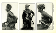
An American census conducted in the early 1900s noted that the island was inhabited by people "greatly divided in origin, temperament and religion".[37] Evidence of the island's cultural diversity can be seen in the buildings and ruins of old Spanish settlements in the northwestern peninsula that span eastwards to the southern gulf coast, the site of the ancient Rajahnate of Butuan in the northeast region (Caraga), the Sultanates in the southwest (Sultanate of Sulu, Sultanate of Lanao, Sultanate of Maguindanao), a number of Buddhist and Taoist temples, and the numerous indigenous tribes.
Today around 25.8 percent of the household population in Mindanao classified themselves as Cebuanos. Other ethnic groups included Bisaya/Binisaya (18.4%), Hiligaynon/Ilonggo (8.2%), Maguindanaon (5.5%), and Maranao (5.4%). The remaining 36.6 percent belonged to other ethnic groups. Cebuano registered the highest proportion of ethnic group in Northern Mindanao and Davao Region with 35.59 percent and 37.76 percent, respectively. In SOCCSKSARGEN, it was Hiligaynon/Ilonggo (31.58%), Binisaya/Bisaya (33.10%) in Zamboanga Peninsula, Maranao (26.40%) in ARMM, and Surigaonon (25.67%) in Caraga.[4]
Languages
Dozens of languages are spoken in Mindanao; among them, Cebuano, Hiligaynon, Surigaonon, Tausug, Maranao, Maguindanao, and Chavacano are most widely spoken. Of the seven aforementioned regional languages, Cebuano (often referred as Bisaya) has the highest number of speakers, being spoken throughout Northern Mindanao (except the southern parts of Lanao del Norte), the Davao region, the western half of the Caraga region (as well as the city of Bislig and the municipalities surrounding it in Surigao del Sur), the entirety of the Zamboanga Peninsula (with the exception of Zamboanga City), and southern SOCCSKSARGEN. Hiligaynon is the main language of SOCCSKSARGEN, where majority of the inhabitants are of ethnic Hiligaynon stock. Surigaonon is spoken in the eastern half of the Caraga region, mainly by the eponymous Surigaonons. Tausug is widely spoken in the western territories of the ARMM, specifically the Sulu Archipelago, which comprises the provinces of Basilan, Sulu, and Tawi-Tawi, with a sizeable community of speakers residing in Zamboanga City. Maguindanao and Maranao are the dominant languages of the eastern territories of the ARMM, respectively, with the former being spoken in Lanao del Sur as well as the southern areas of Lanao del Norte, and the latter in the eponymous province of Maguindanao and also in adjacent areas which are part of SOCCSKSARGEN. Chavacano is the native language of Zamboanga City and is also the lingua franca of Basilan; it is also spoken in the southernmost fringes of Zamboanga Sibugay. It is also spoken, albeit as a minority language, in Cotabato City and Davao City, where dialects of it, respectively, exist, namely Cotabateñ and Castellano Abakay, both of which evolved from the variant of the language spoken in Zamboanga City. English is also widely understood and spoken, being highly utilized in business and academia.
Religion
Christianity is the dominant religious affiliation in Mindanao with 65.9% of the household population, majority of which are adherents of Roman Catholicism, Islam comprised 23.39%,[38] and other religions were Evangelical (5.34%), Aglipayan (2.16%), and Iglesia ni Cristo (2.66%).[4]
Tourism
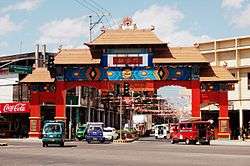
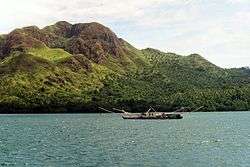
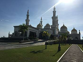
Major tourist spots are scattered throughout Mindanao, consisting mostly of beach resorts, scuba diving resorts, surfing, museums, nature parks, mountain climbing, and river rafting. Siargao, best known for its surfing tower in Cloud 9, also has caves, pools, waterfalls, and lagoons.[39] There are archaeological sites, historical ruins, and museums in Butuan.[40] White Island is a popular tourist spot in Camiguin. The Duka Bay[41] and the Matangale[42] dive resorts in Misamis Oriental offer glass bottomed boat rides and scuba diving lessons. Cagayan de Oro has beach resorts, the Mapawa Nature Park, white water rafting and kayaking, museums, and historical landmarks.[43] Ziplining is the main attraction at the Dahilayan Adventure Park in Bukidnon.[44] Iligan City has The Maria Christina Falls, Tinago Falls, nature parks, beaches, and historical landmarks.[45] There are parks, historical buildings, the Vinta Ride at Paseo del Mar, boat villages, 11 Islands (commonly called as Onçe Islas), 17th-century Fort Pilar Shrine & Museum and the world-renowned Pink Sand Beach of Sta. Cruz in Zamboanga City.[46] There are festivals, fireworks, and the Beras Bird Sanctuary in Takurong City.[47] Davao has Mt Apo, parks, museums, beaches, historical landmarks, and scuba diving resorts.[48]
Energy
Many areas in Mindanao suffer rotating 12-hour blackouts due to the island's woefully inadequate power supply.[49] The island is forecast to continue suffering from a 200-megawatt power deficit until 2015, when the private sector begins to operate new capacity. Aboitiz Equity Ventures, a publicly listed holdings company, has committed to supplying 1,200 megawatts through a coal-fired plant on the border of Davao City and Davao del Sur that is slated for operation by 2018.[50] The Agus-Pulangui hydropower complex, which supplies more than half of Mindanao's power supply, is currently producing only 635 megawatts of its 982 megawatts capacity due to the heavy siltation of the rivers that power the complex. Zamboanga City, an urbanised center in southwest Mindanao, is expected to begin experience daily three-hour brownouts due to the National Power Corporation's decision to reduce power supply in the city by 10 megawatts.[51] The Manila Electric Company (Meralco), the largest power distributor in the Philippines, and Global Business Power Corp (GBPC), also a major provider, have announced plans to enter Mindanao for the first time to establish solutions for the power problems within the island.[51]
See also
- Davao City
- Zamboanga City
- Cagayan de Oro City
- General Santos City
- Iligan City
- Cotabato City
- Mindanao Development Authority
- Mindanao State University
- Mindanao Visayas Basketball Association
- Rajahnate of Butuan
- Sultanate of Maguindanao
- Sultanate of Sulu
- Srivijaya
- Majapahit
- Lumad
- Moro people
- Provinces of the Philippines
- Regions of the Philippines
- Geography of the Philippines
- List of conflicts in the Philippines
- Indigenous peoples of the Philippines
- Young Moro Professionals Council
- Luzon
- Sabah
References
- "Island Directory Tables". UN System-Wide Earthwatch Web Site. Retrieved 10 October 2017.
- "Population and Annual Growth Rates for The Philippines and Its Regions, Provinces, and Highly Urbanized Cities" (PDF). 2010 Census and Housing Population. National Statistics Office. Archived from the original (PDF) on 28 September 2013. Retrieved 15 August 2014.
- "Census of Population (2015): Highlights of the Philippine Population 2015 Census of Population (Report)". PSA. Retrieved 15 March 2017.
- "Mindanao Comprised About 24 Percent of the Philippines' Total Population". Philippine Statistics Authority. 8 June 2005.
- "ZAMBOANGA CITY HISTORY, PHILIPPINES (Official Website of PhilTravelcenter.com - Zamboanga City, Philippines)". info.philtravelcenter.com. Retrieved 11 July 2017.
- Webmaster. "Brief History - Provincial Government of Bukidnon". www.bukidnon.gov.ph. Retrieved 11 July 2017.
- "History". Iligan | City of Majestic Waterfalls. 2 December 2015. Retrieved 11 July 2017.
- "About Davao".
- "Fruits of peace". Retrieved 10 October 2017.
- Calderon, Justin (22 April 2013). "Unearthed gem". Inside Investor. Retrieved 29 April 2013.
- Mindanao: The land of promise? - SunStar
- Campbell, Gwyn (2018). Bondage and the Environment in the Indian Ocean World. Springer. p. 84. ISBN 9783319700281.
- Subanon Territories "The History of Subanon since the Neolithic Era or Stone Age" Archived 9 November 2013 at the Wayback Machine. Retrieved 8 November 2013.
- Koerner, Brendan I. (28 January 2005). "How Islam got to the Philippines". Slate. Retrieved 4 October 2009.
- Magellan's Voyage, Antonio Pigafetta. Chapter XXXIV
- "Ruy Lopez de Villalobos begun his expedition to the Philippines November 1, 1542". The Kahimyang Project. Retrieved 11 July 2017.
- "Zamboanga City History - Zamboanga.com". www.zamboanga.com. Retrieved 11 July 2017.
- "SECOND BOOK OF THE SECOND PART OF THE CONQUESTS OF THE FILIPINAS ISLANDS, AND CHRONICLE OF THE RELIGIOUS OF OUR FATHER, ST. AUGUSTINE" (Zamboanga City History) "He (Governor Don Sebastían Hurtado de Corcuera) brought a great reënforcements of soldiers, many of them from Peru, as he made his voyage to Acapulco from that kingdom."
- Chen, C. Peter. "Invasion of the Philippine Islands". WW2DB. Retrieved 12 July 2017.
- "During the Japanese Period". Iligan | City of Majestic Waterfalls. 22 November 2012. Retrieved 12 July 2017.
- LEE 1942, p. 7.
- Colin Mackerras; Foundation Professor in the School of Asian and International Studies Colin Mackerras (2 September 2003). Ethnicity in Asia. Routledge. pp. 143–. ISBN 978-1-134-51517-2.
- See "History of the Philippines: From Indios Bravos to Filipinos" By Luis H. Francia| Link to page in the referenced book
- For an in-depth survey of indigenous peoples and forced land seizures in the Philippines, see Cultural Survival Quarterly.
- Santillan, Karina R. (January 2015). "Livelihoods for women in Mindanao: A post-conflict reconstruction approach". Asian Journal of Women's Studies. 21 (1): 19–39. doi:10.1080/12259276.2015.1029232.CS1 maint: ref=harv (link)
- "Sendong (2011) Floods in Cagayan de Oro and Iligan | Project NOAH Blog". blog.noah.dost.gov.ph. Retrieved 12 July 2017.
- Unson, John. "ARMM: More than 183,500 displaced by Marawi crisis". philstar.com. Retrieved 12 July 2017.
- Gloria, Mira. "Bringing Mindanao into the fold | BusinessWorld". Retrieved 19 January 2019.
- Gloria, Mira (8 January 2018). "Bringing Mindanao into the fold". BusinessWorld. Retrieved 15 September 2018.
- "Davao Region surprises with historic 10.9% GRDP growth in 2017". Retrieved 15 September 2018.
- "Davao". Reserbasyon (in Japanese). Retrieved 19 January 2019.
- List of Regions in the Philippines Archived 13 October 2008 at the Wayback Machine
- "PSGC Interactive; List of Provinces". Philippine Statistics Authority. Archived from the original on 11 January 2013. Retrieved 3 April 2016.
- "PSGC Interactive; List of Cities". Philippine Statistics Authority. Archived from the original on 29 April 2011. Retrieved 7 April 2016.
- C. Michael Hogan. 2011. "Sulu Sea". Encyclopedia of Earth. Eds. P. Saundry & C. J. Cleveland. Washington, D.C.
- Boquet, Yves (2017). The Philippine Archipelago. Springer. p. 16. ISBN 9783319519265.
- The New Student's Reference Work (1914).
- Philippine Statistics Authority (26 July 2017). "Muslim Population in Mindanao (based on POPCEN 2015". Retrieved 31 August 2018.
- "The Top 10 Things to Do in Siargao Island 2017 - Must See Attractions in Siargao Island, Philippines | TripAdvisor". www.tripadvisor.com. Retrieved 12 July 2017.
- Explorer, Angelo The. "12 Places to explore in BUTUAN CITY". Retrieved 12 July 2017.
- Duka Bay
- Matangale
- "Cagayan de Oro Tourism". Archived from the original on 1 July 2017.
- "Dahilayan Adventure Park". dahilayanadventurepark.com. Retrieved 12 July 2017.
- "Places to see". Iligan | City of Majestic Waterfalls. 21 November 2012. Retrieved 12 July 2017.
- "THINGS TO DO IN ZAMBOANGA CITY". The Pinay Solo Backpacker. 3 January 2017. Retrieved 12 July 2017.
- "Attractions". www.tacurong.gov.ph. Retrieved 12 July 2017.
- "Top 50 Must-visit Tourist Destinations in Davao City | WayPH.com". WayPH.com. Retrieved 12 July 2017.
- IV, Antonio L. Colina. "DLPC eyeing other power sources as dry spell worsens - MindaNews". www.mindanews.com. Retrieved 10 October 2017.
- Calderon, Justin (12 March 2013). "Mindanao to face higher power prices". Inside Investor. Retrieved 13 March 2013.
- "Mindanao power problem close to solution". Investvine. 30 January 2013. Retrieved 11 February 2013.
External links
| Wikivoyage has a travel guide for Mindanao. |
| Look up mindanao in Wiktionary, the free dictionary. |
| Wikimedia Commons has media related to Mindanao. |
| Wikisource has the text of The New Student's Reference Work article "Mindanao". |

- Mindanao News
- Online Mindanao
- Davao City Official Website
- Zamboanga City Official Website
- Cagayan de Oro City Official Website
- Mindanao Development Authority Official Website
- Autonomous Region in Muslim Mindanao Official Website

| Authority control |
|
|---|