Vancouver Island
Vancouver Island is in the northeastern Pacific Ocean, part of the Canadian province of British Columbia. The island is 460 kilometres (290 mi) in length, 100 kilometres (62 mi) in width at its widest point,[5] and 32,134 km2 (12,407 sq mi) in area. It is the largest island on the West Coast of the Americas.
| Geography | |
|---|---|
| Location | Pacific Ocean, on Canada's southwestern coast. |
| Coordinates | 49°30′N 125°30′W[1] |
| Area | 31,285 km2 (12,079 sq mi) |
| Area rank | 43rd |
| Highest elevation | 2,195 m (7,201 ft) |
| Highest point | Golden Hinde[2] |
| Administration | |
Canada | |
| Province | British Columbia |
| Largest settlement | Saanich (city proper), Victoria (metropolitan area) (pop. 85,792 with 367,770 in Greater Victoria[3]) |
| Demographics | |
| Population | 870,297[4] (2019) |
| Pop. density | 23.94/km2 (62/sq mi) |

The southern part of Vancouver Island and some of the nearby Gulf Islands are the only parts of British Columbia or Western Canada to lie south of the 49th Parallel. This area has one of the warmest climates in Canada, and since the mid-1990s has been mild enough in a few areas to grow subtropical Mediterranean crops such as olives and lemons.[6]
The population of Vancouver Island was 870,297 as of 2019.[4] Nearly half of that population (401,700) live in the metropolitan area of Greater Victoria, the capital city of British Columbia. Other notable cities and towns on Vancouver Island include Nanaimo, Port Alberni, Parksville, Courtenay, and Campbell River.
Indigenous peoples had inhabited Vancouver Island for thousands of years,[7] long before the arrival of British and Spanish naval expeditions in the late 18th century. The British and Spanish conjointly named it Quadra's and Vancouver's Island in commemoration of the friendly negotiations held in 1792 between the Spanish commander of the Nootka Sound settlement, Juan Francisco de la Bodega y Quadra, and British naval captain George Vancouver, during the Nootka Crisis. (Bodega y Quadra's name was eventually dropped.) It is one of several North American locations named after George Vancouver, who explored the Pacific Northwest coast between 1791 and 1794.
Vancouver Island is the world's 43rd largest island, Canada's 11th largest island, and Canada's second most populous island after the Island of Montreal. It is the largest Pacific island east of New Zealand.[nb 1]
History
Indigenous peoples
Vancouver Island has been the homeland to many indigenous peoples for thousands of years.[7] The groupings, by language, are the Kwakwaka'wakw (also known as the Kwakiutl), Nuu-chah-nulth, and various Coast Salish peoples. While there is some overlap, Kwakwaka'wakw territory includes northern and northwestern Vancouver Island and adjoining areas of the mainland, the Nuu-chah-nulth span most of the west coast, while the Coast Salish cover the southeastern Island and southernmost extremities along the Strait of Juan de Fuca. Their cultures are connected to the natural resources abundant in the area.
Kwakwaka'wakw

The Kwakwaka'wakw today number about 5,500, who live in British Columbia on northern Vancouver Island and the mainland. They are also known as Kwakiutl in English, from one of their tribes, but they prefer their autonym Kwakwaka'wakw. Their indigenous language, part of the Wakashan family, is Kwak'wala. The name Kwakwaka'wakw means "speakers of Kwak'wala". The language is now spoken by less than 5% of the population—about 250 people. Today 17 separate tribes make up the Kwakwaka'wakw. Some Kwakwaka'wakw groups are now extinct. Kwak'wala is a Northern Wakashan language, a grouping shared with Haisla, Heiltsuk and Wuikyala. Kwakwaka'wakw centres of population on Vancouver Island include communities such as Fort Rupert, Alert Bay and Quatsino, The Kwakwaka'wakw tradition of the potlatch was banned by the federal government of Canada in 1885, but has been revived in recent decades.
Nuu-chah-nulth
The Nuu-chah-nulth (pronounced [nuːʧanˀuɬ], or approximately "new-cha-nulth") are indigenous peoples in Canada. Their traditional home is on the west coast of Vancouver Island. In pre-contact and early post-contact times, the number of nations was much greater, but as in the rest of the region, smallpox and other consequences of contact resulted in the disappearance of some groups, and the absorption of others into neighbouring groups.
They were among the first Pacific peoples north of California to come into contact with Europeans, as the Spanish, Americans and British attempted to secure control of Pacific Northwest and the trade in otter pelts, with Nootka Sound becoming a focus of these rivalries. The Nuu-chah-nulth speak a Southern Wakashan language and are closely related to the Makah of the Olympic Peninsula, Washington State and Ditidaht.
Coast Salish
The Coast Salish are the largest of the southern groups. They are a loose grouping of many tribes with numerous distinct cultures and languages. On Vancouver Island, Coast Salish peoples' territory traditionally spans from the northern limit of the Gulf of Georgia on the east side of Vancouver Island and covering most of southern Vancouver Island. Distinct nations within the Coast Salish peoples on Vancouver Island include the Chemainus, the Comox of the Comox Valley area, the Cowichan of the Cowichan Valley, the Esquimalt, the Saanich of the Saanich Peninsula, the Songhees of the Victoria area and Snuneymuxw in the Nanaimo area.
European exploration
Europeans began to explore the island in 1774, when rumours of Russian fur traders caused Spain to send a number of expeditions to assert its long-held claims to the Pacific Northwest. The first expedition was that of the Santiago, under the command of Juan José Pérez Hernández. In 1775, a second Spanish expedition under the Spanish Peruvian captain Juan Francisco de la Bodega y Quadra was sent. By 1776 Spanish exploration had reached Bucareli Bay including the mouth of the Columbia River between Oregon and Washington, and Sitka Sound.
Vancouver Island came to the attention of Britain after the third voyage of Captain James Cook, who spent a month during 1778 at Nootka Sound, on the island's western coast. Cook claimed it for Great Britain. The fur trade began expanding into the island; this would eventually lead to permanent settlement.[8] Fur trader John Meares arrived in 1786 and set up a single-building trading post near the native village of Yuquot (Friendly Cove), at the entrance to Nootka Sound in 1788.[9] The fur trade began expanding across the island; this would eventually lead to permanent settlement.[10]
Dispute over sovereignty
The island was further explored by Spain in 1789 with Esteban José Martínez, who established the settlement of Yuquot and the artillery battery of Fort San Miguel at Friendly Cove, which Spain called Puerto de San Lorenzo de Nuca. This was to be the only Spanish settlement in what would later be Canada. Asserting their claim of exclusive sovereignty and navigation rights, the Spanish force seized the Portuguese-flagged British ships. [11]
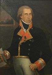
British naval captain George Vancouver was sent to Nootka Sound in 1792 in order to negotiate a settlement. His Spanish counterpart in the negotiations was Juan Francisco de la Bodega y Quadra, who was commandant of Santa Cruz de Nuca in 1792. Vancouver had sailed as a midshipman with Cook. The negotiations between Vancouver and Bodega y Quadra ended in a deadlock with nothing resolved. Vancouver insisted the entire Spanish establishment be turned over, but Bodega y Quadra held that there were no buildings seized in 1789, and the only possible land was a tiny and useless cove nearby. The two decided to refer the entire matter back to their respective governments. The friendly meeting between Bodega y Quadra and Vancouver led the former to propose that the island be named after both: "Quadra and Vancouver Island", which became the original name. While we know this island today as "Vancouver Island", the English explorer had not intentionally meant to name such a large body of land solely after himself.[12] In his September 1792 dispatch log report for the British Admiralty, Captain Vancouver reveals that his decision here was rather meant to honour a request by Bodega y Quadra that Vancouver:
- "would name some port or island after us both in commemoration of our meeting and friendly intercourse that on that occasion had taken place (Vancouver had previously feted Bodega y Quadra on his ship);....and conceiving no place more eligible than the place of our meeting, I have therefore named this land...The Island of Quadra and Vancouver."[13]
Bodega y Quadra wrote, however, that it was Vancouver who made the suggestion of combining their names to designate some geographical feature.[14]
In 1792, the Spanish explorer Dionisio Alcalá Galiano and his crew were the first Europeans to circumnavigate Vancouver Island. On April 8, 1806, Captain John D'Wolf of Bristol, Rhode Island, sailed the Juno to Newettee, a small inlet in the northwestern promontory of Vancouver's Island. The Captain described Newette as one of the southernmost harbors frequented by American fur traders at lat. 51 degrees N. and long. 128 degrees. He relates that since Captain Robert Gray of Tiverton, Rhode Island, had sailed the Columbia River in 1792, the trade of the Northwest coast had been almost entirely in the hands of Boston merchants, so much so that the natives called all traders "Boston Men."[15]
A settlement was not successfully negotiated and ownership of the island remained in dispute between Britain and the Spain in the early 1790s. The two countries nearly began a war over the issue; the confrontation became known as the Nootka Crisis. That was averted when both agreed to recognize the other's rights to the area in the first Nootka Convention in 1790, a first step to peace.[16] Finally, the two countries signed the second Nootka Convention in 1793 and the third Convention in 1794. As per that final agreement, the Spanish dismantled their fort at Nootka and left the area, giving the British sovereignty over Vancouver Island and the adjoining islands (including the Gulf Islands).[17]
For decades, "Quadra's and Vancouver's Island" was the most prominent name on maps of the coast, and appeared on most British, French and Spanish maps of the period. But as Spanish interests in the region dwindled, so did the use of Bodega y Quadra's name. The Hudson's Bay Company played a major part in the transition; by 1824 'Vancouver's Island' had become the usual designation in its correspondence for the island.[18]
A quarter of a century later, Vancouver Island had become such a well-known geographical feature that the founding of the Colony of Vancouver Island in 1849 gave this name full official status.[19] Period references to "Vancouver" referred to Vancouver Island until the naming of the city of Vancouver in 1885.
British settlement
In March of 1843, James Douglas of the Hudson's Bay Company and a missionary had arrived and selected an area for settlement. Construction of the fort began in June of that year.[22] This settlement was a fur trading post originally named Fort Albert (afterward Fort Victoria). The fort was located at the Songhees settlement of Camosack (Camosun), 200 metres northwest of the present-day Empress Hotel on Victoria's Inner Harbour.
In 1846, the Oregon Treaty was signed by the British and the U.S. to settle the question of the U.S. Oregon Territory borders.[23] The Treaty made the 49th parallel latitude north the official border between the two countries. In order to ensure that Britain retained all of Vancouver Island and the southern Gulf Islands, however, it was agreed that the border would swing south around that area.[24]
In 1849, the Colony of Vancouver Island was established. The Colony was leased to the Hudson’s Bay Company (HBC) for an annual fee of seven shillings; the Company's responsibility in return was to increase the population by promoting colonisation. The first independent settler arrived that year: Captain Walter Grant started a homestead in Sooke. Following the brief governorship of Richard Blanshard, James Douglas, Chief Factor of the Hudson's Bay post, assumed the role in 1851.
The island's first legislative assembly was formed in 1856.[25] Government buildings were built and were occupied in 1859; the replacement, today's Parliament Buildings, were opened in 1898.[26]
Fort Victoria had become an important base when prospectors, miners and merchants began arriving for the Fraser Canyon Gold Rush in 1858. The Hudson's Bay lease expired in 1859 and the island reverted to Great Britain. The burgeoning town was incorporated as Victoria in 1862. Victoria became the capital of the colony of Vancouver Island, retaining this status when the island was amalgamated with the mainland in 1866.[27]
A British naval base, including a large shipyard and a naval hospital, was established at Esquimalt in 1865 and eventually taken over by the Canadian military.[28]
Union and Confederation
The economic situation of the colony declined following the Cariboo Gold Rush of 1861–1862, and pressure grew for amalgamation of the colony with the mainland colony of British Columbia (which had been established in 1858). The two colonies were merged in 1866 into the United Colonies of Vancouver Island and British Columbia by the Act for the Union of the colonies, passed by the Imperial Parliament.[29] Kennedy was appointed governor of the united entity. (He would leave office in 1866 and later became Governor of the West African Settlements, British West Africa.)[30] Victoria became the capital but the legislative assembly was located in New Westminster on the Lower Mainland. The capital was moved to Victoria in 1868.[31]
Confederation
By 1867, Canada was established by the British North America Act and the United Colonies joined Canada on 20 July 1871. Victoria was named the capital of the province of British Columbia. Three delegates were appointed to the federal government.[32][33]
Geography
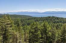
Vancouver Island is located in the southwestern corner of the province of British Columbia. It is separated from the mainland of British Columbia by Johnstone Strait and Queen Charlotte Strait on the north and northeast, and by the Strait of Georgia on the southeast, which along with the Strait of Juan de Fuca along its southwest separate it from the United States (the Straits of Georgia and Juan de Fuca are now officially also part of the Salish Sea, which includes Puget Sound as well). West of the island is the open Pacific Ocean, while to its north is Queen Charlotte Sound.

The Vancouver Island Ranges run most of the length of the island, dividing it into a wet and rugged west coast and a drier, more rolling east coast. The highest point in these ranges and on the island is the Golden Hinde, at 2,195 metres (7,201 ft). Located near the centre of Vancouver Island in 2,500 square kilometres (965 sq mi) Strathcona Provincial Park, it is part of a group of peaks that include the only glaciers on the island, the largest of which is the Comox Glacier. The west coast shoreline is rugged and in many places mountainous, characterized by its many fjords, bays, and inlets. The interior of the island has many lakes (Kennedy Lake, north of Ucluelet, is the largest) and rivers.
Rivers
There are a number of rivers draining the island, some of which though short are large in volume. Among the more notable rivers are the Somass River in the Alberni Valley, the Nimpkish River in the North Island region, the Englishman River up island from Nanaimo near Parksville, and the Cowichan River whose basin forms the Cowichan Valley region in the South Island region.
Major centres
.jpg)
Vancouver Island's major population centre and only metropolitan area is Greater Victoria. There are also six census agglomeration areas as defined by Statistics Canada, including Nanaimo which has a population over 100,000 and as of 2016 is eligible to become a CMA. These metropolitan and agglomeration areas' populations in 2016 were as follows:
| Rank | Metropolitan Area | Population (2016 Census)[35] | Core city |
|---|---|---|---|
| 1 | Greater Victoria | 367,770 | Victoria |
| 2 | Greater Nanaimo | 104,936 | Nanaimo |
| 3 | Comox Valley | 54,157 | Courtenay |
| 4 | Cowichan Valley | 44,451 | Duncan |
| 5 | Campbell River | 37,861 | Campbell River |
| 6 | Oceanside (Parksville-Qualicum Beach) | 28,922 | Parksville |
| 7 | Alberni Valley | 25,112 | Port Alberni |
Climate
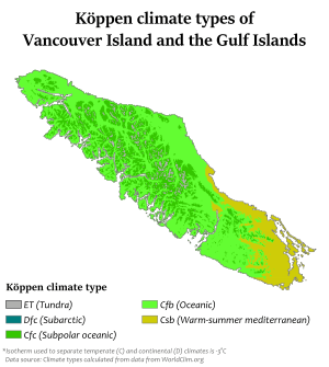
The climate is the mildest in Canada, with temperatures on the coast even in January being usually above 0 °C (32 °F).
In summer, the warmest days usually achieve a maximum of 28–33 °C (82.4–91.4 °F). However, the rain shadow effect of the island's mountains, as well as the mountains of Washington's Olympic Peninsula, creates wide variation in precipitation. The west coast is considerably wetter than the east coast. Average annual precipitation ranges from 6,650 millimetres (261.8 in) at Henderson Lake on the west coast (making it the wettest place in North America) to only 608 millimetres (23.9 in) at Victoria Gonzales, the driest recording station in the provincial capital of Victoria. Precipitation is heaviest in the autumn and winter. Snow is rare at low altitudes but is common on the island's mountaintops in winter.
A notable feature of Vancouver Island is the extension of summer dryness to latitudes as high as 50°N. Only in the extreme north of the island near Port Hardy is the rainfall of the driest summer month as much as one fifth that of the wettest months from November to March. West coasts of other continents at similar latitudes have a practically even distribution of rainfall through the year.
Geology

Vancouver Island is mostly made up of volcanic and sedimentary rock which was formed offshore on the now disappeared Kula oceanic plate. Around 55 million years ago, a microplate of the Kula Plate subducted below the North American continental margin with great strain. A volcanic arc on the surface of the Kula Plate was thus accreted and fused onto the western edge of North America. These terranes were subjected to extreme warping from continued subduction of the Kula plate, leading to the formation of the distorted Insular Mountains. Much of the central mountainous region around Strathcona Park is part of the Karmutsen Formation, which is a sequence of tholeiitic pillow basalts and breccias. Since Vancouver Island has become an accretionary wedge on the North American continent, the Kula Plate has fully subducted beneath it and the remnants of the Farallon Plate, the Juan de Fuca Plate, are now subducting below the island. This process has led to Vancouver Island being one of the most seismically active regions in Canada. The subduction zone off the coast of the island forms a section of the Pacific Ring of Fire. The area has been known to host megathrust earthquakes in the past, the last occurring in 1700. In 1946, the Forbidden Plateau in the east of the Vancouver Island Ranges was the epicentre of an earthquake that registered 7.3 on the moment magnitude scale, the strongest ever recorded on land in Canada.[36]
Vancouver Island was the location of the observation of the episodic tremor and slip seismic phenomenon.
Ecology
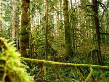
Vancouver Island lies in the temperate rainforest biome. On the southern and eastern portions of the island, this is characterized by Douglas fir, western red cedar, arbutus (or madrone), Garry oak, salal, Oregon grape, and manzanita; moreover, Vancouver Island is the location where the Douglas fir was first recorded by Archibald Menzies.[37] Vancouver Island is also the location where some of the tallest Douglas fir were recorded. This southeastern portion of the island is the most heavily populated region of Vancouver Island and a major area for recreation. The northern, western, and most of the central portions of the island are home to the coniferous "big trees" associated with British Columbia's coast – western hemlock, western red cedar, Pacific silver fir, yellow cedar, Douglas fir, grand fir, Sitka spruce, and western white pine. It is also characterised by bigleaf maple, red alder, sword fern, and red huckleberry.
The fauna of Vancouver Island is similar to that found on the mainland coast, with some notable exceptions and additions. For example, mountain goats, moose, porcupines, chipmunks, and numerous species of small mammals, while plentiful on the mainland, are absent from Vancouver Island. Grizzly bears are absent from the island, where black bears are prevalent, but in 2016 a pair of grizzlies were sighted swimming between smaller islands off the coast near Port McNeill.[38] Vancouver Island does support most of Canada's Roosevelt elk, however, and several mammal species and subspecies, such as the Vancouver Island marmot are unique to the island. The island's rivers, lakes, and coastal regions are renowned for their fisheries of trout, salmon, and Steelhead. It has the most concentrated population of cougars in North America. Wolves are also present on this island.[39]
After near-total extirpation by fur traders in the eighteenth and nineteenth centuries, sea otters (Enhydra lutris) were protected by international treaty in 1911. Despite protection, the remnant population off Vancouver Island died out with the last sea otter taken near Kyuquot in 1929. From 1969 to 1972, 89 sea otters were flown or shipped from Alaska to the west coast of Vancouver Island. This population expanded to over 3,000 as of 2005, and their range on the island's west coast expanded from Cape Scott in the north to Barkley Sound to the south.[40]
Economy
Technology
Within the island's largest city, Victoria, there is a significant IT and technology industry. According to the Victoria Advanced Technology Council website, over 800 technology companies operate in the Victoria area, with combined annual revenues of $1.95 billion.[41]
High-speed internet is delivered to the island by Shaw Communications, Telus, and various local providers with their own networks. Wireless Internet connections can be found all over the island, many free for public use.
While the island does generate much of its own power at several hydroelectric stations, increased demand required the construction of several high-voltage power cables, both HVDC and AC, connecting to the Canadian Mainland. See power lines connecting Vancouver Island with Canadian Mainland.
Logging
Outside of Victoria, Vancouver Island's economy is largely dominated by the forestry industry. Many of the logging operations are for export, although, historically, were for sawn lumber and pulp and paper operations. Recently, rotations are much shorter than the historical 80 years. Logging operations involving old-growth forests such as those found in Clayoquot Sound are controversial and have gained international attention through the efforts of activists and environmental organizations. Another source of controversy all over the island are logging operations occurring in community watersheds.
Fishing
Fishing plays a large role in the lives of many islanders. Commercial fishing vessels operate out of the island's ports and harbours, and coastal fish farms produce many tons of Atlantic salmon yearly.[42][43][44]
Tourism

In recent years the government of British Columbia has engaged in an advertising program to draw more tourists to beach resorts in places such as Tofino and Ucluelet. Sport fishing, whale-watching, hiking, SCUBA diving, surfing, and skiing are just a few things for which tourists visit Vancouver Island. Visitors also come to see Victoria's nineteenth-century architecture, and the many villages which line the coast such Cowichan Bay, Chemainus, and Qualicum Beach.
Food products
Consumer food products companies also exist in the various cities and towns on Vancouver Island. Bakeries, dairies, food processing plants, breweries, wineries, of varying size and scope, are found all along the island. Some of these organizations have international customer reach.
Education
Vancouver Island is home to a handful of universities, several colleges and trade-schools, hundreds of public schools, and a few dozen private schools (including Montessori and Waldorf schools).
Universities
- University of Victoria
- Vancouver Island University (formerly Malaspina University-College)
- Royal Roads University
Colleges
Public school districts
There are 12 school districts on Vancouver Island with several elementary, junior high, and high schools in each. Three school districts are in the Greater Victoria area and the other eight cover the rest of the island to the north. All public schooling falls under the jurisdiction of the British Columbia Ministry of Education.
Private schools
- St. Michael's University School, Victoria, with campuses in Oak Bay and Saanich
- Glenlyon Norfolk, Victoria
- St. Margaret's School, Victoria (limited to female students)
- Brentwood College, Mill Bay
- Shawnigan Lake
- Queen Margaret's School, Duncan
- Brookes Shawnigan Lake
- Sunrise Waldorf School, Duncan
- Island Oak High School, Duncan
- Maria Montessori Academy, Victoria, located in Gordon Head
- Selkirk Montessori School, Victoria, located at the Selkirk Waterway
- Lester B. Pearson College of the Pacific, Metchosin
- St. Joseph's Chemainus Catholic Elementary School, Chemainus
- Duncan Christian School, Duncan
- Nanaimo Christian School, Nanaimo
- Pacific Christian School, Victoria
- Phil and Jennie Gaglardi Academy (formerly Comox Valley Christian School), Comox
- Aspengrove School, Nanaimo
- St. Joseph's Catholic Elementary School, Victoria
- St. Patrick's Catholic Elementary School, Victoria
- St. Andrew's Regional High School, Victoria
- Queen of Angels, Duncan
- John Paul II, Port Alberni
Transport
Sea
Marine transport is very important to Vancouver Island for access to the mainland of British Columbia and Washington. There are no bridges connecting the island to the mainland, although the idea of building one has been brought up many times. Major technical issues and cost are the largest barriers to a bridge currently though exact public support for the idea is not currently known.[45] The only vehicle access to Vancouver Island is by ferry. BC Ferries, Washington State Ferries and Black Ball Transport Inc. operate the seven vehicle ferry routes to the island.

BC Ferries
- Tsawwassen (38 km (24 mi) south of Vancouver) – Swartz Bay (32 km (20 mi) north of Victoria)
- Crossing time: 1 hour 35 minutes; 8 sailings per day year-round with added sailings depending on day and season)
- Tsawwassen – Duke Point (13 km (8 mi) south of Nanaimo)
- Crossing time: 2 hours; 8 round trips daily – varies in winter.
- Horseshoe Bay (19 km (12 mi) northwest of Vancouver) – Departure Bay (3 km (2 mi) north of downtown Nanaimo)
- Crossing time: 1 hour 35 minutes; Sailings every 2 hours with extra sailings during the summer and holidays.
- Gulf Islands – Swartz Bay
- Crossing time: 35 minutes- 3 hours depending on island of departure; 4 or more trips daily.
- Powell River – Comox
- Crossing time: 1 hour 20 minutes; 4 round trips daily.
- Port Hardy – Prince Rupert
- Service daily or on alternate days; changes seasonally.
Washington State Ferries
- Crossing time: 2 hours (not counting stops in the San Juan Islands)
- 1 round trip in March–June and September–January – 2 round trips in June–September
Black Ball Transport
- Port Angeles, Washington – Victoria
- Crossing time: 1 hour 30 minutes; 1 to 4 round trips daily; changes seasonally.
Passenger-only service In addition, there is passenger-only ferry services from the mainland to Vancouver Island:
- Victoria Clipper (Seattle, Washington – Victoria)
- Crossing time: 2 hour 45 minutes; 1 to 3 round trips daily
- In the past, several private operators have run ferries between Nanaimo and Vancouver (most recently by HarbourLynx). Despite the operations repeatedly going bankrupt, there is still popular interest and ongoing discussion regarding re-establishing service between Nanaimo and Vancouver, but no signs that operations are imminent.[46][47][48][49]
Rail
The Island Corridor Foundation (ICF), a federally registered charity, was established in 2006 for the purposes of owning and managing the former Esquimalt and Nanaimo Railway (E&N) Corridor on Vancouver Island. The ICF has established a contract with Southern Rail of Vancouver Island (SVI) to move all rail freight on the island to and from the mainland. SVI is a private commercial rail company and subsidiary of Southern Rail of British Columbia, a short line rail operator that is part of the Washington Transportation Group. SVI assumed operating control from RailAmerica in July 2006 and offers general freight service only on the north Nanaimo to South Duncan segment of the Victoria–Courtenay main line (called the Victoria Subdivision by the railroad). The Port Alberni branch line (called the Port Alberni Subdivision by the railroad) has been out of service since late 2001. Passenger service, which had been operated by Via Rail under contract, was halted in 2011 after it was identified that a portion of the line failed to meet operating requirements for passenger service.[50] Since then, there have been ongoing efforts to secure funding from various levels of government to complete the necessary repairs, but the decision remains open.
Western Forest Products operates the Englewood Railway which is Canada's last logging railway, running from Woss to Beaver Cove on the northern end of the island. The former Canadian National Railway line running from Victoria to the Cowichan Valley was abandoned in the late 1980s/early 1990s, and the former grade between Victoria and Sooke is now the multi-use Galloping Goose Regional Trail. The BC Forest Discovery Centre has a narrow gauge railway winding around the park, and the Alberni Pacific Railway operates a tour train during the summer from the restored E&N Railway station in Port Alberni to the McLean's Mill on former E&N Railway trackage that is now owned by the ICF.
Road
There is one major north-south highway system on the island, which runs along the eastern side. It begins in Victoria as Highway 1 which is part of the Trans-Canada Highway system as far as Nanaimo. There, Highway 19 takes over and continues to Port Hardy. The route is a patchwork of two-, four-, and six-lane roadways between Victoria and Port Hardy. The engineering characteristics and traffic control systems of the roadway vary widely from one city or district to the next and include the following variations:
Trans-Canada Highway:
- Congested, heavily signalized four-lane urban core streets with heavy pedestrian activity in Victoria and Duncan.
- Short four- to six-lane freeways with interchanges just west of Victoria and just south of Nanaimo.
- A mix of two-lane to four-lane winding mountain arterial highway through the Malahat pass that is subject to frequent accidents and closures.
- A moderate to heavily signalized four-lane divided arterial highway from Mill Bay to Nanaimo (interrupted by the Duncan urban-core bottleneck).
Highway 19:
- A moderately signalized expressway called the Nanaimo Parkway bypassing Nanaimo.
- A lightly signalized four-lane divided arterial highway from the Nanaimo to Parksville.
- A stretch of four-lane high-speed freeway/expressway from Parksville to Campbell River.
- A moderate-speed two-lane arterial highway north from Campbell River to Port Hardy.[51]
Without a "fixed link" to the BC mainland, there is little probability of substantial improvements in the mobility characteristics of some of the more congested or heavily signalized sections of the Island Trans-Canada Highway or the Nanaimo Parkway. Proposals have been made for this kind of link for over a century. Because of the extreme depth and soft seabed of the Georgia Strait, and the potential for seismic activity, a bridge or tunnel would face monumental engineering, safety, and environmental challenges at a prohibitive cost.[52]
Another north-south route is Highway 17 a four-lane divided highway that has a mix of interchanges and traffic lights. It connects Victoria with the Saanich Peninsula, terminating the Vancouver Island portion of its route at the Swartz Bay Ferry Terminal.
The main east-west routes are mostly two-lane but are generally free of the congestion seen on some of the four-lane highways. They comprise the following:
- Highway 4 between Qualicum Beach and Tofino;
- Highway 14 between Greater Victoria and Port Renfrew;
- Highway 18 between Duncan and Lake Cowichan;
- Highway 28 between Campbell River and Gold River; and
- Highway 30 between Port McNeill and Port Alice.
Vancouver Island is also well served by secondary routes, a growing number of which have efficient roundabouts in place of the traffic lights that can back up traffic on the main highway routes. Numerous active and decommissioned logging and forest service roads provide access into the back country.
Many communities are served by public and private transit. Greater Victoria is one of the few places in North America where double-decker buses are used in the regular public transit system. Tofino Bus All Island Express serves all major cities on Vancouver Island including Greyhound stations.[53]
Air
Victoria International Airport (YYJ)
- Victoria Airport is the major airport on Vancouver Island. In 2010, it was the 9th busiest airport in Canada in terms of passenger movements (1,464,420).[54] Six major carriers (Air Canada, United Airlines, Horizon Air, Delta Air Lines (2016–), Pacific Coastal Airlines and WestJet) offer a variety of direct flights of short and medium distance including to and from Seattle, San Francisco, Calgary, Edmonton, Vancouver, and Toronto. Victoria International also has seasonal service to Puerto Vallarta.
CFB Comox (YQQ)
- CFB Comox/Comox Valley Airport is a shared military and civilian airport. In 2010 the Comox Valley Airport was the second busiest airport on Vancouver Island in terms of passenger movements (291,910).[54] It offers direct flights to Calgary, Edmonton, Vancouver, and Campbell River several times daily, as well as Puerto Vallarta, Mexico, on a weekly basis through WestJet.
Nanaimo Airport (YCD)
- Nanaimo Airport has flights with Air Canada Jazz to Vancouver and Calgary, Westjet Airlines to Calgary, Island Express Air to Victoria and Abbotsford. A recently installed (as of February 2010) instrument landing system and runway extension has improved the capacity, safety, and punctuality of flights. There are more improvements slated for completion March 2011.[55]
Qualicum Beach Airport (XQU), Tofino Airport (YAZ), Campbell River Airport (YBL) and Port Hardy Airport (YZT)
- Qualicum Beach,[56] Tofino, Campbell River and Port Hardy have small airports capable of handling private aircraft and small commercial jets.
Harbour Airports and Heliports
- Floatplane and helicopter traffic to and from Victoria's Inner Harbour (YWH) accounted for 261,712 passengers in 2010,[54] making it the third busiest airport on Vancouver Island. Nanaimo Harbour (ZNA) also operates a busy water aerodrome. Much of the floatplane traffic is downtown-to-downtown service between these two and Vancouver Harbour, the primary carriers being Harbour Air, West Coast Air, and Baxter Aviation. Harbour Air also flies to other areas around Vancouver, service to Seattle's Lake Union is provided by Kenmore Air, and Orca Airways runs flights between Vancouver and Tofino Harbour. These carriers make several daily scheduled flights, weather permitting. Helicopter service is provided by Helijet in Victoria and various private operators elsewhere.
See also
Notes
- Though Isla Grande de Tierra del Fuego (off the southern tip of South America) and Alexander Island (west of Palmer Land, Antarctic Peninsula) are both larger, neither are generally considered "Pacific islands" due to their locations in the Southern Ocean, bordering the Atlantic.
References
- "The Atlas of Canada – Sea Islands". Archived from the original on 2006-06-04. Retrieved 2010-09-16.
- "BC Parks – Strathcona Provincial Park, Central Vancouver Island, British Columbia". Retrieved 2010-09-16.
- "Saanich, BC Census Profile". Retrieved 2014-11-12.
- Sub-provincial Population Estimates. BC Stats. Retrieved 2020-01-24.
- "Regional Geography – Vancouver Island, BC – Destination BC – Official Site". Hellobc.com. Retrieved 8 January 2018.
- "Milder winters allow growth of lemons and olives on Vancouver Island". The Globe and Mail. Retrieved 8 January 2018.
- "History and Heritage of Vancouver Island, British Columbia". Retrieved 2007-07-08.
- "History of Victoria". City of Victoria. 19 October 2018. Retrieved 13 January 2020.
- "Early European Exploration in Nootka Sound". Get West. 19 March 2011. Retrieved 13 January 2020.
- "History of Victoria". City of Victoria. 19 October 2018. Retrieved 13 January 2020.
- "Early European Exploration in Nootka Sound". Get West. 19 March 2011. Retrieved 13 January 2020.
- The Voyage of George Vancouver 1791–1795, Volume 1, ed: W. Kaye Lamb, Hakluyt Society, 1984, p.247
- George Vancouver, "A Narrative of my proceedings in HMS Discovery from 28 August – 26 September 1792"; the cited quote from Vancouver is given in the final section of his report here from Nootka and is dated 26 September 1792, P.R.O., C.O. 5/187, f. 114
- Tovell, Freeman M. (2008). At the Far Reaches of Empire: The Life of Juan Francisco De La Bodega Y Quadra. University of British Columbia Press. p. 249. ISBN 978-0-7748-1367-9.
- Tales of an Old Seaport ed: Wilfred Harold Munro, Princeton University Press, 1917, pp.109–114
- "Vancouver Island History". Discover Vancouver Island. Retrieved 13 January 2020.
- "Early European Exploration in Nootka Sound". Get West. 19 March 2011. Retrieved 13 January 2020.
- The Voyage of George Vancouver in Lamb, 1984, p.247
- The Voyage of George Vancouver in Lamb, 1984, p.248
- Swan, Conrad (8 January 1977). Canada, symbols of sovereignty: an investigation of the arms and seals borne and used from the earliest times to the present in connection with public authority in and over Canada, along with consideration of some connected flags. University of Toronto Press. Retrieved 8 January 2018 – via Internet Archive.
- "The Flags of Canada by Alistair B. Fraser". Fraser.cc. Retrieved 2011-11-26.
- "History of Victoria". City of Victoria. 19 October 2018. Retrieved 13 January 2020.
- "Places". Our History. Hbc Heritage. Archived from the original on 2004-12-06. Retrieved 2008-03-08.
- "Britain and the United States agree on the 49th parallel as the main Pacific Northwest boundary in the Treaty of Oregon on June 15, 1846". History Link. 13 July 2013. Retrieved 13 January 2020.
- "Vancouver Island History timeline". Tourism Vancouver Island. 11 July 2016. Retrieved 13 January 2020.
- "History of Victoria". City of Victoria. 19 October 2018. Retrieved 13 January 2020.
- "History of Victoria". City of Victoria. 19 October 2018. Retrieved 13 January 2020.
- "Vancouver Island History timeline". Tourism Vancouver Island. 11 July 2016. Retrieved 13 January 2020.
- "History of Victoria". City of Victoria. 19 October 2018. Retrieved 13 January 2020.
- "KENNEDY, Sir ARTHUR EDWARD". Dictionary of Canadian Biography. 19 October 2018. Retrieved 13 January 2020.
- "History of Victoria". City of Victoria. 19 October 2018. Retrieved 13 January 2020.
- "Vancouver Island History timeline". Tourism Vancouver Island. 11 July 2016. Retrieved 13 January 2020.
- "History of Victoria". City of Victoria. 19 October 2018. Retrieved 13 January 2020.
- Canada, Government of Canada, Statistics. "Census Profile, 2016 Census – Vancouver Island and Coast [Economic region], British Columbia and Saskatchewan [Province]". www12.statcan.gc.ca. Retrieved 2018-04-30.
- "Population and dwelling counts, for Canada, provinces and territories, census metropolitan areas and census agglomerations, 2016 and 2011 censuses – 100% data". 12.statcan.gc.ca. Retrieved 8 January 2017.
- Derek Sidenius (1999-01-24). "Shake, Rattle and Roll in '46 Earthquake". Victoria Times Colonist Islander Magazine. Archived from the original on 2006-09-26. Retrieved 2006-07-14.
- C. Michael Hogan (2008) Douglas-fir: Pseudotsuga menziesii Archived 2009-06-04 at the Wayback Machine, GlobalTwitcher.com, ed. Nicklas Strõmberg)
- Yvette Brend. "Grizzly bears spotted swimming near Port McNeill seen as 'red flag'". CBC News.
- "VI-WILDS – Vancouver Island Wolf – Vancouver Island Wildlife". www.geog.uvic.ca.
- "Sea Otter Recovery on Vancouver Island's West Coast". Bamfield Marine Sciences Centre Public Education Programme. Retrieved 2011-08-22.
- "What is VIATeC? – VIATeC". Viatec.ca. Retrieved 2010-09-13.
- "Fresh Fish in BC". Marineharvestcanada.com. Retrieved 8 January 2017.
- "Vancouver Island salmon farm accused of putting diseased fish in ocean pens". Times Colonist. Retrieved 2013-06-27.
- "BC farmed Atlantic salmon sales". Mainstreamcanada.ca. Mainstream Canada Aquaculture. Archived from the original on 2013-07-07. Retrieved 2013-06-27.
- "A Potential Fixed Link to Vancouver Island". British Columbia Ministry of Transportation and Infrastructure. Archived from the original on 2010-08-21. Retrieved 2012-01-28.
- "Passenger Ferry Survey 2009" (PDF). City of Nanaimo. Archived from the original (PDF) on 2012-03-04. Retrieved 2012-01-28.
- "Businessman proposes Nanaimo passenger ferry to mainland". Stephen Rees's blog. Stephenrees.wordpress.com. 2008-12-03. Retrieved 2010-09-13.
- "Downtown Nanaimo To Downtown Vancouver Passenger Ferry Survey". nanaimo-info-Blog. 2009-02-05. Retrieved 2010-09-13.
- Wilson, Carla. "Nanaimo adds urgency to passenger ferry plan". Times Colonist. Retrieved 2016-01-28.
- "No Vancouver Island railway deal yet, says VIA Rail". Cbc.ca. Retrieved 2016-01-28.
- BC ministry of transportation and infrastructure (2013). "BC highways". Retrieved 2013-10-24.
- "A Potential Fixed Link to Vancouver Island – Ministry of Transportation". Th.gov.bc.ca. Archived from the original on 2010-08-21. Retrieved 2010-09-13.
- Tofino Bus (2016). "Tofino Bus schedule". Retrieved 2016-06-23.
- "Air Carrier Traffic at Canadian Airports (Catalogue no. 51-203-X)" (PDF). Statistics Canada. 2010. p. 10. Retrieved 2013-06-27.
- "YCD". Nanaimo Airport. Archived from the original on 2008-08-20. Retrieved 2010-09-13.
- "CAT4 – Qualicum Beach Airport". Qualicum Beach. Retrieved 2012-04-15.
Further reading
- Cheadle, Chris (2008). Portrait of Vancouver Island. Heritage House Pub. ISBN 978-1-894974-47-9. Retrieved 2013-06-27.
External links
| Wikimedia Commons has media related to Vancouver Island. |
| Wikivoyage has a travel guide for Vancouver Island. |
- Birds of Vancouver Island
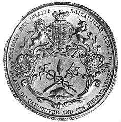
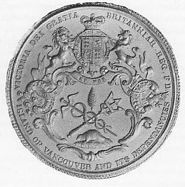
- Great Seal of the crown colony of Vancouver Island
- Measuring crustal motions in coastal British Columbia with continuous GPS
- BC Ministry of Transportation – Report on Fixed Link
- Qualicum Beach Airport on COPA's Places to Fly airport directory
| Subdivisions |  | |
|---|---|---|
| Communities | ||
| Metro areas and agglomerations |
| |
| Regions | ||
| ||
| Authority control |
|
|---|