Fowler, Colorado
Fowler is a Statutory Town in Otero County, Colorado, United States. The town is named in honor of Orson Squire Fowler. The population was 1,182 at the 2010 census.
Fowler, Colorado | |
|---|---|
 Fowler welcome sign | |
 Location of Fowler in Otero County, Colorado. | |
| Coordinates: 38°7′42″N 104°1′30″W | |
| Country | |
| State | |
| County[1] | Otero |
| Incorporated (town) | August 25, 1925[2] |
| Government | |
| • Type | Statutory Town[1] |
| Area | |
| • Total | 0.52 sq mi (1.36 km2) |
| • Land | 0.52 sq mi (1.36 km2) |
| • Water | 0.00 sq mi (0.00 km2) 6%% |
| Elevation | 4,340 ft (1,322 m) |
| Population (2010) | |
| • Total | 1,182 |
| • Estimate (2018)[5] | 1,144 |
| • Density | 2,185.11/sq mi (844.39/km2) |
| Time zone | UTC-7 (MST) |
| • Summer (DST) | UTC-6 (MDT) |
| ZIP code[6] | 81039 |
| Area code(s) | 719 |
| FIPS code | 08-27975 |
| GNIS feature ID | 0204802 |
| Website | fowlercolorado.com |
History
Fowler was named for Orson Squire Fowler, a phrenologist who founded the town.[7] The town was incorporated in 1925.[8]
The town was built as a small railroad station for the Atchison, Topeka and Santa Fe Railway. The town was originally named Oxford, for a large ox that was killed when crossing the railroad tracks. The name of the town was changed because there was another town named Oxford located on the rail line. [9]
Geography
Fowler is located at 38°7′42″N 104°1′30″W (38.128343, -104.025007).[10]
According to the United States Census Bureau, the town has a total area of 0.5 square miles (1.3 km2), all of it land.
Demographics
| Historical population | |||
|---|---|---|---|
| Census | Pop. | %± | |
| 1910 | 925 | — | |
| 1920 | 1,062 | 14.8% | |
| 1930 | 968 | −8.9% | |
| 1940 | 922 | −4.8% | |
| 1950 | 1,025 | 11.2% | |
| 1960 | 1,240 | 21.0% | |
| 1970 | 1,241 | 0.1% | |
| 1980 | 1,227 | −1.1% | |
| 1990 | 1,154 | −5.9% | |
| 2000 | 1,206 | 4.5% | |
| 2010 | 1,182 | −2.0% | |
| Est. 2018 | 1,144 | [5] | −3.2% |
| U.S. Decennial Census[11] | |||
As of the census[12] of 2000, there were 1206 people, 521 households, and 330 families residing in the town. The population density was 2,468.5 people per square mile (950.3/km²). There were 591 housing units at an average density of 1,209.7 per square mile (465.7/km²). The racial makeup of the town was 95.02% White, 0.08% Black, 1.08% Native American, 0.17% Asian, 2.99% from other races, and 0.66% from two or more races. Latino or Hispanic of any race were 12.35% of the population.
There were 521 households out of which 25.9% had children under the age of 18 living with them, 52.8% were married couples living together, 7.7% had a female householder with no husband present, and 36.5% were non-families. 34.5% of all households were made up of individuals and 16.3% had someone living alone who was 65 years of age or older. The average household size was 2.22 and the average family size was 2.87.
In the town, the population was spread out with 22.3% under the age of 18, 7.5% from 18 to 24, 22.5% from 25 to 44, 23.1% from 45 to 64, and 24.6% who were 65 years of age or older. The median age was 43 years. For every 100 females, there were 84.4 males. For every 100 females age 18 and over, there were 79.2 males. The Civilians are protected and served by the Fowler Police Department
The median income for a household in the town was $25,761, and the median income for a family was $32,143. Males had a median income of $25,536 versus $20,750 for females. The per capita income for the town was $15,501. About 11.3% of families and 11.9% of the population were below the poverty line, including 13.0% of those under age 18 and 9.3% of those age 65 or over.
Education
The Fowler School District has one elementary school and one high school. Their high school mascot is the Grizzlies.
Transportation
Fowler is part of Colorado's Bustang network. It is along the Lamar-Pueblo-Colorado Springs Outrider line.[13]
Gallery
 Aerial view of the Arkansas River at Fowler
 Fowler State Bank building
 Fowler Fire Department and City Hall on U.S. Highway 50
 First Methodist Church of Fowler
 Fowler Historical Society
See also
- Outline of Colorado
- State of Colorado
- Colorado cities and towns
- Colorado municipalities
- Colorado counties
- Colorado cities and towns
References
- "Active Colorado Municipalities". State of Colorado, Department of Local Affairs. Archived from the original on 2009-12-12. Retrieved 2007-09-01.
- "Colorado Municipal Incorporations". State of Colorado, Department of Personnel & Administration, Colorado State Archives. 2004-12-01. Retrieved 2007-09-02.
- "2016 U.S. Gazetteer Files". United States Census Bureau. Retrieved Jul 25, 2017.
- "US Board on Geographic Names". United States Geological Survey. 2007-10-25. Retrieved 2015-09-01.
- "Population and Housing Unit Estimates". Retrieved February 12, 2020.
- "ZIP Code Lookup". United States Postal Service. Archived from the original (JavaScript/HTML) on November 4, 2010. Retrieved October 19, 2015.
- Dawson, John Frank. Place names in Colorado: why 700 communities were so named, 150 of Spanish or Indian origin. Denver, CO: The J. Frank Dawson Publishing Co. p. 22.
- "Fowler, Colorado". City-Data.com. Retrieved July 12, 2012.
- "History". Fowler, Colorado. Retrieved July 12, 2012.
- "US Gazetteer files: 2010, 2000, and 1990". United States Census Bureau. 2011-02-12. Retrieved 2011-04-23.
- "Census of Population and Housing". Census.gov. Retrieved June 4, 2015.
- "U.S. Census website". United States Census Bureau. Retrieved 2008-01-31.
- "Bustang Schedule". RideBustang. CDOT.
External links
Municipalities and communities of Otero County, Colorado, United States | ||
|---|---|---|
| Cities | 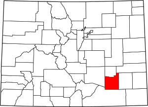 Map of Colorado highlighting Otero County | |
| Towns | ||
| CDPs | ||
| Unincorporated communities | ||
| Ghost town | ||

| Authority control |
|
|---|