Crowley, Colorado
The Town of Crowley is a Statutory Town in Crowley County, Colorado, United States. The town population was 176 at the 2010 United States Census.[10]
Town of Crowley, Colorado | |
|---|---|
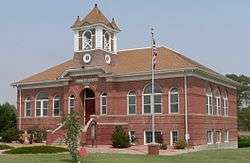 The Crowley County Heritage Center, formerly the Crowley School, is listed in the National Register of Historic Places.[2] | |
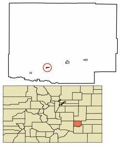 Location of Crowley in Crowley County, Colorado. | |
| Coordinates: 38°11′37″N 103°51′35″W[3] | |
| Country | |
| State | |
| County | Crowley County[4] |
| Incorporated | October 10, 1921[5] |
| Government | |
| • Type | Statutory Town[4] |
| Area | |
| • Total | 0.23 sq mi (0.58 km2) |
| • Land | 0.23 sq mi (0.58 km2) |
| • Water | 0.00 sq mi (0.00 km2) |
| Elevation | 4,354 ft (1,327 m) |
| Population (2010) | |
| • Total | 176 |
| • Estimate (2018)[8] | 167 |
| • Density | 768.89/sq mi (296.22/km2) |
| Time zone | UTC-7 (MST) |
| • Summer (DST) | UTC-6 (MDT) |
| ZIP codes[9] | 81033-81034 |
| Area code(s) | 719 |
| FIPS code | 08-18750 |
| GNIS feature ID | 0195382 |
Geography
Crowley is located in southern Crowley County at 38°11′37″N 103°51′28″W (38.193614, -103.857802).[11] Colorado State Highway 96 leads east 6 miles (10 km) to Ordway, the county seat, and west 43 miles (69 km) to Pueblo. Highway 207 leads south 6 miles (10 km) to Manzanola and U.S. Route 50.
According to the United States Census Bureau, Crowley has a total area of 0.22 square miles (0.58 km2), all of it land.[10]
Demographics
| Historical population | |||
|---|---|---|---|
| Census | Pop. | %± | |
| 1920 | 224 | — | |
| 1930 | 323 | 44.2% | |
| 1940 | 318 | −1.5% | |
| 1950 | 379 | 19.2% | |
| 1960 | 265 | −30.1% | |
| 1970 | 216 | −18.5% | |
| 1980 | 192 | −11.1% | |
| 1990 | 225 | 17.2% | |
| 2000 | 187 | −16.9% | |
| 2010 | 176 | −5.9% | |
| Est. 2018 | 167 | [8] | −5.1% |
| U.S. Decennial Census[12] | |||
As of the census[13] of 2000, there were 187 people, 76 households, and 48 families residing in the town. The population density was 730.6 people per square mile (277.7/km²). There were 85 housing units at an average density of 332.1 per square mile (126.2/km²). The racial makeup of the town was 82.35% White, 1.60% African American, 2.67% Native American, 12.30% from other races, and 1.07% from two or more races. Hispanic or Latino of any race were 39.04% of the population.
There were 76 households out of which 27.6% had children under the age of 18 living with them, 44.7% were married couples living together, 14.5% had a female householder with no husband present, and 36.8% were non-families. 31.6% of all households were made up of individuals and 14.5% had someone living alone who was 65 years of age or older. The average household size was 2.46 and the average family size was 3.19.
In the town, the population was spread out with 25.7% under the age of 18, 11.2% from 18 to 24, 21.9% from 25 to 44, 23.5% from 45 to 64, and 17.6% who were 65 years of age or older. The median age was 40 years. For every 100 females, there were 98.9 males. For every 100 females age 18 and over, there were 93.1 males.
The median income for a household in the town was $30,313, and the median income for a family was $32,083. Males had a median income of $21,875 versus $20,500 for females. The per capita income for the town was $11,119. About 8.3% of families and 15.3% of the population were below the poverty line, including 22.0% of those under the age of eighteen and 24.0% of those sixty five or over.
Notable People
Jonathan Almanzar (founder of Chick'nCone)[14]
See also
- Outline of Colorado
- State of Colorado
- Colorado cities and towns
- Colorado municipalities
- Colorado counties
- Colorado cities and towns
References
- "Crowley County Heritage Center". Archived 2013-09-02 at the Wayback Machine Retrieved 2012-08-27.
- "Crowley County Heritage Center". Archived 2013-09-02 at the Wayback Machine Retrieved 2012-08-27.
- "2014 U.S. Gazetteer Files: Places". United States Census Bureau. July 1, 2014. Retrieved January 5, 2015.
- "Active Colorado Municipalities". State of Colorado, Department of Local Affairs. Archived from the original on December 12, 2009. Retrieved 2007-09-01.
- "Colorado Municipal Incorporations". State of Colorado, Department of Personnel & Administration, Colorado State Archives. 2004-12-01. Retrieved 2007-09-02.
- "2016 U.S. Gazetteer Files". United States Census Bureau. Retrieved Jul 25, 2017.
- "US Board on Geographic Names". United States Geological Survey. 2007-10-25. Retrieved 2008-01-31.
- "Population and Housing Unit Estimates". Retrieved March 21, 2020.
- "ZIP Code Lookup". United States Postal Service. Archived from the original (JavaScript/HTML) on November 4, 2010. Retrieved September 6, 2007.
- "Geographic Identifiers: 2010 Demographic Profile Data (G001): Crowley town, Colorado". U.S. Census Bureau, American Factfinder. Archived from the original on February 12, 2020. Retrieved June 24, 2014.
- "US Gazetteer files: 2010, 2000, and 1990". United States Census Bureau. 2011-02-12. Retrieved 2011-04-23.
- "Census of Population and Housing". Census.gov. Retrieved June 4, 2015.
- "U.S. Census website". United States Census Bureau. Retrieved 2008-01-31.
- "Founders". Chick'nCone. Retrieved 2018-06-03.
External links
- Town of Crowley page at Crowleycounty.net
- CDOT map of the Town of Crowley
Municipalities and communities of Crowley County, Colorado, United States | ||
|---|---|---|
| Towns | 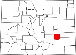 Map of Colorado highlighting Crowley County | |
