Conejos, Colorado
Conejos is a census-designated place,[3] a U.S. Post Office, and the county seat of Conejos County, Colorado, United States.[4] Conejos has the distinction of being the only unincorporated county seat in the state of Colorado. As of the 2010 Census, the CDP had a population of 58.[5] The community is located in the San Luis Valley.
Conejos, Colorado | |
|---|---|
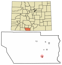 Location of Conejos in Conejos County, Colorado. | |
 Conejos Location within the state of Colorado  Conejos Conejos (the United States) | |
| Coordinates: 37°05′19″N 106°01′12″W | |
| Country | |
| State | |
| County | Conejos County Seat[1] |
| Area | |
| • Total | 0.48 sq mi (1.25 km2) |
| • Land | 0.48 sq mi (1.25 km2) |
| • Water | 0 sq mi (0 km2) |
| Elevation | 7,904 ft (2,409 m) |
| Population (2010) | |
| • Total | 58 |
| • Density | 120/sq mi (46.3/km2) |
| Time zone | UTC-7 (MST) |
| • Summer (DST) | UTC-6 (MDT) |
| ZIP Code[2] | 81129 |
| Area code(s) | 719 |
| FIPS code | 08-16715 |
Conejos is a historic site of Hispano settlement. A major historical and architectural feature of Conejos is the Our Lady of Guadalupe Parish Church, founded in 1858.
The Conejos Post Office has the ZIP Code 81129.[2]
A post office called Conejos has been in operation since 1862.[6] The community takes its name from Conejos County.[7]
Geography
Conejos is located in southeastern Conejos County at 37°05′19″N 106°01′12″W (37.088597,-106.019955). It is bordered to the south by the town of Antonito. U.S. Route 285 forms the eastern edge of the community and leads north 28 miles (45 km) to Alamosa, Colorado, and south 31 miles (50 km) to Tres Piedras, New Mexico.
According to the U.S. Census Bureau, Conejos has a total area of 0.48 square miles (1.25 km2), all of it land.[8]
References
- "US Board on Geographic Names". United States Geological Survey. 2007-10-25. Retrieved 2008-01-31.
- "ZIP Code Lookup". United States Postal Service. December 22, 2006. Archived from the original (JavaScript/HTML) on September 3, 2007. Retrieved December 22, 2006.
- "Archived copy" (PDF). Archived from the original (PDF) on 2012-04-01. Retrieved 2011-02-05.CS1 maint: archived copy as title (link)
- "Find a County". National Association of Counties. Archived from the original on 2011-05-31. Retrieved 2011-06-07.
- Colorado Trend Report 2: State and Complete Places (Sub-state 2010 Census Data). Archived 2012-07-11 at Archive.today Missouri Census Data Center. Accessed 2011-02-25.
- "Post offices". Jim Forte Postal History. Archived from the original on 6 March 2016. Retrieved 25 June 2016.
- Dawson, John Frank. Place names in Colorado: why 700 communities were so named, 150 of Spanish or Indian origin. Denver, CO: The J. Frank Dawson Publishing Co. p. 15.
- "Geographic Identifiers: 2010 Demographic Profile Data (G001): Conejos CDP, Colorado". U.S. Census Bureau, American Factfinder. Archived from the original on February 12, 2020. Retrieved June 24, 2014.
- "Census of Population and Housing". Census.gov. Retrieved June 4, 2016.

Municipalities and communities of Conejos County, Colorado, United States | ||
|---|---|---|
| Towns | 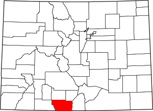 Map of Colorado highlighting Conejos County | |
| CDPs | ||
| Unincorporated communities | ||
| Authority control |
|
|---|