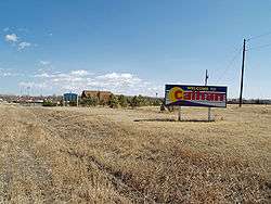
Calhan, Colorado
The Town of Calhan is a Statutory Town in El Paso County, Colorado, United States. The town population was 780 at the 2010 United States Census.[8] Calhan straddles U.S. Highway 24. With Calhan sitting at an elevation of 6,535 feet (1,992 meters) above sea level, Calhan is the highest non-mountain town in the United States.
Town of Calhan, Colorado | |
|---|---|
 | |
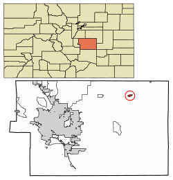 Location of Calhan in El Paso County, Colorado | |
| Coordinates: 39°02′04″N 104°17′57″W[1] | |
| Country | |
| State | |
| County | El Paso County[2] |
| Incorporated | May 10, 1919[3] |
| Government | |
| • Type | Statutory Town[2] |
| • Mayor (Pro-Term) | Cameron Chaussee |
| Area | |
| • Total | 0.87 sq mi (2.26 km2) |
| • Land | 0.87 sq mi (2.26 km2) |
| • Water | 0.00 sq mi (0.00 km2) |
| Elevation | 6,535 ft (1,992 m) |
| Population (2010) | |
| • Total | 780 |
| • Estimate (2018)[6] | 834 |
| • Density | 912.74/sq mi (352.41/km2) |
| Time zone | UTC-7 (MST) |
| • Summer (DST) | UTC-6 (MDT) |
| ZIP code | 80808[7] |
| Area code(s) | 719 |
| FIPS code | 08-11260 |
| GNIS feature ID | 0193304 |
| Major Highways | |
| Website | calhan |
History
Calhan was established in 1888 as a water station for the now-defunct Chicago, Rock Island and Pacific Railroad, with the first steam locomotive arriving on November 5, 1888. The town was named by and for Michael Calahan, who had the contract to lay railroad tracks from the Colorado/Kansas border to Colorado Springs. However, when the town's first U.S. Post Office opened on November 24, 1888, the middle "a" had been dropped and the town was registered as "Calhan."[9] The town was incorporated as a Statutory Town in 1919.
The town grew quickly, but it wasn't until 1906 that the Calhan Rock Island Railroad Depot was built to meet the growing needs of the area.
Geography
Calhan is located at 39°2′7″N 104°17′59″W (39.035395, -104.299835).[10]
According to the United States Census Bureau, the town has a total area of 0.85 square miles (2.2 km2), all of it land.[11]
| Climate data for Calhan, Colorado | |||||||||||||
|---|---|---|---|---|---|---|---|---|---|---|---|---|---|
| Month | Jan | Feb | Mar | Apr | May | Jun | Jul | Aug | Sep | Oct | Nov | Dec | Year |
| Average high °F (°C) | 43 (6) |
45 (7) |
52 (11) |
60 (16) |
69 (21) |
79 (26) |
86 (30) |
82 (28) |
75 (24) |
63 (17) |
51 (11) |
42 (6) |
62 (17) |
| Average low °F (°C) | 15 (−9) |
18 (−8) |
25 (−4) |
32 (0) |
42 (6) |
50 (10) |
56 (13) |
55 (13) |
45 (7) |
34 (1) |
23 (−5) |
16 (−9) |
34 (1) |
| Average precipitation inches (mm) | 0.23 (5.8) |
0.27 (6.9) |
0.77 (20) |
1.48 (38) |
2.20 (56) |
2.28 (58) |
2.61 (66) |
2.68 (68) |
0.97 (25) |
0.78 (20) |
0.42 (11) |
0.27 (6.9) |
14.96 (381.6) |
| Source: The Weather Channel[12] | |||||||||||||
Demographics
| Historical population | |||
|---|---|---|---|
| Census | Pop. | %± | |
| 1930 | 399 | — | |
| 1940 | 352 | −11.8% | |
| 1950 | 375 | 6.5% | |
| 1960 | 347 | −7.5% | |
| 1970 | 465 | 34.0% | |
| 1980 | 541 | 16.3% | |
| 1990 | 562 | 3.9% | |
| 2000 | 896 | 59.4% | |
| 2010 | 780 | −12.9% | |
| Est. 2018 | 834 | [6] | 6.9% |
| U.S. Decennial Census[13] | |||
As of the census[14] of 2000, there were 896 people, 347 households, and 246 families residing in the town. The population density was 1,204.1 people per square mile (467.5/km²). There were 376 housing units at an average density of 505.3 per square mile (196.2/km²). The racial makeup of the town was 96.99% White, 0.22% Native American, 0.67% Asian, 0.22% from other races, and 1.90% from two or more races. Hispanic or Latino of any race were 1.90% of the population.
There were 347 households out of which 39.5% had children under the age of 18 living with them, 57.3% were married couples living together, 10.1% had a female householder with no husband present, and 29.1% were non-families. 25.4% of all households were made up of individuals and 14.4% had someone living alone who was 65 years of age or older. The average household size was 2.58 and the average family size was 3.11.
In the town, the population was spread out with 29.7% under the age of 18, 7.4% from 18 to 24, 28.1% from 25 to 44, 20.3% from 45 to 64, and 14.5% who were 65 years of age or older. The median age was 36 years. For every 100 females, there were 86.7 males. For every 100 females age 18 and over, there were 84.8 males.
The median income for a household in the town was $35,735, and the median income for a family was $50,000. Males had a median income of $32,135 versus $24,659 for females. The per capita income for the town was $19,266. About 3.7% of families and 8.2% of the population were below the poverty line, including 5.4% of those under age 18 and 12.0% of those age 65 or over.
Notable people
- Jesse N. Funk, Medal of Honor, World War I
- Trista Vick-Majors, Antarctic researcher
Education
Students are served by Calhan School District RJ-1.
Attractions
- Calhan Rock Island Railroad Depot
- Calhan Paint Mines Archeological District
- The El Paso County Fair
- Calhan SummerFest, held the Friday before the El Paso County Fair opens
- The annual Homecoming Parade, held in late September/early October
- El Paso County Speedway
Transportation
U.S. Highway 24 runs directly through town. Calhan is served by U.S. 24 as it heads to Limon from Colorado Springs.
See also
- Outline of Colorado
- State of Colorado
- Colorado cities and towns
- Colorado municipalities
- Colorado counties
- Colorado metropolitan areas
- Front Range Urban Corridor
- South Central Colorado Urban Area
- Colorado Springs, CO Metropolitan Statistical Area
- Colorado cities and towns
References
- "2014 U.S. Gazetteer Files: Places". United States Census Bureau. July 1, 2014. Retrieved January 5, 2015.
- "Active Colorado Municipalities". State of Colorado, Department of Local Affairs. Archived from the original on 2009-12-12. Retrieved 2007-09-01.
- "Colorado Municipal Incorporations". State of Colorado, Department of Personnel & Administration, Colorado State Archives. 2004-12-01. Retrieved 2007-09-02.
- "2016 U.S. Gazetteer Files". United States Census Bureau. Retrieved Jul 25, 2017.
- "US Board on Geographic Names". United States Geological Survey. 2007-10-25. Retrieved 2008-01-31.
- "Population and Housing Unit Estimates". Retrieved March 1, 2020.
- "ZIP Code Lookup". United States Postal Service. Archived from the original (JavaScript/HTML) on September 3, 2007. Retrieved September 4, 2007.
- "Profile of General Population and Housing Characteristics: 2010 Demographic Profile Data (DP-1): Calhan town, Colorado". United States Census Bureau. Retrieved April 10, 2012.
- Larry l. King (1987). The History of Calhan and Vicinity 1888–1988. Gaddy Printing Company. p. 10. ISBN 0-9619442-0-X.
- "US Gazetteer files: 2010, 2000, and 1990". United States Census Bureau. 2011-02-12. Retrieved 2011-04-23.
- "Geographic Identifiers: 2010 Demographic Profile Data (G001): Calhan town, Colorado". United States Census Bureau. Retrieved April 10, 2012.
- "Average Weather for Castle Rock, CO". The Weather Channel. Archived from the original on 2012-12-10. Retrieved 2013-10-17.
- "Census of Population and Housing". Census.gov. Retrieved June 4, 2015.
- "U.S. Census website". United States Census Bureau. Retrieved 2008-01-31.
External links
| Wikimedia Commons has media related to Calhan, Colorado. |
Municipalities and communities of El Paso County, Colorado, United States | ||
|---|---|---|
| Cities |  Map of Colorado highlighting El Paso County | |
| Towns | ||
| CDPs | ||
| Unincorporated communities | ||
| Former populated places | ||
| Footnotes | ‡This populated place also has portions in an adjacent county or counties | |

| Authority control |
|
|---|