Brookside, Colorado
The Town of Brookside is a Statutory Town in Fremont County, Colorado, United States. The town population was 233 at the 2010 United States Census.
Town of Brookside, Colorado | |
|---|---|
 Entering from the east on Highway 115. | |
 Location of Brookside in Fremont County, Colorado. | |
| Coordinates: 38°24′49″N 105°11′28″W[1] | |
| Country | |
| State | |
| County | Fremont County[2] |
| Government | |
| • Type | Statutory Town[2] |
| Area | |
| • Total | 0.47 sq mi (1.20 km2) |
| • Land | 0.47 sq mi (1.20 km2) |
| • Water | 0.00 sq mi (0.00 km2) |
| Elevation | 5,344 ft (1,629 m) |
| Population (2010) | |
| • Total | 233 |
| • Estimate (2018)[5] | 260 |
| • Density | 546.24/sq mi (210.95/km2) |
| Time zone | UTC-7 (MST) |
| • Summer (DST) | UTC-6 (MDT) |
| ZIP code | Cañon City CO 81212 |
| Area code(s) | 719 |
| FIPS code | 08-09115 |
| GNIS feature ID | 0192018 |
| Website | www |
Geography
Brookside is located at 38°24′49″N 105°11′27″W (38.413513, -105.190734).[6]
According to the United States Census Bureau, the town has a total area of 0.4 square miles (1.0 km2), all of it land.
Demographics
| Historical population | |||
|---|---|---|---|
| Census | Pop. | %± | |
| 1920 | 202 | — | |
| 1930 | 198 | −2.0% | |
| 1940 | 196 | −1.0% | |
| 1950 | 175 | −10.7% | |
| 1960 | 163 | −6.9% | |
| 1970 | 173 | 6.1% | |
| 1980 | 178 | 2.9% | |
| 1990 | 183 | 2.8% | |
| 2000 | 219 | 19.7% | |
| 2010 | 233 | 6.4% | |
| Est. 2018 | 260 | [5] | 11.6% |
| U.S. Decennial Census[7] | |||
As of the census[8] of 2000, there were 219 people, 85 households, and 62 families residing in the town. The population density was 507.5 people per square mile (196.6/km²). There were 88 housing units at an average density of 203.9 per square mile (79.0/km²). The racial makeup of the town was 96.35% White, 0.46% Native American, 0.46% from other races, and 2.74% from two or more races. Hispanic or Latino of any race were 10.96% of the population.
There were 85 households out of which 28.2% had children under the age of 18 living with them, 63.5% were married couples living together, 5.9% had a female householder with no husband present, and 25.9% were non-families. 23.5% of all households were made up of individuals and 11.8% had someone living alone who was 65 years of age or older. The average household size was 2.58 and the average family size was 3.02.
In the town, the population was spread out with 23.3% under the age of 18, 5.5% from 18 to 24, 26.9% from 25 to 44, 26.0% from 45 to 64, and 18.3% who were 65 years of age or older. The median age was 42 years. For every 100 females, there were 97.3 males. For every 100 females age 18 and over, there were 102.4 males.
The median income for a household in the town was $34,688, and the median income for a family was $40,833. Males had a median income of $33,333 versus $26,875 for females. The per capita income for the town was $14,841. About 13.8% of families and 13.7% of the population were below the poverty line, including 29.6% of those under the age of eighteen and none of those sixty five or over.
See also
- Outline of Colorado
- State of Colorado
- Colorado cities and towns
- Colorado municipalities
- Colorado counties
- Colorado metropolitan areas
- Colorado cities and towns
References
- "2014 U.S. Gazetteer Files: Places". United States Census Bureau. July 1, 2014. Retrieved January 5, 2015.
- "Active Colorado Municipalities". State of Colorado, Department of Local Affairs. Archived from the original on 2009-12-12. Retrieved 2007-09-01.
- "2016 U.S. Gazetteer Files". United States Census Bureau. Retrieved Jul 25, 2017.
- "US Board on Geographic Names". United States Geological Survey. 2007-10-25. Retrieved 2008-01-31.
- "Population and Housing Unit Estimates". Retrieved March 21, 2020.
- "US Gazetteer files: 2010, 2000, and 1990". United States Census Bureau. 2011-02-12. Retrieved 2011-04-23.
- "Census of Population and Housing". Census.gov. Retrieved June 4, 2015.
- "U.S. Census website". United States Census Bureau. Retrieved 2008-01-31.
External links
| Wikimedia Commons has media related to Brookside, Colorado. |
Municipalities and communities of Fremont County, Colorado, United States | ||
|---|---|---|
| Cities | 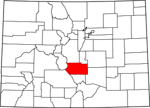 Map of Colorado highlighting Fremont County | |
| Towns | ||
| CDPs | ||
| Unincorporated communities | ||
| Ghost towns | ||
