Arrowbear Lake, California
Arrowbear Lake is an unincorporated community in San Bernardino County, California, United States. Its altitude is 6,086 feet (1,855 m), in the San Bernardino Mountains.[1]
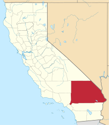
Arrowbear Lake, California | |
|---|---|
 Arrowbear Lake, California Location within the state of California | |
| Coordinates: 34°12′39″N 117°05′00″W | |
| Country | |
| State | |
| County | |
| Population (2000) | |
| • Total | 736 |
| Time zone | UTC-8 (Pacific (PST)) |
| • Summer (DST) | UTC-7 (PDT) |
| ZIP codes | 92382 |
| GNIS feature ID | 269578 |
The community of Arrowbear Lake is located east of Running Springs along Highway 18 in the San Bernardino National Forest, a mountain community with a population of 736. [2]
The town gets its name from the fact that it lies halfway between Lake Arrowhead and Big Bear.[3]
References
- "Arrowbear Lake". Geographic Names Information System. United States Geological Survey.
- "Archived copy". Archived from the original on 2011-07-25. Retrieved 2009-05-31.CS1 maint: archived copy as title (link) |arrowbear water
- David W. Kean, Wide Places in the California Roads: The encyclopedia of California's small towns and the roads that lead to them (Volume 1 of 4: Southern California Counties), pp. 17-18

This article is issued from Wikipedia. The text is licensed under Creative Commons - Attribution - Sharealike. Additional terms may apply for the media files.