Sunfair Heights, California
Sunfair Heights is an unincorporated community in the Mojave Desert, within San Bernardino County, California. It is about 8.5 miles (13.7 km) northeast of the town of Joshua Tree.
Sunfair Heights | |
|---|---|
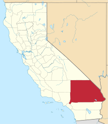
 Sunfair Heights Location within the state of California | |
| Coordinates: 34°14′25″N 116°13′5″W | |
| Country | United States |
| State | California |
| County | San Bernardino |
| Time zone | UTC-8 (Pacific (PST)) |
| • Summer (DST) | UTC-7 (PDT) |
| ZIP codes | 92277 |
| Area code(s) | 760 |
| GNIS feature ID | 1661526[1] |
Geography
The community is officially recognized by the US Geological Survey with a USGS feature ID of 1661526. Latitude and longitude for the community are 34°14′25″N 116°13′05″W. The USGS lists elevation above mean sea level as 2,580 feet.[2]
State Route 62 traverses the area south of Sunfair Heights in an east-west direction.[3] This community is served by the Morongo Unified School District.[4] The ZIP Code is 92277 and the community is inside area code 760.
Area landmarks
Other nearby geographic features include:[5]
- Coyote Lake at 35°04′13″N 116°45′14″W.
- Copper Mountain at 34°09′16″N 116°12′04″W.
- Morongo Basin Broadcasting KCDZ-FM tower east of the Copper Mountain summit, at 34°09′15″N 116°11′50″W.
See also
References
- "Sunfair Heights, California". Geographic Names Information System. United States Geological Survey.
- From: National Geographic Names Database, US Geological Survey. Data present as of 02/20/2006.
- Sunfair, California, 7.5-minute quadrangle, US Geological Survey, 1993.
- US Department of Education, National Center for Educational Statistics, Common Core of Data files, 2006.
- From: National Geographic Names Database, US Geological Survey.
This article is issued from Wikipedia. The text is licensed under Creative Commons - Attribution - Sharealike. Additional terms may apply for the media files.