Apple River, Illinois
Apple River is a village in Jo Daviess County, Illinois, United States. The population was 366 at the 2010 census, down from 379 in 2000.
Apple River | |
|---|---|
Village | |
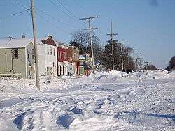 Apple River - Railroad Street in Winter 2008 | |
| Etymology: the nearby Apple River | |
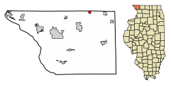 Location of Apple River in Daviess County, Illinois. | |
.svg.png) Location of Illinois in the United States | |
| Coordinates: 42°30′11″N 90°05′50″W | |
| Country | United States |
| State | Illinois |
| County | Jo Daviess |
| Township | Apple River |
| Government | |
| • Village President | Timothy Raisbeck |
| Area | |
| • Total | 0.70 sq mi (1.82 km2) |
| • Land | 0.70 sq mi (1.82 km2) |
| • Water | 0.00 sq mi (0.00 km2) |
| Elevation | 1,010 ft (310 m) |
| Population (2010) | |
| • Total | 366 |
| • Estimate (2016)[3] | 351 |
| • Density | 497.87/sq mi (192.35/km2) |
| Time zone | UTC-6 (CST) |
| • Summer (DST) | UTC-5 (CDT) |
| ZIP Code(s) | 61001 |
| Area code(s) | 815, 779 |
| FIPS code | 17-01673 |
| Wikimedia Commons | Apple River, Illinois |
Geography
Apple River is located at 42°30′11″N 90°5′50″W (42.502998, -90.097209).[4]
According to the 2010 census, Apple River has a total area of 0.79 square miles (2.05 km2), all land.[5]
Demographics
| Historical population | |||
|---|---|---|---|
| Census | Pop. | %± | |
| 1880 | 626 | — | |
| 1890 | 572 | −8.6% | |
| 1900 | 576 | 0.7% | |
| 1910 | 581 | 0.9% | |
| 1920 | 484 | −16.7% | |
| 1930 | 421 | −13.0% | |
| 1940 | 461 | 9.5% | |
| 1950 | 431 | −6.5% | |
| 1960 | 477 | 10.7% | |
| 1970 | 482 | 1.0% | |
| 1980 | 472 | −2.1% | |
| 1990 | 414 | −12.3% | |
| 2000 | 379 | −8.5% | |
| 2010 | 366 | −3.4% | |
| Est. 2016 | 351 | [3] | −4.1% |
| U.S. Decennial Census[6] | |||
At the 2000 census there were 379 people, 159 households, and 102 families in the village. The population density was 479.6 people per square mile (185.2/km²). There were 187 housing units at an average density of 236.6 per square mile (91.4/km²). The racial makeup of the village was 98.94% White, 0.79% African American, and 0.26% from two or more races.[7] Of the 159 households 30.8% had children under the age of 18 living with them, 50.9% were married couples living together, 9.4% had a female householder with no husband present, and 35.8% were non-families. 32.1% of households were one person and 16.4% were one person aged 65 or older. The average household size was 2.38 and the average family size was 2.93.
The age distribution was 27.7% under the age of 18, 5.3% from 18 to 24, 30.3% from 25 to 44, 19.5% from 45 to 64, and 17.2% 65 or older. The median age was 38 years. For every 100 females, there were 98.4 males. For every 100 females age 18 and over, there were 94.3 males.
The median household income was $40,250 and the median family income was $51,042. Males had a median income of $35,893 versus $21,103 for females. The per capita income for the village was $18,267. About 8.8% of families and 10.2% of the population were below the poverty line, including 8.0% of those under age 18 and 13.3% of those age 65 or over.
References
- "2016 U.S. Gazetteer Files". United States Census Bureau. Retrieved Jun 30, 2017.
- "USGS detail on Newtown". Retrieved 2007-10-21.
- "Population and Housing Unit Estimates". Retrieved June 9, 2017.
- "US Gazetteer files: 2010, 2000, and 1990". United States Census Bureau. 2011-02-12. Retrieved 2011-04-23.
- "G001 - Geographic Identifiers - 2010 Census Summary File 1". United States Census Bureau. Archived from the original on 2020-02-13. Retrieved 2015-08-01.
- "Census of Population and Housing". Census.gov. Retrieved June 4, 2015.
- "U.S. Census website". United States Census Bureau. Retrieved 2008-01-31.
External links
Municipalities and communities of Jo Daviess County, Illinois, United States | ||
|---|---|---|
| Cities | Map of Illinois highlighting Jo Daviess County | |
| Villages | ||
| Townships | ||
| CDPs | ||
| Other unincorporated communities | ||
| Ghost town | ||
| Authority control |
|
|---|