Rochelle, Illinois
Rochelle is a city in Ogle County, Illinois. The population was 9,574 at the 2010 census, up from 9,424 at the 2000 census. Rochelle is approximately 80 miles (130 km) west of Chicago and 25 miles (40 km) south of Rockford.
Rochelle, Illinois | |
|---|---|
City | |
 Sign seen entering the city of Rochelle | |
 Seal | |
| Nickname(s): The Hub City | |
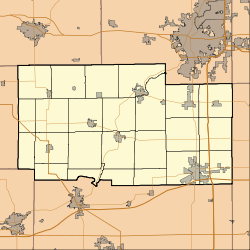
 Location of Rochelle in Ogle County, Illinois. | |
 Rochelle, Illinois Location within Ogle County 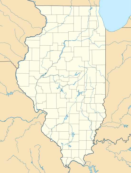 Rochelle, Illinois Rochelle, Illinois (Illinois) | |
| Coordinates: 41°55′24″N 89°03′56″W | |
| Country | United States |
| State | Illinois |
| County | Ogle |
| Township | Flagg, Dement |
| Government | |
| • Mayor | John Bearrows (R) |
| Area | |
| • Total | 12.98 sq mi (33.62 km2) |
| • Land | 12.96 sq mi (33.57 km2) |
| • Water | 0.02 sq mi (0.05 km2) |
| Elevation | 823 ft (251 m) |
| Population (2010) | |
| • Total | 9,574 |
| • Estimate (2018)[3] | 9,103 |
| • Density | 711.90/sq mi (274.87/km2) |
| Time zone | UTC-6 (CST) |
| • Summer (DST) | UTC-5 (CDT) |
| Postal code | 61068 |
| Area code(s) | 815 |
| FIPS code | 17-64746 |
| Website | www |
History
Originally named Hickory Grove, the town sits at the intersection of two rail lines. Having a number of granaries holding corn, wheat and other crops for shipping eastward, the town was an important rail link for farmers. During the Civil War, an arsonist burned some of the granaries. He was arrested but vigilantes stormed the local jail and hanged him from a tree. The town then was called Hang Town by locals and travelers. Later in the local pharmacy, some of the city fathers were discussing the problem of lack of people coming to reside in the town. It was agreed a new name was necessary. One of the men reached up on a shelf and picked up a bottle of Rochelle Salts, saying Rochelle would be a good name for the town.
After World War II, Rochelle grew, becoming a center for Swift Meat Packing and Del Monte canned vegetables such as asparagus, corn, green beans, and peas. Now the town hosts Nippon Sharyo, a Japanese maker of railroad passenger cars for commuter lines and regional corridor routes operated by Amtrak,[4] as well as a meat packing plant owned by Hormel Foods.
On April 9, 2015, parts of the city suffered damage when an EF4 tornado struck near the town.[5][6]
Geography
Rochelle is located along the Kyte River (commonly, if inaccurately, known to most locals as "Kyte Creek"). It is also located near the junction of Interstates 39 and 88.
According to the 2010 census, Rochelle has a total area of 12.919 square miles (33.46 km2), of which 12.9 square miles (33.41 km2) (or 99.85%) is land and 0.019 square miles (0.05 km2) (or 0.15%) is water.[7]
Demographics
| Historical population | |||
|---|---|---|---|
| Census | Pop. | %± | |
| 1880 | 1,893 | — | |
| 1890 | 1,789 | −5.5% | |
| 1900 | 2,073 | 15.9% | |
| 1910 | 2,732 | 31.8% | |
| 1920 | 3,310 | 21.2% | |
| 1930 | 3,785 | 14.4% | |
| 1940 | 4,200 | 11.0% | |
| 1950 | 5,449 | 29.7% | |
| 1960 | 7,008 | 28.6% | |
| 1970 | 8,594 | 22.6% | |
| 1980 | 8,982 | 4.5% | |
| 1990 | 8,769 | −2.4% | |
| 2000 | 9,424 | 7.5% | |
| 2010 | 9,574 | 1.6% | |
| Est. 2018 | 9,103 | [3] | −4.9% |
| U.S. Decennial Census[8] | |||
As of the census[9] of 2000, there were 9,424 people, 3,688 households, and 2,415 families living in the city. The population density was 1,260.9 people per square mile (487.1/km²). There were 3,895 housing units at an average density of 521.1 per square mile (201.3/km²). The racial makeup of the city was 86.81% White, 1.14% African American, 0.49% Native American, 0.92% Asian, 0.02% Pacific Islander, 8.69% from other races, and 1.93% from two or more races. Hispanic or Latino of any race were 19.16% of the population.
There were 3,688 households out of which 33.4% had children under the age of 18 living with them, 49.7% were married couples living together, 11.1% had a female householder with no husband present, and 34.5% were non-families. Of all households 29.3% were made up of individuals and 12.1% had someone living alone who was 65 years of age or older. The average household size was 2.52 and the average family size was 3.13.
In the city, the population was spread out with 27.1% under the age of 18, 10.1% from 18 to 24, 28.7% from 25 to 44, 19.6% from 45 to 64, and 14.5% who were 65 years of age or older. The median age was 34 years. For every 100 females, there were 97.0 males. For every 100 females age 18 and over, there were 93.1 males.
The median income for a household in the city was $37,984, and the median income for a family was $46,563. Males had a median income of $35,890 versus $25,058 for females. The per capita income for the city was $18,139. About 7.6% of families and 10.4% of the population were below the poverty line, including 11.1% of those under age 18 and 4.3% of those age 65 or over.
Education
Rochelle is served by two separate school districts. Rochelle Community Consolidated District 231 serves Rochelle and limited areas just outside town. District 231 has four elementary schools serving grades K–5: Abraham Lincoln Elementary, Central Elementary, Floyd J. Tilton Elementary, and Phillip May Elementary. The district also operates one middle school, Rochelle Middle School, serving grades 6–8. Rochelle Township High School District 212 operates Rochelle Township High School. About half of the high school's students come from Rochelle and District 231; the remaining students come from a number of outlying communities, including Kings, Steward, Creston, Hillcrest, Esmond, and Lindenwood.
There is also a private school named, St. Paul Lutheran School which enrolls children from the age of three, and up through the eighth grade.
Transportation
Rochelle Railroad Park has spawned many imitators, such as the Railroad Platform in Folkston, Georgia. For many years the Whitcomb Locomotive Works, founded by George Dexter Whitcomb, manufactured industrial locomotives as well as the Partin Palmer automobile, in Rochelle.
Rochelle is also home to Union Pacific's Global III Intermodal Facility. At the time it opened it was Union Pacific's largest intermodal facility. Construction on the state-of-the-art facility was completed in 2003.[10] On May 2, 2019, it was announced the yard would be closing in July 2019.[11]
The Illinois River Energy ethanol plant is located in Rochelle.[12]
Rochelle owns and operates Rochelle Municipal Airport.
Hub
Rochelle is known as the "Hub City" because of its location at the intersection of several major transportation routes. The first transcontinental highway in the United States, the Lincoln Highway, passed through Rochelle, as did US-51, one of the first highways to go the full north–south length of the United States. Both these roads have diminished in importance (and are now state highways 38 and 251, respectively), but Rochelle continues to be crossed by major highways, especially Interstates 88 and 39. Besides roadways, Rochelle is also crossed by two major rail lines; the Union Pacific Railroad and BNSF Railway mainlines cross inside of the city limits.[13] The effect, as seen on a map, was one of the spokes of an old wagon wheel meeting at the "hub", and thus the nickname was born. Today, literally dozens of businesses carry the moniker "Hub City", including furniture stores, shopping centers, realty firms, dry cleaners, and many others. Even the local high school's teams are known as the "Hubs".[14][15]
Rochelle was once a stop for passenger trains operated by the Chicago, Burlington & Quincy, and its successor, the Burlington Northern, such as North Coast Limited. The town saw its last passenger train in 1971, and in 2007, the depot, which had been built in 1921, was demolished.
Notable people
- Joan Allen, actress
- Joanna Baker, professor of ancient languages
- Delos W. Baxter, Illinois state senator, lawyer, and mayor of Rochelle
- Stan Campbell, pro football player
- Mabel Craft Deering, journalist, born in Rochelle[16][17][18]
- William Gehring, Professor of Cognitive Psychology and one of the discoverers of Error Related Negativity
- Lloyd Ingraham, actor
- Paul R. Lawrence, Harvard professor and pioneer of contingency theory
- William W. May, American athlete, competed in the 1908 London Olympics,[19] Rochelle Township High School graduate and 1905 State Champion in the 50 yard dash[20]
- Daniel Van Kirk, comedian
Notable buildings
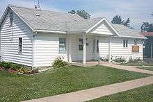
- William H. Holcomb House
- City and Town Hall
- Flagg Township Public Library
- The Hub Theater
See also
- Impact of the 2019–20 coronavirus pandemic on the meat industry in the United States
References
- "2016 U.S. Gazetteer Files". United States Census Bureau. Retrieved Jun 30, 2017.
- "USGS detail on Newtown". Retrieved 2007-10-21.
- "Population and Housing Unit Estimates". Archived from the original on February 22, 2020. Retrieved August 16, 2019.
- "Archived copy". Archived from the original on 2015-02-18. Retrieved 2015-02-18.CS1 maint: archived copy as title (link)
- "Severe weather: Tornadoes hit Iowa, Illinois, Ohio; CNN; April 9, 2015". Archived from the original on April 10, 2015. Retrieved April 10, 2015.
- "Tornadoes touch down, leave 1 dead in Fairdale; ABC7; April 9, 2015". Archived from the original on April 13, 2015. Retrieved April 10, 2015.
- "G001 - Geographic Identifiers - 2010 Census Summary File 1". United States Census Bureau. Archived from the original on 2020-02-13. Retrieved 2015-12-27.
- "Census of Population and Housing". Census.gov. Archived from the original on April 26, 2015. Retrieved June 4, 2015.
- "U.S. Census website". United States Census Bureau. Archived from the original on 1996-12-27. Retrieved 2008-01-31.
- Malone, Frank (2003). "Design for decongestion". Railway Age. Archived from the original on 2012-07-11.
- "Archived copy". Archived from the original on 2019-05-04. Retrieved 2019-05-04.CS1 maint: archived copy as title (link)
- "Archived copy". Archived from the original on 2011-06-24. Retrieved 2011-06-21.CS1 maint: archived copy as title (link)
- "Archived copy" (PDF). Archived from the original (PDF) on 2011-07-15. Retrieved 2010-03-28.CS1 maint: archived copy as title (link)
- "Archived copy". Archived from the original on 2010-01-29. Retrieved 2010-03-28.CS1 maint: archived copy as title (link)
- "Archived copy". Archived from the original on 2004-07-23. Retrieved 2010-03-28.CS1 maint: archived copy as title (link)
- California State Library, 1906
- "The High School," Oakland Daily Evening Tribune, June 2, 1888, image 3
- "Popular Member of Junior League to Wed Mr. Howe," The San Francisco Examiner, August 22, 1931, image 6
- "Fighting Illini At The Olympics".
- "IHSA Boys Track & Field - Records & History".
External links
| Wikimedia Commons has media related to Rochelle, Illinois. |
Municipalities and communities of Ogle County, Illinois, United States | ||
|---|---|---|
| Cities | Map of Illinois highlighting Ogle County | |
| Villages | ||
| Townships | ||
| CDPs | ||
| Other unincorporated communities | ||
| Footnotes | ‡This populated place also has portions in an adjacent county or counties | |
| Authority control |
|
|---|