Rock Falls, Illinois
Rock Falls is a city in Whiteside County, Illinois, United States. The population was 9,266 at the 2010 census, down from 9,580 in 2000. The city is located on the Rock River, directly opposite of the hardware town Sterling.
Rock Falls | |
|---|---|
City | |
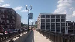 The Lawrence Hardware building (right) in Sterling overlooking the bridge to Rock Falls, Illinois | |
 Location of Rock Falls in Whiteside County, Illinois. | |
.svg.png) Location of Illinois in the United States | |
| Coordinates: 41°46′29″N 89°41′29″W | |
| Country | United States |
| State | Illinois |
| County | Whiteside |
| Area | |
| • Total | 3.88 sq mi (10.06 km2) |
| • Land | 3.75 sq mi (9.71 km2) |
| • Water | 0.14 sq mi (0.35 km2) |
| Population (2010) | |
| • Total | 9,266 |
| • Estimate (2018)[2] | 8,814 |
| • Density | 2,399.41/sq mi (926.31/km2) |
| Time zone | UTC−6 (CST) |
| • Summer (DST) | UTC−5 (CDT) |
| ZIP Code(s) | 61071 |
| Area code(s) | 815 |
| FIPS code | 17-64928 |
| Wikimedia Commons | Rock Falls, Illinois |
| Website | rockfalls61071 |

Geography
Rock Falls is separated from its twin city, Sterling, to the North by the Rock River.
According to the 2010 census, Rock Falls has a total area of 3.795 square miles (9.83 km2), of which 3.66 square miles (9.48 km2) (or 96.44%) is land and 0.135 square miles (0.35 km2) (or 3.56%) is water.[3]
Demographics
| Historical population | |||
|---|---|---|---|
| Census | Pop. | %± | |
| 1870 | 471 | — | |
| 1880 | 894 | 89.8% | |
| 1890 | 1,900 | 112.5% | |
| 1900 | 2,176 | 14.5% | |
| 1910 | 2,657 | 22.1% | |
| 1920 | 2,927 | 10.2% | |
| 1930 | 3,893 | 33.0% | |
| 1940 | 4,987 | 28.1% | |
| 1950 | 7,983 | 60.1% | |
| 1960 | 10,261 | 28.5% | |
| 1970 | 10,287 | 0.3% | |
| 1980 | 10,633 | 3.4% | |
| 1990 | 9,654 | −9.2% | |
| 2000 | 9,580 | −0.8% | |
| 2010 | 9,266 | −3.3% | |
| Est. 2018 | 8,814 | [2] | −4.9% |
| U.S. Decennial Census[4] | |||
At the 2000 census there were 9,580 people, 3,895 households, and 2,559 families living in the city. The population density was 2,888.0 people per square mile (1,114.1/km²). There were 4,098 housing units at an average density of 1,235.4 per square mile (476.6/km²). The racial makeup of the city was 91.78% White, 0.88% African American, 0.45% Native American, 0.26% Asian, 4.71% from other races, and 1.92% from two or more races. Hispanic or Latino of any race were 11.54%.[5]
Of the 3,895 households 30.7% had children under the age of 18 living with them, 47.5% were married couples living together, 13.7% had a female householder with no husband present, and 34.3% were non-families. 29.4% of households were one person and 13.9% were one person aged 65 or older. The average household size was 2.43 and the average family size was 2.99.
The age distribution was 25.5% under the age of 18, 9.0% from 18 to 24, 27.6% from 25 to 44, 21.9% from 45 to 64, and 15.9% 65 or older. The median age was 36 years. For every 100 females, there were 90.8 males. For every 100 females age 18 and over, there were 87.5 males.
The median household income was $34,442 and the median family income was $41,803. Males had a median income of $32,733 versus $21,092 for females. The per capita income for the city was $16,524. About 10.3% of families and 11.5% of the population were below the poverty line, including 14.8% of those under age 18 and 6.8% of those age 65 or over.
Arts and culture
The City of Rock Falls hosts many annual events each year. Some of the most popular events are: Percussion-Paloosa (February), Rock Falls Spring Challenge (May), Bass Pro Shop's Big Cat Quest Catfish Tournament (June), Summer Splash (June), River Chase Boat Races (June), Pink Heals Tour (July), Whiteside County Barn Tour (July), Touch a Truck (August), Fiesta Days (September), Bridge the Communities 5K/10K race (September), The Hennepin Hundred 100k Ultra race (October) and Hometown Holidays (November).
Parks and recreation
The City of Rock Falls and Township of Coloma have 16 parks (over 100 acres) in which one can use baseball diamonds, basketball courts, tennis courts, disc golf, open fields, playground equipment, pavilions, picnic areas, or a bandshell. Also, with the close proximity of the Rock River, the Hennepin Feeder Canal, and a lake in Centennial Park one can use boats ramps, canoes, paddle boats, or engage in fishing.
Infrastructure
Airport
The Whiteside County Airport is located about 2 mi (3.2 km) south of the city.
Roads
- Interstate 88 (west)
- U.S. Route 30
- Illinois Route 40
Notable people
- Louie Bellson, drummer, creator of the double bass drumkit
- Seth Blair, minor league baseball player for San Diego Padres
- Frank Harts, actor
- Cal Howe, professional baseball player for Chicago Cubs
- Otis Adelbert Kline, songwriter, an adventure novelist and literary agent
- Gary Kolb, professional baseball player for St. Louis Cardinals, Milwaukee Braves, New York Mets and Pittsburgh Pirates
- Jake Junis, professional baseball player for Kansas City Royals
- Zelma O'Neal, actress and singer
- Mariya Takeuchi, singer and songwriter (international exchange student)
References
- "2016 U.S. Gazetteer Files". United States Census Bureau. Retrieved Jun 30, 2017.
- "Population and Housing Unit Estimates". Retrieved August 18, 2019.
- "G001 - Geographic Identifiers - 2010 Census Summary File 1". United States Census Bureau. Archived from the original on 2020-02-13. Retrieved 2015-12-27.
- "Census of Population and Housing". Census.gov. Retrieved June 4, 2015.
- "U.S. Census website". United States Census Bureau. Retrieved 2008-01-31.
External links
Municipalities and communities of Whiteside County, Illinois, United States | ||
|---|---|---|
| Cities | Map of Illinois highlighting Whiteside County | |
| Villages | ||
| Townships | ||
| CDP | ||
| Other unincorporated communities |
| |
| Authority control |
|
|---|