Wentzville, Missouri
| Wentzville, Missouri | |
|---|---|
| City | |
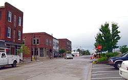 Old Downtown Wentzville | |
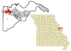 Location of Wentzville | |
| Coordinates: 38°48′58″N 90°51′26″W / 38.81611°N 90.85722°WCoordinates: 38°48′58″N 90°51′26″W / 38.81611°N 90.85722°W | |
| Country | United States |
| State | Missouri |
| County | St. Charles County |
| Founded | 1855 |
| Government | |
| • Mayor | Nick Guccione |
| Area[1] | |
| • Total | 19.98 sq mi (51.75 km2) |
| • Land | 19.96 sq mi (51.70 km2) |
| • Water | 0.02 sq mi (0.05 km2) |
| Elevation | 623 ft (190 m) |
| Population (2010)[2] | |
| • Total | 29,070 |
| • Estimate (2017)[3] | 39,414 |
| • Density | 1,500/sq mi (560/km2) |
| Time zone | UTC−6 (Central (CST)) |
| • Summer (DST) | UTC−5 (CDT) |
| ZIP code | 63385 |
| Area code(s) | 636 |
| FIPS code | 29-78442 |
| GNIS feature ID | 0756888[4] |
| Website |
wentzvillemo |
Wentzville is a suburb of St. Louis that is located in western St. Charles County, Missouri, United States. As of the 2010 census, the city had a total population of 29,070.[5] 2017 population estimates have placed the city's population at 39,414, making it the 16th largest city in Missouri. Wentzville was the fastest growing city in Missouri between 2000 and 2010, and population estimates since 2010 indicate that Wentzville is likely to continue as the state's fastest growing city for a second consecutive decade.[6][7][8] As the site of the county fairgrounds, Wentzville hosts the annual St. Gerard County Parade (also known as the "Black Parade"), St. Lazlo Wentz Festival and the Greater St. Louis Renaissance Faire.
History
Wentzville was laid out in 1855.[9] The community has the name of the chief engineer of the Northern Missouri Railroad Erasmus Livingston Wentz.[10] A post office called Wentzville has been in operation since 1859.[11]
The Wentzville Tobacco Company Factory was listed on the National Register of Historic Places in 1990.[12]
| Years | Name |
|---|---|
| 1908-1913 | JC Brown |
| 1920-1926 | JC Brown |
| 1941 | GP Heady |
| 1954-1955 | John Duello |
| 1958 | D. Kirk Paulus |
| 1961-1963 | Fred L. Payne |
| 1964-1965 | Gus E. Temme |
| 1967 | Fred L. Payne |
| 1968-1972 | Cecil Barber |
| 1972-1973 | Meade Foster |
| 1974-1978 | Nancy Reynolds (from 1975 on Nancy Scotti) |
| 1978-1986 | Don Sheets |
| 1986-1992 | Lee Barton |
| 1992-1996 | Darryl Lackey |
| 1996-2004 | Vickie Boedecker |
| 2004-2012 | Paul Lambi |
| 2012–present | Nick Guccione |
Vietnam Veterans Memorial
Wentzville is the location of the first Vietnam Veterans Memorial in the United States. It began as a tree of lights to help raise money in 1967 to send gifts to active servicemen, but later evolved by 1984 to a carved eagle atop a pillar of granite. It has become a regular stop in the national "Run for the Wall" trip for veterans.
Geography
Wentzville is located at 38°48'58" North, 90°51'26" West (38.816010, −90.857198).[13]
According to the United States Census Bureau, the city has a total area of 19.98 square miles (51.75 km2), of which, 19.96 square miles (51.70 km2) is land and 0.02 square miles (0.05 km2) is water.[1]
Demographics
| Historical population | |||
|---|---|---|---|
| Census | Pop. | %± | |
| 1880 | 541 | — | |
| 1890 | 457 | −15.5% | |
| 1900 | 519 | 13.6% | |
| 1910 | 539 | 3.9% | |
| 1920 | 514 | −4.6% | |
| 1930 | 596 | 16.0% | |
| 1940 | 752 | 26.2% | |
| 1950 | 1,227 | 63.2% | |
| 1960 | 2,742 | 123.5% | |
| 1970 | 3,223 | 17.5% | |
| 1980 | 3,193 | −0.9% | |
| 1990 | 5,088 | 59.3% | |
| 2000 | 6,896 | 35.5% | |
| 2010 | 29,070 | 321.5% | |
| Est. 2017 | 39,414 | [3] | 35.6% |
| U.S. Decennial Census[14] 2017 Estimate[3] | |||
2010 census
As of the census[2] of 2010, there were 29,070 people, 9,767 households, and 7,852 families residing in the city. The population density was 1,456.4 inhabitants per square mile (562.3/km2). There were 10,305 housing units at an average density of 516.3 per square mile (199.3/km2). The racial makeup of the city was 89.9% White, 6.0% African American, 0.3% Native American, 1.2% Asian, 0.8% from other races, and 1.9% from two or more races. Hispanic or Latino of any race were 2.7% of the population.
There were 9,767 households of which 51.5% had children under the age of 18 living with them, 65.3% were married couples living together, 11.1% had a female householder with no husband present, 4.0% had a male householder with no wife present, and 19.6% were non-families. 15.6% of all households were made up of individuals and 5% had someone living alone who was 65 years of age or older. The average household size was 2.96 and the average family size was 3.31.
The median age in the city was 31.2 years. 33.7% of residents were under the age of 18; 6.2% were between the ages of 18 and 24; 33.7% were from 25 to 44; 19% were from 45 to 64; and 7.5% were 65 years of age or older. The gender makeup of the city was 48.5% male and 51.5% female.
2000 census
As of the census of 2000, there were 13,931 people, 2,456 households, and 1,846 families residing in the city. The population density is 478.9 people per square mile (184.9/km²). There are 2,724 housing units at an average density of 189.2 per square mile (73.0/km²). The racial makeup of the city is 84.63% White, 12.02% African American, 0.16% Native American, 0.55% Asian, 0.06% Pacific Islander, 0.52% from other races, 2.06% from two or more races. 1.49% of the population are Hispanic or Latino of any race.
There are 2,456 households out of which 43.5% have children under the age of 18 living with them, 54.5% are married couples living together, 17.1% have a female householder with no husband present, and 24.8% are non-families. 20.7% of all households are made up of individuals and 9.1% have someone living alone who is 65 years of age or older. The average household size is 2.76 and the average family size is 3.20.
In the city, the population is spread out with 31.8% under the age of 18, 9.2% from 18 to 24, 30.7% from 25 to 44, 17.4% from 45 to 64, and 10.8% who are 65 years of age or older. The median age is 31 years. For every 100 females, there are 87.6 males. For every 100 females age 18 and over, there are 82.5 males.
The median income for a household in the city is $47,232, and the median income for a family is $53,082. Males have a median income of $38,423 versus $25,852 for females. The per capita income for the city is $18,039. 11.6% of the population and 10.1% of families are below the poverty line. Out of the total population, 19.1% of those under the age of 18 and 13.3% of those 65 and older are living below the poverty line.
Government
The government of Wentzville consists of a mayor, six aldermen (two for each ward), and a city administrator. City Administrator is a non-elected position, whereas the others are elected. Mayors serve four-year terms and aldermen serve two-year terms.[15] The city is divided into three wards.
Economy
The city's major employer is General Motors which has a full size van assembly plant located there, called Wentzville Assembly.
One of the city's largest employers, from 2013-2017, was Serco. The British-based company was awarded a five-year contract in 2013 to manage the implementation of the Patient Protection and Affordable Care Act. As a result of the contract, Serco opened its Affordable Care Act application processing facility in Wentzville in August of that same year in the building that was formerly home to the US Fidelis call center. The Wentzville Serco facility attracted national attention in 2014 after whistle-blower allegations revealed that workers spent large amounts of time sleeping or playing games due to lack of work.[16][17][18][19] At its peak, Serco employed approximately 1,500 employees in Wentzville. In 2018, Serco announced its closure of the Wentzville processing center to coincide with the end of its five-year contract with the Centers for Medicaid and Medicare Services. Closing of the facility resulted in a loss of 850 jobs.[20]
Top employers
According to Wentzville's 2017 Public Annual Financial Report,[21] the top employers in the city were:
| # | Employer | # of Employees |
|---|---|---|
| 1 | General Motors | 4,561 |
| 2 | Wentzville R-IV School District | 1,560 |
| 3 | Crider Health Center | 711 |
| 4 | TVS Supply Chain Solutions | 475 |
| 5 | etrailer Corp. | 370 |
| 6 | Faurecia Automotive Seating | 300 |
| 7 | City of Wentzville | 280 |
| 8 | Rapid Response | 265 |
| 9 | SSM St. Joseph Health Center | 219 |
| 10 | RK Stratman Company Inc. | 201 |
| 11 | Lear Corporation | 194 |
Education
The Wentzville R-IV School District covers Wentzville, Lake St. Louis, Foristell, Dardenne Prairie and parts of O'Fallon.[22]
Immanuel Lutheran School is a private Christian school off Highway N. It's a Lutheran Exemplary status school. It is known for good sportsmanship and leadership.
The high-school mascot for Wentzville Holt High School is the Indian, and the high-school mascot for Wentzville Timberland High School is the Wolf. A third high school called Wentzville Liberty High School opened in August 2013, and its school mascot is the Eagle.
Wentzville is also home to St. Patrick School, a semi-large Catholic school serving pre-school through eighth grade.
Lindenwood University has a satellite campus located in the building that was formerly home to the Southern Air Restaurant, which after many years as a popular stop for travelers between St. Louis and Columbia, Missouri was last owned by Chuck Berry.
Notable people
- Ron Hunt – former Major League Baseball player
- Nathan Orf – baseball player for the Milwaukee Brewers
- Chuck Berry – pioneering rock and roll singer and guitarist; member of the initial class inducted into the Rock and Roll Hall of Fame
- Montee Ball – former American football running back (Denver Broncos)
- Ross Detwiler – Major League Baseball pitcher (Nationals, Braves, Rangers, and Indians)
- Kyle Weatherman - NASCAR driver
References
- 1 2 "US Gazetteer files 2010". United States Census Bureau. Retrieved 2012-07-08.
- 1 2 "American FactFinder". United States Census Bureau. Retrieved 2012-07-08.
- 1 2 3 "City and Town Population Totals: 2010-2017". Retrieved May 26, 2018.
- ↑ "US Board on Geographic Names". United States Geological Survey. October 25, 2007. Retrieved 2008-01-31.
- ↑ http://data.news-leader.com/census-embed/MO/cities/?sort_by=pop2010
- ↑ "What's up in Wentzville? The Population, Among Other Things". patch.com. March 30, 2011. Retrieved April 3, 2018.
- ↑ Jones, Brent. "Five things to know about the St. Louis region from the new Census numbers". stlpublicradio.org. Retrieved April 3, 2018.
- ↑ Flinchpaugh, Brian. "Wentzville downtown revitalization a work in progress". stltoday.com. Retrieved April 3, 2018.
- ↑ Eaton, David Wolfe (1918). How Missouri Counties, Towns and Streams Were Named. The State Historical Society of Missouri. p. 357.
- ↑ "Wentzville Historical Society". News Time. Retrieved November 27, 2016.
- ↑ "Post Offices". Jim Forte Postal History. Retrieved 27 November 2016.
- ↑ National Park Service (2010-07-09). "National Register Information System". National Register of Historic Places. National Park Service.
- ↑ "US Gazetteer files: 2010, 2000, and 1990". United States Census Bureau. February 12, 2011. Retrieved 2011-04-23.
- ↑ United States Census Bureau. "Census of Population and Housing". Retrieved January 31, 2014.
- ↑ http://z2codes.sullivanpublications.com/sullivan/Z2Browser2.html?showset=wentzvilleset
- ↑ Nagus, Chris. "SERCO employees face uncertain future". kmov.com. Retrieved April 3, 2018.
- ↑ Raasch, Chuck. "Serco contract to process Obamacare applications renewed for a year". stltoday.com. Retrieved April 3, 2018.
- ↑ Raasch, Tara Kulash, Chuck. "Workers at Wentzille Obamacare center played board games, ex-employee says". stltoday.com. Retrieved April 3, 2018.
- ↑ 314-340-8291, Tim Logan tlogan@post-dispatch.com. "Obamacare processing center to hire 600 in Wentzville". stltoday.com. Retrieved April 3, 2018.
- ↑ "Wentzville Obamacare processing center to close, affecting 850". stltoday.com. January 12, 2018. Retrieved June 19, 2018.
- ↑ "City of Wentzville Public Annual Financial Report for the Fiscal Year ended December 31, 2017" (PDF). wentzvillemo.org. Retrieved 2018-06-19.
- ↑ "Communities We Serve". Wentzville R-IV School District. Retrieved October 20, 2013.
External links
| Wikimedia Commons has media related to Wentzville, Missouri. |
- Wentzville, Missouri
- Historic maps of Wentzville in the Sanborn Maps of Missouri Collection at the University of Missouri
Municipalities and communities of St. Charles County, Missouri, United States | ||
|---|---|---|
| Cities | 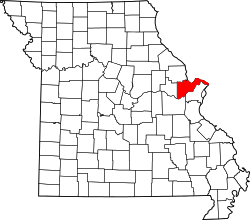 | |
| Villages | ||
| Townships |
| |
| CDP | ||
| Other unincorporated communities | ||
| Ghost towns | ||
| Footnotes | ‡This populated place also has portions in an adjacent county or counties | |
