Waipa District
| Waipa District | |
|---|---|
 | |
| Country |
|
| Region | Waikato |
| District | Waipa District |
| Wards |
Te Awamutu Cambridge Pirongia Maungatautari Kakepuku |
| Seat | Te Awamutu |
| Government | |
| • Mayor | Jim Mylchreest |
| Area | |
| • Territorial | 1,473.47 km2 (568.91 sq mi) |
| Population (June 2018)[1] | |
| • Territorial | 54,000 |
| • Density | 37/km2 (95/sq mi) |
| Postcode(s) | Map of postcodes |
| Area code(s) | 07 |
| Website | Waipa District Council |
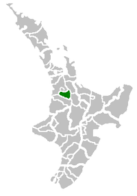
Waipa District is a municipality in the Waikato region of New Zealand that is administered by the Waipa District Council. Its most populous town is Cambridge. The seat of the council is at the second most populous town, Te Awamutu. The district is south and south-east of the city of Hamilton. It has five wards: Te Awamutu, Cambridge, Pirongia, Maungatautari and Kakepuku.
History
The District was formed from Waipa County Council and its town boroughs in 1989.[2] The county boundaries had varied since five ridings were formed in Waipa county in 1876: Newcastle, Hamilton, Mangapiko North and South,[3] Rangiaowhia,[4] and Pukekura.[5] In 1902 it covered 282 sq mi (730 km2) and had an additional riding, Tuhikaramea.[6]
Geography
The district has a land area of 1,473.47 km² (568.91 sq mi). Its population at the June 2018 census was 54,000,[1] of whom approximately 35% lived in each of the two main towns.
The Waikato River forms much of the eastern boundary of the district, before it flows north-westward through the district, past Cambridge. The Waipa River, the Waikato River's main tributary, flows northwards through the western part of the district;[7] the two rivers meet outside the district. The highest mountains are Mount Pirongia in the west and Maungatautari in the east.
The region's economy is based largely on dairy farming and cereal production. The southeastern corner of the district includes the hydroelectric project at Karapiro.
References
- 1 2 "Subnational Population Estimates: At 30 June 2018 (provisional)". Statistics New Zealand. 23 October 2018. Retrieved 23 October 2018. For urban areas, "Subnational population estimates (UA, AU), by age and sex, at 30 June 1996, 2001, 2006-18 (2018 boundary)". Statistics New Zealand. 23 October 2018. Retrieved 23 October 2018.
- ↑ "Te Awamutu Borough Council". thecommunityarchive.org.nz. Retrieved 2017-04-30.
- ↑ "Counties ridings". The New Zealand Herald. 27 November 1876. Retrieved 2017-04-30.
- ↑ "Rangiaohia". nzetc.victoria.ac.nz. 1902. Retrieved 2017-04-30.
- ↑ "Pukekura". nzetc.victoria.ac.nz. 1902. Retrieved 2017-04-30.
- ↑ "Te Awamutu". nzetc.victoria.ac.nz. 1902. Retrieved 2017-04-30.
- ↑ "Waipa River, Waikato". NZ Topo Map. Retrieved 2017-04-30.
External links
Coordinates: 37°59′10″S 175°25′16″E / 37.986°S 175.421°E