Whangarei District
| Whangarei District | |
|---|---|
| Territorial authority | |
| Motto(s): Creating the ultimate living environment | |
 | |
| Country | New Zealand |
| Region | Northland |
| District | Whangarei District Council |
| Wards |
Bream Bay Denby Hikurangi-Coastal Mangakahia-Maungatapere Okara Whangarei Heads |
| Local Hapū |
Ngāti Hine Ngāti Wai Patuharakeke Te Parawhau |
| Named for | Reipae, Waikato princess |
| Seat | Whangarei |
| Government | |
| • Mayor | Sheryl Mai |
| • Deputy Mayor | Sharon Morgan |
| Area[1] | |
| • Land | 2,855 km2 (1,102 sq mi) |
| Population | |
| • Estimate (June 2018) | 91,400 |
| Postcode(s) | Map of postcodes |
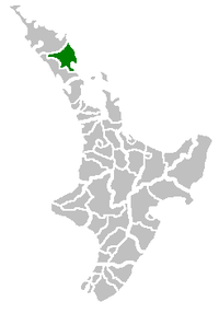
Whangarei District is a territorial authority district in the Northland Region of New Zealand that is governed by the Whangarei District Council. The district is made up in area largely by rural land, and includes a fifth of the Northland Region. It extends southwards to the southern end of Bream Bay, northwards to Whangaruru and almost to the Bay of Islands, and westwards up the Mangakahia River valley past Pakotai and almost to Waipoua Forest. It includes the Hen and Chicken Islands and the Poor Knights Islands.
The principal town and district seat is the city of Whangarei. Other towns include Hukerenui, Hikurangi, Titoki, Portland, Ruakaka and Waipu. The district population was 91,400 in June 2018.[2]
The district contains beaches such as Ngunguru, game fishing at Tutukaka, a variety of beaches along Whangarei Harbour, as well as Matakohe or Limestone Island in the Harbour, now subject to ecological restoration. The main airport for the district is Whangarei Airport.
Government
Whangarei District Council was formed by an amalgamation of Whangarei City Council, Whangarei County Council and Hikurangi Town Council as part of New Zealand's 1989 local government reforms.
There are six wards, which is more than in 1989. The main part of Whangarei city is divided into the northern ward of Denby, and the southern ward of Okara. The other four wards are Hikurangi-Coastal in the north, Mangakahia-Maungatapere inland to the west, Bream Bay in the south, and Whangarei Heads to the east of the city.[3]
The mayor of Whangarei District is Sheryl Mai.
References
- ↑ "Whangarei District Quarterly Review" (PDF). Statistics New Zealand. September 2007. p. 13. Archived from the original (PDF) on 4 June 2010.
- ↑ "Subnational Population Estimates: At 30 June 2018 (provisional)". Statistics New Zealand. 23 October 2018. Retrieved 23 October 2018. For urban areas, "Subnational population estimates (UA, AU), by age and sex, at 30 June 1996, 2001, 2006-18 (2018 boundary)". Statistics New Zealand. 23 October 2018. Retrieved 23 October 2018.
- ↑ "Wards". Whangarei District Council. Retrieved 29 October 2017.