Hauraki District
| Hauraki District | |
|---|---|
| Territorial authority | |
 | |
| Country | New Zealand |
| Region | Waikato |
| District | Hauraki District Council |
| Wards |
Paeroa Plains Waihi |
| Seat | Paeroa |
| Government | |
| • Mayor | John Tregidga |
| • Deputy Mayor | Toby Adams |
| Area | |
| • Total | 1,144 km2 (442 sq mi) |
| Population (June 2017)[1] | |
| • Total | 19,850 |
| • Density | 17/km2 (45/sq mi) |
| Time zone | UTC+12 (NZST) |
| • Summer (DST) | UTC+13 (NZDT) |
| Postcode(s) | Map of postcodes |
| Website | Hauraki District Council |
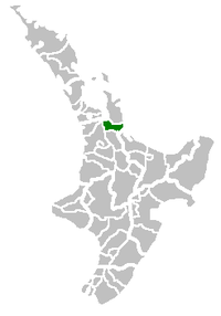
Hauraki District is a territorial authority within the Waikato Region of New Zealand. The seat of the council is at Paeroa.
The area covered by the district extends from the southwest coast of the Firth of Thames southeast towards Te Aroha, although that town lies beyond its boundaries. It extends eastwards to the Bay of Plenty coast, taking in the southernmost part of the Coromandel Peninsula. The rest of the peninsula is part of Thames-Coromandel District.
Features of the district include the Karangahake Gorge, Whiritoa, the Hauraki Plains, Ngatea and the gold mining town of Waihi.
Population
The district covers 1,144 km², and has a population of approximately 19,850 (June 2017)[1] residents, of whom 3,978 live in Paeroa[2] and 4,503 in Waihi.[3]
Local government
In 2010, the neighbouring Franklin District was abolished during the creation of the Auckland Council, and a stretch of the southwest coast of the Firth of Thames was added to the Hauraki District.
The current mayor is John Tregidga and deputy mayor is Toby Adams.[4]
Populated places
Hauraki District consists of the following towns, localities, settlements and communities:
|
|
|
Notes:
1 - partly shared with Thames-Coromandel District
2 - formerly part of the defunct Franklin District
3 - also known as Pukorokoro
References
- 1 2 "Subnational Population Estimates: At 30 June 2017 (provisional)". Statistics New Zealand. 24 October 2017. Retrieved 24 October 2017. For urban areas, "Subnational population estimates (UA, AU), by age and sex, at 30 June 1996, 2001, 2006-16 (2017 boundary)". Statistics New Zealand. 24 October 2017. Retrieved 24 October 2017.
- ↑ Quickstats about Paeroa
- ↑ Quickstats about Waihi
- ↑ "Mayor & Councillors » Hauraki District Council". www.hauraki-dc.govt.nz. Retrieved 2017-03-28.