Ngaruawahia
| Ngaruawahia | |
|---|---|
| Town | |
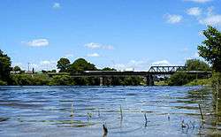 Waikato River passing through Ngaruawahia | |
| Population (2010 estimate)[1] | |
| • Territorial | 5,506 |
| Time zone | UTC+12 (NZST) |
| • Summer (DST) | UTC+13 (NZDT) |
Ngaruawahia (Māori: Ngāruawāhia; Māori pronunciation: [ŋaːɾʉaˈwaːhia]) (pop. 5,506[1]) is a town in the Waikato region of the North Island of New Zealand. It is located 20 kilometres (12 mi) north-west of Hamilton at the confluence of the Waikato and Waipa Rivers, adjacent to the Hakarimata Range. Ngaruawahia lies within the Hamilton Urban Area, the fourth largest urban area in New Zealand. The location was once considered as a potential capital of New Zealand.[2]
Name origin
The name Ngāruawāhia means "the opened food pits", which derives from a great feast in the 17th century.[3] Te Ngaere, a Ngāti Tamainupō chief, and Heke-i-te-rangi, a Ngāti Maniapoto woman, had eloped and settled at Ngaruawahia, causing a rift between their tribes. When their first child was born, Ngāti Maniapoto were invited to the celebration in an attempt to reconcile the tribes. Te Ngaere's father named the boy Te Mana-o-te-rangi in honour of Ngāti Maniapoto. Peace was established between the tribes, and Te Ngaere shouted "Wāhia ngā rua" (break open the food pits).[3][4][5]
History
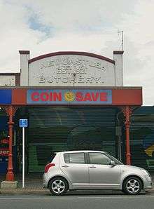
During the 19th century, Ngaruawahia was named Queenstown and then Newcastle. However, the town returned to the original name in 1878.[6] Despite Māori protest, sales of confiscated land went ahead in 1864, shortly after the invasion.[7]
20th century
A 100 hp (75 kW)[8] gas power station[9] was built in Herschell St in 1913 by the Town Board for lighting. It used Glen Massey coal, which was converted to gas in a Cambridge Patent Gas Producer (many were used about this time in Australasia)[10] and used to drive a 2-cylinder gas engine.[11] It closed in 1924.[12] Much of the machinery was removed in 1950 and from 1954 the building was used as a scout hall.[13]
Officers from the United States visited Ngaruawahia during World War II and would share food at hāngis.[14] Queen Elizabeth II has visited Ngaruawahia on two occasions (1953 & 1974).[15] On the latter occasion, then Māori Queen Dame Te Ātairangikaahu and her husband Whatumoana Paki welcomed Queen Elizabeth II to the local marae.[16] The Great Ngaruawahia Music Festival was held in 1973, and featured many music acts, including some that went on to become internationally famous such as Black Sabbath and Split Enz.[17] It was the first large outdoor music festival in New Zealand.
In 1980, Mayor Latta released a book about the history of the town titled 'Meeting of the Waters'.[1]
In March 1998, a freight train derailed on the local North Island Main Trunk line's rail bridge across the Waikato River. The incident caused structural damage to the bridge.[1]
21st century
By April 2001, the damaged rail bridge was mended.[1]
In 2008, Ngaruawahia set a world record for the largest haka[18] and by 2010 the town had its own community news.[1]
In 2011, murals were installed for Ngaruawahia's 150th anniversary in 2013 [19] Ngaruawahia High School (which opened in 1963) celebrated its 50th anniversary in 2013.
In May 2016, Heather du Plessis-Allan (an NZME broadcaster) claimed that the "town is rotting".[20] The broadcaster later accepted a challenge to visit the town[21] and an article relating to the incident appeared on a Waikato Times front page.[22] According to Waikato District Mayor Allan Sanson, du Plessis-Allan "really upset locals".[23] In June 2016, local mayor Allan Sanson said du Plessis-Allan spent around three hours in the town, apologizing to residents.[24]
Waikato River crossings
Until the Waikato invasion the rivers were the main transport routes, but, after the Great South Road and main trunk line were built, the rivers became barriers, which needed crossings.
As early as 1870 a public meeting called for a bridge,[25] but a punt continued to be the main means of crossing the river until the road-rail bridge opened for traffic in 1876. So long as there were few trains, there was little complaint that gates closed 10 minutes before a train was due.[26] However, by the 1900s road[27] and rail traffic was increasing, averaging 20 trains,[28] 275 pedestrians, 43 equestrians, 29 light vehicles, 18 milk carts, 6 wagons, and 55 stock a day in 1910.[29]
1921 single-lane road bridge
A survey for a road bridge was done in 1911.[30] Test borings for piles were done in 1912.[31] The Ngaruawahia Town Board and Waikato, Waipa, and Raglan County Councils agreed to share the cost in 1914.[32] The State Advances office lent £2,500 for the bridge in 1915.[33] Wartime shortages caused further delays, but by 1917 the new bridge was taking shape.[34] Further delay occurred when additional piles had to be driven.[35] The Minister reported the work well in hand in 1919,[36] but then a temporary bridge, used in construction, was hit by a steamer.[37] Work got under way again,[38] £3,000 was in the Public Works Estimates[39] and the bridge was reported complete in 1920, except for its approaches.[40] The bridge opened in 1921[41] and, on 28 July 1921, was officially opened by the Minister of Public Works, J. G. Coates.[42] It was 12 ft (3.7 m) wide[43] and 436 ft (133 m) long, made up of 3 x 123 ft (37 m), a 43 ft (13 m) and a 20 ft (6.1 m) span. Two piers were in the river on 6 ft (1.8 m) concrete cylinders sunk 37 ft (11 m) below normal water-level. The others were reinforced concrete on concrete piling and the deck and trusses of Australian hardwood.[44]
Complaints had been made about a single-lane bridge since before it was built,[43] so, when the new NIMT bridge was built, the Main Highways Board leased the old one and added decking.[45] The conversion was completed in early November 1931,[46][47] allowing 2-way traffic.[48] Single lane traffic was reinstated for a few months in 1936 to allow a 40 ft (12 m) truss on the 1921 bridge to be replaced.[49] Traffic was still increasing. In 1935 traffic between Ohinewai and Ngaruawahia averaged 660 vehicles a day. By 1938 it had risen to 1,329.[50]
1956 bridge
On 13 March 1953 a contract was let for a new steel truss bridge.[43] An April 1955 photo shows two piers in the river.[lower-roman 1] On 20 August 1955 the centre span was placed[43] and a 1955 photo shows the bridge almost finished.[lower-roman 2] The first car drove over the bridge on 19 October 1956.[43] By 2008 17,392 vehicles a day were crossing the bridge.[51] No more recent counts have been published, but, after the opening of the Taupiri link in 2013,[52] traffic on the Great South Rd in Ngaruawahia, was 12,467 in 2015, suggesting that traffic on the bridge has been reduced by about 5,000 vehicles a day.[53]
Listed buildings
Ngaruawahia's history is reflected in the number of its Listed Buildings -
Category 1 Turangawaewae House built in 1912-1919 as Te Kauhanganui building in a fusion of Arts and Crafts and traditional Māori styles;[54]
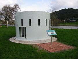
Category 2 - Band Rotunda,[55] Delta Tavern,[56] Doctor's House, former bakery,[57] former Flourmill Store,[58] former Māori pā - Puke i Ahua,[59] Grant's Chambers,[60] 13 Lower Waikato Esplanade,[61] 2 Old Taupiri Rd,[62] Pioneer Gun Turret,[63] Riverdale,[64] St Paul's Church,[65] War Memorial.[66]
Community
Māori King Movement
Ngaruawahia is home to the Kīngitanga.[20] The first Māori King, Pōtatau Te Wherowhero, was crowned at Ngaruawahia in 1858 and was living there when he died two years later. The current Māori King is Tūheitia Paki; he obtained the throne at Tūrangawaewae Marae immediately following his mother's passing in 2006.[6][67]
Tribal Huk
A local gang is Tribal Huk, who have been seen as heroes by the community for providing lunches to schoolchildren in Ngaruawahia, Hamilton and Huntly.[68] In particular, they have been known for making sandwiches,[69] which earned them the nickname "Sandwich Gang".[70]
In October 2016, Tribal Huk president Jamie Pink started a movement against methamphetamine, known in New Zealand as "P".[70] Waikato District Mayor Allan Sanson supported Pink's message to Ngaruawahia methamphetamine dealers to either leave the town within 24 hours or "visits" would begin.[71] The demand was also supported by members of the community who had gathered at a local meeting,[72] as methamphetamine was blamed for an apparent rise of crime in the town.[73] According to a gang source, Ngaruawahia became P free,[74] but the Police Association stated that there was no evidence that P dealers had left Ngaruawahia.[75] There is additionally concern Pink has damaged the work that Tribal Huk did feeding a thousand Waikato schoolchildren.[70]
In November 2016, another community meeting was held. Pink was not present."[76]
Christianity
In the 1996 census, the majority of residents identified as Christian. A Bible is traditionally used during the crowning of a Māori monarch.[67] In 1995, the Holy Trinity Anglican Church burned down, and a new church had been built in its place by 1998.[1]
On the northern side of the Waipa River is the Christian Youth Camps (CYC), the largest youth camp site in New Zealand. CYC started in the early 1960s with large Easter conventions. Today there are two separate camp sites on 38 hectares of land. The camp offers school holiday camps throughout the year. During the terms, the camps are used by various groups, including schools, churches and sporting organisations.
Sport and recreation
Football (soccer)
Ngaruawahia United, known as "The Green Machine", is the local football (soccer) club, founded in 1968. Centennial Park serves as the home ground for the club, and has been the home venue for ASB Premiership side Waikato FC in past seasons.
Rugby league
The town's rugby league teams are Ngaruawahia Panthers and Tūrangawaewae.[77] The Ngaruawahia Rugby League Club is the oldest such club in the Waikato. Early games were played on varying venues, for instance Taupiri paddock and Paterson Park. The first major match for the town was held in August 1911 when they lost to Auckland 22 - 36 at the Caledonian Ground in Frankton. Ngaruawahia did however beat Hamilton United 27 - 4 in the first ever Northern Union game to be played at Hamilton's Steele Park in 1912. The senior team were Champion of Champions in 1956 and 1957.[78]
Ngaruawahia is the home of the rugby league team Turangawaewae RLC, which is named after the marae opposite the clubrooms. The club currently holds the record for the first team to win consecutive titles in the annual Waicoa Bay Premiers Competition, consisting of all teams in the Waikato, Coast and Bay Of Plenty regions. Ngaruawahia Rugby League Club (Panthers) are 2011 champions, Premiers, U17, U14, U13 are all champions.
River activities
The local regatta has been a fundamental event for the region for well over a century. An event is held every year in March on the Waikato River.[6] The first regatta was an unofficial event in 1892, involving both Māori and Pākehā festivities. The regatta provided a means of association between two ethnic groups, socially and culturally. The first official regatta took place in 1896 and since then has grown to become one of New Zealand's largest aquatic festivals.[79] During the centennial regatta in March 1996, over 48,000 people visited the town to see thousands of performers from a number of countries.[1]
For many years, jumping off the rail bridge has been a tradition. However, groups such as KiwiRail want the practice to end.[80]
Hopuhopu
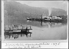
Hopuhopu is 5 km (3.1 mi) north of Ngaruawahia.[81] From 1853[82] Hopuhopu had a boys' mission school, which lost most of its pupils in 1862[83] and, by 1863, was reported as in disrepair.[84] The mission house burnt down in 1886.[85] An army camp was built on the mission site in the 1920s,[86] including its own water supply, ammunition dumps and a railway siding.[87] A 1925 photograph showed only one building and many tents,[88] but a 1955 aerial photo showed the extent of building,[89] which was largely complete by 1927.[90] In 1993 the camp was returned to Waikato-Tainui, who converted it to their headquarters and Waikato-Tainui College for Research and Development.[91]
Former residents
- Shaun Kenny-Dowall, rugby league player
- Dallin Watene-Zelezniak, rugby league player
- Richard Tomlinson, MI6 officer
- Kelvin Cruickshank, television personality[92]
See also
Notes
References
- 1 2 3 4 5 6 7 8 Mark Smith (2012). Ngaruawahia 1980-2010 A Brief History. Lions Club of Ngaruawahia Incorporated Charitable Trust. ISBN 978-0-473-21930-7. Retrieved 9 October 2016.
- ↑ Ngaruawahia - a small town with a big history
- 1 2 Swarbrick, Nancy. "Waikato places - Ngāruawāhia". Te Ara - the Encyclopedia of New Zealand. Updated 8 December 2011.
- ↑ "Heritage planners minutes" (PDF). Waikato District Council. 18 June 2010. Archived from the original (PDF) on 9 February 2013. Retrieved 19 April 2012.
- ↑ "Puke-i-aahua Pa Palisade, Ngaaruaawahia". Retrieved 19 April 2012.
- 1 2 3 Ian D. Robinson (2010). Waikato River It's People, Places & History. David Bateman Limited, New Zealand, 2009. ISBN 9781869537531. Retrieved November 2016
- ↑ "GOVERNMENT LAND SALE. (New Zealander, 1864-09-30)". paperspast.natlib.govt.nz National Library of New Zealand. Retrieved 2017-06-14.
- ↑ "PUBLIC WORKS STATEMENT BY THE HON. J. G. COATES, MINISTER OF PUBLIC WORKS. (Appendix to the Journals of the House of Representatives, 1921-01-01)". paperspast.natlib.govt.nz National Library of New Zealand. Retrieved 2017-07-01.
- ↑ "Appendix to the Journals of the House of Representatives 1922 Session PUBLIC WORKS STATEMENT BY THE HON. J. G. COATES, MINISTER OF PUBLIC WORKS". paperspast.natlib.govt.nz National Library of New Zealand. Retrieved 2017-07-01.
- ↑ ""Cambridge" Gas Producer". Sunday Times (Perth, WA : 1902 - 1954). 1912-10-13. p. 7. Retrieved 2017-07-16.
- ↑ "NGARUAWAHIA POWER STATION (Waikato Argus, 1914-03-17)". paperspast.natlib.govt.nz National Library of New Zealand. Retrieved 2017-07-01.
- ↑ "PUBLIC WORKS STATEMENT BY THE HON. J. G. COATES, MINISTER OF PUBLIC WORKS. (Appendix to the Journals of the House of Representatives, 1924-01-01)". paperspast.natlib.govt.nz National Library of New Zealand. Retrieved 2017-07-06.
- ↑ Latta, A. M. (1980). Meeting of the Waters.
- ↑ American officer and Tainui kuia Retrieved 2016
- ↑ 1953 & 1974 – Queen Elizabeth’s Visits
- ↑ Māori and English Queens, 1974
- ↑ 1973 – The Great Ngaruawahia Music Festival
- ↑ "Top of the south aims for largest haka". The Nelson Mail. Stuff.co.nz. July 2010.
- ↑ Aaron Leaman (May 2011). "Murals set scene for 150th mark". Waikato Times. stuff.co.nz.
- 1 2 Phillipa Yalden. "Ngaruawahia residents riled at columnist's 'town is rotting' comments". stuff.co.nz. Retrieved October 2016
- ↑ Belinda Feek (May 2016). "Heather du Plessis-Allan accepts challenge to visit Ngaruawahia". Hamilton News. The New Zealand Herald.
- ↑ 'Epic front page' prompts Heather du Plessis-Allan visit to Ngaruawahia
- ↑ 'Rotting' Ngaruawahia hits back at Heather du Plessis-Allan
- ↑ Nancy El-Gamel (June 2016). "Broadcaster Heather du Plessis-Allan gets a tour of 'rotting' Ngaruawahia". stuff.co.nz. Retrieved October 2016
- ↑ "NEWCASTLE: PUBLIC MEETING. (Daily Southern Cross, 1870-10-26)". paperspast.natlib.govt.nz National Library of New Zealand. Retrieved 2017-07-17.
- ↑ "NGARUAWAHIA BRIDGE. (Waikato Times, 1891-03-28)". paperspast.natlib.govt.nz National Library of New Zealand. Retrieved 2017-07-17.
- ↑ "NGARUAWAHIA RAILWAY BRIDGE. (New Zealand Herald, 1904-06-27)". paperspast.natlib.govt.nz National Library of New Zealand. Retrieved 2017-07-17.
- ↑ "Ngaruawahia Traffic Bridge (Waikato Argus, 1910-10-01)". paperspast.natlib.govt.nz National Library of New Zealand. Retrieved 2017-07-17.
- ↑ "THE NGARUAWAHIA BRIDGE. (New Zealand Herald, 1910-10-01)". paperspast.natlib.govt.nz National Library of New Zealand. Retrieved 2017-07-17.
- ↑ "PUBLIC WORKS STATEMENT. BY THE HON. RODERICK McKENZIE, MINISTER OF PUBLIC WORKS. 16th OCTOBER, 1911. (Appendix to the Journals of the House of Representatives)". paperspast.natlib.govt.nz National Library of New Zealand. Retrieved 2017-07-17.
- ↑ "THE NEED FOR A NEW TRAFFIC BRIDGE ACROSS THE WAIKATO RIVER: BORING FOR FOUNDATIONS AT NGARUAWAHIA". www.aucklandcity.govt.nz. 19 September 1912. Retrieved 2017-07-17.
- ↑ "NGARUAWAHIA BRIDGE. (New Zealand Herald, 1914-07-31)". paperspast.natlib.govt.nz National Library of New Zealand. Retrieved 2017-07-17.
- ↑ More, David. Waikato County 1876-1976. Wilson & Horton Ltd. ISBN 086864000X.
- ↑ Auckland Weekly News (4 October 1917). "commencing the erection of a new bridge at Ngaruawahia". www.aucklandcity.govt.nz. Retrieved 2017-07-17.
- ↑ "Public Works Statement, By The Hon. Sir William Fraser, Kt. Bach., Minister of Public Works. 1 January 1918". paperspast.natlib.govt.nz National Library of New Zealand. Retrieved 2017-07-17.
- ↑ "Public Works Statement. By the Hon. Sir William Fraser, Kt. Bach., Minister of Public Works 1 JANUARY 1919". paperspast.natlib.govt.nz National Library of New Zealand. Retrieved 2017-07-17.
- ↑ "DAMAGE TO BRIDGE. (New Zealand Herald, 1919-05-30)". paperspast.natlib.govt.nz National Library of New Zealand. Retrieved 2017-07-17.
- ↑ "ENGINEERS IN HAMILTON (Waikato Times, 1919-10-27)". paperspast.natlib.govt.nz National Library of New Zealand. Retrieved 2017-07-17.
- ↑ "PUBLIC WORKS ESTIMATES (Waikato Times, 1920-10-23)". paperspast.natlib.govt.nz National Library of New Zealand. Retrieved 2017-07-17.
- ↑ "Parliamentary Papers - Appendix to the Journals of the House of Representatives 1920". paperspast.natlib.govt.nz National Library of New Zealand. Retrieved 2017-07-17.
- ↑ "NGARUAWAHIA BOROUGH (Waikato Times, 1921-07-22)". paperspast.natlib.govt.nz National Library of New Zealand. Retrieved 2017-07-17.
- ↑ "NGARUAWAHIA BRIDGE (Waikato Times, 1921-07-29)". paperspast.natlib.govt.nz National Library of New Zealand. Retrieved 2017-07-17.
- 1 2 3 4 5 Latta, A. M. (1980). Meeting of the Waters.
- ↑ "Appendix to the Journals of the House of Representatives 1921". paperspast.natlib.govt.nz National Library of New Zealand. Retrieved 2017-07-17.
- ↑ "BRIDGE AT NGARUAWAHIA. (New Zealand Herald, 1931-05-13)". paperspast.natlib.govt.nz National Library of New Zealand. Retrieved 2017-07-17.
- ↑ "MAIN HIGHWAYS BOARD. (New Zealand Herald, 1931-10-30)". paperspast.natlib.govt.nz National Library of New Zealand. Retrieved 2017-07-17.
- ↑ "WAIKATO COUNTY. (New Zealand Herald, 1931-11-12)". paperspast.natlib.govt.nz National Library of New Zealand. Retrieved 2017-07-17.
- ↑ "Public Works Statement (By The Hon. C. E. Macmillan, Acting Minister of Public Works). 1 January 1932". paperspast.natlib.govt.nz National Library of New Zealand. Retrieved 2017-07-17.
- ↑ "NGARUAWAHIA BRIDGE (New Zealand Herald, 1936-04-03)". paperspast.natlib.govt.nz National Library of New Zealand. Retrieved 2017-07-17.
- ↑ "Appendix to the Journals of the House of Representatives - 1938 Public Works Statement (By The Hon. R. Semple, Minister of Public Works)". paperspast.natlib.govt.nz National Library of New Zealand. Retrieved 2017-07-17.
- ↑ "www.trafficcounts.co.nz". Retrieved 2017-07-17.
- ↑ "Waikato Expressway - Ngaruawahia Section Update - September 2010" (PDF). NZTA.
- ↑ "RAMM Traffic and Loading - GREAT SOUTH RD between ELLERY ST and GALILEO ST" (PDF). Waikato DC. November 2016.
- ↑ "Turangawaewae House / Maori Parliament Building". www.heritage.org.nz. Retrieved 2018-10-10.
- ↑ "Band Rotunda". www.heritage.org.nz. Retrieved 2018-10-10.
- ↑ "Delta Tavern". www.heritage.org.nz. Retrieved 2018-10-10.
- ↑ "Bakery (Former)". www.heritage.org.nz. Retrieved 2018-10-10.
- ↑ "Flourmill Store (Former)". www.heritage.org.nz. Retrieved 2018-10-10.
- ↑ "Puke i Ahua". www.heritage.org.nz. Retrieved 2018-10-10.
- ↑ "Grant's Chambers". www.heritage.org.nz. Retrieved 2018-10-10.
- ↑ "House". www.heritage.org.nz. Retrieved 2018-10-10.
- ↑ "House". www.heritage.org.nz. Retrieved 2018-10-10.
- ↑ "Pioneer Gun Turret". www.heritage.org.nz. Retrieved 2018-10-10.
- ↑ "Riverdale". www.heritage.org.nz. Retrieved 2018-10-10.
- ↑ "St Paul's Church (Catholic)". www.heritage.org.nz. Retrieved 2018-10-10.
- ↑ "World War One and Two Memorial". www.heritage.org.nz. Retrieved 2018-10-10.
- 1 2 "Tuheitia new Maori king". The New Zealand Herald. New Zealand Press Association. August 2006.
- ↑ "Tribal Huk members show they are good neighbours in Ngaruawahia". Waikato Times. stuff.co.nz. October 2016.
- ↑ "Shades of Bad? The changing face of NZ gang culture". Special Broadcasting Service.
- 1 2 3 Jo Lines-Mackenzie (October 2016). "Ngaruawahia community on edge after gang unrest". Waikato Times. stuff.co.nz.
- ↑ "Gang boss gives P dealers ultimatum". October 2016.
- ↑ "Ngaruawahia gang leader tells drug dealers: Leave - or else". New Zealand Herald. October 2016.
- ↑ "'They have 24 hours': Gang boss issues menacing warning to meth dealers to get out of town after his own daughter, 13, was offered the drug". Daily Mail. October 2016.
- ↑ "Tribal Huk clears Ngaruawahia of P dealers, as promised". Stuff. October 2016.
- ↑ "There's no evidence that P dealers have left Ngaruawahia after Tribal Huk claims, says Police Association". October 2016.
- ↑ "Strong police presence at Ngaruawahia community meeting". The New Zealand Herald. November 2016.
- ↑ "People matter most in lovely Ngaruawahia". stuff.co.nz. Waikato Times. 20 July 2012.
- ↑ Ngaruawahia Rugby League: 1911-2011, 100 Years Ngaruawahia Rugby League Football Club, 2011
- ↑ The Regatta
- ↑ Kelsey Wilkie (November 4, 2016). "Ending the bridge jumping tradition in Ngaruawahia". stuff.co.nz. Retrieved November 2016
- ↑ "Waikato-Tainui College : Our Location". www.waikatotainui.ac.nz. Retrieved 2017-06-29.
- ↑ "MAORI SCHOOL LAND. (Auckland Star, 1921-11-24)". paperspast.natlib.govt.nz National Library of New Zealand. Retrieved 2017-06-29.
- ↑ "NATIVE SCHOOLS. REPORTS OF INSPECTORS. (Appendix to the Journals of the House of Representatives, 1862-01-01)". paperspast.natlib.govt.nz National Library of New Zealand. Retrieved 2017-06-29.
- ↑ "Parliamentary papers. (New Zealander, 1863-12-24)". paperspast.natlib.govt.nz National Library of New Zealand. Retrieved 2017-06-29.
- ↑ "THE BURNING OF THE MISSION STATION AT HOPUHOPU. (New Zealand Herald, 1886-04-10)". paperspast.natlib.govt.nz National Library of New Zealand. Retrieved 2017-06-29.
- ↑ "GREAT MILITARY CAMP. (Auckland Star, 1925-04-08)". paperspast.natlib.govt.nz National Library of New Zealand. Retrieved 2017-06-29.
- ↑ "NGARUAWAHIA CAMP. (New Zealand Herald, 1925-08-31)". paperspast.natlib.govt.nz National Library of New Zealand. Retrieved 2017-06-29.
- ↑ "CAMP OF THE FIRST BATTALION OF THE WAIKATO REGIMENT NEAR NGARUAWAHIA". www.aucklandcity.govt.nz. 19 February 1925. Retrieved 2017-06-30.
- ↑ "Hopuhopu Military Camp on the banks of the Waikato River with training grounds, barracks, residential housing and rugby field, farmland beyond". Alexander Turnbull Library. 5 Apr 1955.
- ↑ "Appendix to the Journals of the House of Representatives PUBLIC WORKS STATEMENT (BY THE HON. K. S. WILLIAMS, MINISTER OF PUBLIC WORKS)". paperspast.natlib.govt.nz National Library of New Zealand. Retrieved 2017-07-01.
- ↑ "Ngaaruawaahia, Hopuhopu, Taupiri, Horotiu, Te Kowhai & Glen Massey Structure Plan" (PDF). Waikato District Council. March 2017.
- ↑ Kelvin Cruickshank is Sensing Murder? I'm sensing comedy
External links
| Wikimedia Commons has media related to Ngaruawahia. |
- 1861 drawing
- Auckland Weekly News photo - road and rail bridges in 1922
- 1926 photos of Hophopu
- Photo of 1936 tar sealing of Great South Rd
- Whites Aviation Collection, Alexander Turnbull Library photos of Waikato river bridges 1946 and 1947