Mackenzie District
| Mackenzie District | |
|---|---|
| Territorial authority | |
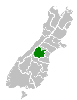 Mackenzie District within the South Island | |
| Country | New Zealand |
| Island | South Island / Te Waipounamu |
| Region | Canterbury |
| District | Mackenzie District Council |
| Wards |
Opuha Pukaki |
| Formed | 1989 |
| Seat | Fairlie |
| Government | |
| • Mayor | Graham Smith |
| • Deputy Mayor | James Leslie |
| Area | |
| • Total | 7,339.23 km2 (2,833.69 sq mi) |
| Population (June 2017)[1] | |
| • Total | 4,600 |
| • Density | 0.63/km2 (1.6/sq mi) |
| Postcode(s) | Map of postcodes |
| Website | Mackenzie District Council |
Mackenzie District is a local government district in New Zealand's South Island administered by the Mackenzie District Council. It is part of the larger Canterbury region.
Principal settlements
The Mackenzie District only has three towns with a permanent population over 300 at the 2013 census:
- Fairlie (pop. 690) – seat of the district
- Twizel (pop. 1,140) – the district's largest town
- Tekapo (pop. 370)
Other smaller settlements include:
Geography
Economy
A relatively weakly settled area, the district does have a wide number of farms. However, in the late 2000s, numerous proposals for new farming operations have locals fearing that the agriculture will be transformed from often family-held farms to large agribusiness operations, causing increased local ecologic damage and siphoning off capital overseas.[2]
Climate
The Mackenzie District has a dry temperate-continental climate with clear, crisp snowy winters and long, hot summers. Autumn is known for being a riot of colour, while spring brings wildflowers blooming throughout the region, including lupins. The warm summer season is from November to February, with temperatures often passing 30 degrees. In the cooler winter season, from June to September, temperatures drop to below 0 degrees Celsius overnight, while sunny winter days average around 8 degrees and regular snowfall.[3]
History
The MacKenzie Basin was named in the 1850s by and after James Mckenzie, a Scottish-origin shepherd and sheep thief, and the name transferred to the modern district.
Notable places
Mountains
Lakes
- Lake Tekapo and the 'Church of the Good Shepherd'.
- Lake Pukaki
- Lake Ruataniwha, one of New Zealand's main rowing venues
- Lake Ohau
Glaciers
- Tasman Glacier
- Hooker Glacier
Skifields
- Fox Peak
- Mt Dobson
- Round Hill
- Tasman Glacier Heliski
National parks
List of Mayors
| Name | Term of Office |
|---|---|
| Neil Anderson | 1992–2001[4] |
| Stan Scorringe | 2001–2004[5] |
| John O'Neill | 2004–2010[6] |
| Claire Barlow | 2010–2016[7] |
| Graham Smith | 2016–present[8] |
References
- ↑ "Subnational Population Estimates: At 30 June 2017 (provisional)". Statistics New Zealand. 24 October 2017. Retrieved 24 October 2017. For urban areas, "Subnational population estimates (UA, AU), by age and sex, at 30 June 1996, 2001, 2006-16 (2017 boundary)". Statistics New Zealand. 24 October 2017. Retrieved 24 October 2017.
- ↑ Taylor, Gary (2010-02-08). "A national treasure is being squandered". The New Zealand Herald. Retrieved 8 February 2010.
- ↑ "Aoraki Mount Cook Mackenzie". mtcooknz.com.
- ↑ "Health Minister announces DHB deputy chairs". Scoop.co.nz. 21 December 2001.
- ↑ "Mayoral Election Results 2004 Affecting the Mayors Taskforce For Jobs". Mayors Taskforce for Jobs.
- ↑ "O'Neill plans family time". Stuff.co.nz. 8 October 2010.
- ↑ "Receptionist becomes Mayor for Mackenzie". Newshub. 10 October 2010.
- ↑ "'Exciting times' for new Mackenzie mayor Graham Smith". Stuff.co.nz. 9 October 2016.