Horowhenua District
| Horowhenua District | |
|---|---|
| Territorial authority | |
 | |
| Country | New Zealand |
| Region | Manawatu-Wanganui |
| District | Horowhenua District Council |
| Wards |
Levin Waiopehu Miranui Kere Kere |
| Seat | Levin |
| Government | |
| • Mayor | Michael Feyen |
| • Deputy Mayor | Wayne Bishop |
| Area | |
| • Total | 1,063.60 km2 (410.66 sq mi) |
| Population (June 2017)[1] | |
| • Total | 32,500 |
| • Density | 31/km2 (79/sq mi) |
| Time zone | UTC+12 (NZST) |
| • Summer (DST) | UTC+13 (NZDT) |
| Postcode(s) | Map of postcodes |
| Website | Horowhenua District Council |
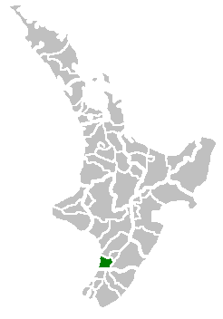
Horowhenua District is a local government district on the west coast of the North Island of New Zealand. It forms part of the Manawatu-Wanganui Region. Its name roughly means shaking or rippling earth.
Located north of Wellington and Kapiti, the district stretches from slightly north of the town of Otaki in the south to just south of Himatangi in the north, and from the coast to the summit of the Tararua Ranges.
The main town and seat of the district council is Levin, and other towns in the district include Foxton, Shannon, and Tokomaru. The population of the district is 32,500 (June 2017).[1]
Populated places
Horowhenua District consists of the following towns, localities, settlements and communities (larger towns shown in bold):
Land use in Horowhenua
Much of the area was once an extensive wetland and the centre of a substantial flax industry. It has been progressively drained and converted to productive but flood-prone farmland, with a mixture of loam and peat based soils. Some parts of the wetland, particularly those around Lake Horowhenua are being returned to their former state as a conservation area, with the help of local Māori. One of the local tribal authorities is the Muaūpoko Tribal Authority.
Schools in Horowhenua District
Secondary
- Manawatu College, Foxton
- Horowhenua College, Levin
- Waiopehu College, Levin
Primary
- Foxton Beach School, Foxton Beach
- Coley Street School, Foxton
- Foxton Primary, Foxton
- St. Marys, Foxton
- Levin East School, Levin
- Fairfield School, Levin
- Ohau School, Ohau (Levin Rural)
- Koputuroa School, Levin Rural
- St. Josephs, Levin
- Levin School, Levin
- Levin North School, Levin
- Taitoko School, Levin
- Poroutawhao School, Levin Rural
- Shannon School, Shannon
- Manakau School, Manakau
- Opiki School, Opiki
- Tokomaru School, Tokomaru
Intermediate
- Levin Intermediate, Levin (Years 7 & 8 only)
Sport
In rugby, a combined Horowhenua-Kapiti team represents the area in the amateur Heartland Championship.
In cricket, a Horowhenua-Kapiti team has competed in the Hawke Cup since 2002.
References
- 1 2 "Subnational Population Estimates: At 30 June 2017 (provisional)". Statistics New Zealand. 24 October 2017. Retrieved 24 October 2017. For urban areas, "Subnational population estimates (UA, AU), by age and sex, at 30 June 1996, 2001, 2006-16 (2017 boundary)". Statistics New Zealand. 24 October 2017. Retrieved 24 October 2017.