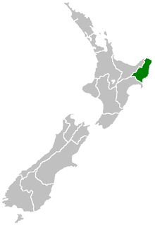
Gisborne District
| Gisborne District Te Tai Rāwhiti | |
|---|---|
| Region of New Zealand | |
 | |
| Country |
|
| Region | Gisborne Region |
| Territorial authority | Gisborne District Council |
| Seat | Gisborne City |
| Government | |
| • Mayor | Meng Foon |
| • Deputy Mayor | Rehette Stoltz |
| Area | |
| • Territorial | 8,355 km2 (3,226 sq mi) |
| Population (June 2017)[1] | |
| • Territorial | 48,500 |
| • Density | 5.8/km2 (15/sq mi) |
| • Urban | 36,600 |
| Area code(s) | 06 |
| Website | gdc.govt.nz |
The Gisborne District (Māori: Te Tai Rāwhiti) is an area of northeastern New Zealand governed by the Gisborne District Council. A unitary authority (with the combined powers of a district and regional council), it is also known as the Gisborne Region.[2] It is named after its largest settlement, the city of Gisborne. The region is also commonly referred to as the East Coast.[3]
The region is commonly divided into the East Cape and Poverty Bay. It is bounded by mountain ranges to the west, rugged country to the south, and faces east onto the Pacific Ocean.
Names
Gisborne is named for an early Colonial Secretary William Gisborne. The council is located in the town of Gisborne (locally referred to as the City of Gisborne).
The region was formerly known as the East Coast, although the region is often divided into the East Coast proper (or East Cape), north of the city, and Poverty Bay, the area including and surrounding the city. The region is also sometimes referred to as the East Cape, although that also refers specifically to the promontory at the northeastern extremity. More recently, it has been called Eastland, although that can also include Opotiki in the eastern Bay of Plenty to the northwest, and Wairoa to the south.[3]
Its Māori name, Te Tai Rāwhiti, means the Coast of the Sunrise,[4] reflecting the fact that it is the first part of the New Zealand mainland to see the sun rise.
Geography
The region is located in the northeastern corner of the North Island. It ranges from the Wharerata Hills in the south, which divide it from the Wairoa district in the Hawke's Bay region, to Lottin Point in the north. The western boundary runs along the Raukumara Range, which separates it from the Opotiki district. In the southwest, its boundary runs along the western edge of Te Urewera National Park.
It is sparsely inhabited and isolated, with small settlements mainly clinging to small bays along the eastern shore including Tokomaru Bay and Tolaga Bay. Its population is 48,500 (June 2017).[1] Three-quarters of the population – 36,600 (June 2017)[1] – lives in the city of Gisborne. No other settlement has a population of over 1000. The largest other settlements are the towns of Tolaga Bay and Ruatoria, each with populations of over 800 in 2001.
Inland, the land is rough, predominantly forested, hill country. A spine of rough ridges dominates the centre of the region, culminating in the impressive bulk of the 1752 metre Mount Hikurangi in Waiapu Valley in the region's northeast. This mountain is the fifth highest mountain in the North Island, and the highest that is not a volcano. Regarded as sacred by the Māori, there is some justification to the claims that this is the first mountain to see the sun in summer.
The region's population has higher than the national average proportion of Māori - over 50% in some areas - and still maintains strong ties to both Māori tradition and the iwi and marae structure. The predominant iwi are Ngāti Porou, Rongowhakaata, Ngai Tamanuhiri, Te Aitanga a Mahaki.
Government
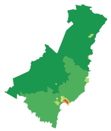
Gisborne District Council is a unitary territorial authority, which means that it performs the functions of a regional council as well as those of a territorial authority (a district or city). It includes a mayor, 13 elected councillors,[5] an appointed chief executive officer, 4 department managers and approximately 250 staff. Its headquarters are in the city of Gisborne. The area it governs is constituted as both the Gisborne District and the Gisborne Region.[2]
Gisborne District Council was created as part of a major nationwide reform of local government in 1989. It replaced the councils of Gisborne City, Cook County, Waiapu County and Waikohu County, East Cape United Council, East Cape Catchment Board and Regional Water Board, East Coast Pest Destruction Board, two harbour boards, and several noxious plants authorities and recreation reserve boards.[2] It was the only unitary authority in New Zealand until three others were created in 1992.
Economy
The sub-national GDP of the Gisborne region was estimated at US$1.031 billion in 2003, 1% of New Zealand's national GDP.[6]
Climate
The region is sheltered by high country to the west and has a dry, sunny climate. It has a yearly average of 2,200 sunshine hours. The annual rainfall varies from about 1000mm near the coast to over 2500mm in higher inland country.
| Climate data for Gisborne | |||||||||||||
|---|---|---|---|---|---|---|---|---|---|---|---|---|---|
| Month | Jan | Feb | Mar | Apr | May | Jun | Jul | Aug | Sep | Oct | Nov | Dec | Year |
| Average high °C (°F) | 24.9 (76.8) |
24.2 (75.6) |
22.6 (72.7) |
19.9 (67.8) |
17.1 (62.8) |
14.7 (58.5) |
14.1 (57.4) |
14.9 (58.8) |
16.8 (62.2) |
19.0 (66.2) |
21.3 (70.3) |
23.3 (73.9) |
19.5 (67.1) |
| Average low °C (°F) | 13.6 (56.5) |
13.6 (56.5) |
12.2 (54) |
9.6 (49.3) |
6.9 (44.4) |
5.3 (41.5) |
4.6 (40.3) |
5.4 (41.7) |
6.8 (44.2) |
8.6 (47.5) |
10.5 (50.9) |
12.3 (54.1) |
9.1 (48.4) |
| Average precipitation mm (inches) | 54 (2.13) |
78 (3.07) |
99 (3.9) |
103 (4.06) |
97 (3.82) |
125 (4.92) |
119 (4.69) |
93 (3.66) |
101 (3.98) |
63 (2.48) |
65 (2.56) |
67 (2.64) |
1,050 (41.34) |
| Source: NIWA Climate Data[7] | |||||||||||||
Demographics
| Historical population of Gisborne District[8][9] | ||
|---|---|---|
| New Zealand census | Pop. | ±% |
| 1986 | 45,758 | — |
| 1991 | 44,361 | −3.2% |
| 1996 | 45,962 | +3.6% |
| 2001 | 43,971 | −4.5% |
| 2006 | 44,463 | +1.1% |
| 2013 | 43,656 | −1.8% |
Gisborne District had a population of 43,656 according to the 2013 New Zealand census. This is a decrease of 807, or 1.8 percent, since the 2006 census. There were 16,185 occupied dwellings, 1,824 unoccupied dwellings, and 51 dwellings under construction.[8]
Of the residential population, 21,093 (48.3%) were male compared to 48.7% nationally, and 22,560 (51.7%) were female, compared to 51.3% nationally. The city had a median age of 37.0 years, 1.0 years below the national median age of 38.0 years. People aged 65 and over made up 14.0% of the population, compared to 14.3% nationally, and people under 15 years made up 24.6%, compared to 20.4% nationally. People aged between 15 and 24 made up approximately 12.7% of the city's residential population.[8]
Gisborne's ethnicity is made up of (national figures in brackets): 56.1% European (74.0%), 45.1% Māori (14.9%), 2.2% Asian (11.8%), 3.5% Pacific Islanders (7.4%), 0.4% Middle Eastern, Latin American or African (1.2%), 1.4% 'New Zealanders' (1.6%), and 0.05% Other (0.1%).[8]
Gisborne had an unemployment rate of 9.4% of people 15 years and over, compared to 7.4% nationally. The median annual income of all people 15 years and over was $24,400, compared to $28,500 nationally. Of those, 41.9% earned under $20,000, compared to 38.2% nationally, while 19.6% earned over $50,000, compared to 26.7% nationally.[8]
Gisborne has the smallest percentage of population born overseas at 9.7% compared to 25.2% for New Zealand as a whole.[10] The highest of these are British totalling 1,335 or 3.1% of the population.[11] Furthermore, 73.0% of the population could speak in one language only, 16.2% in two languages and 1.1% in three or more languages.[8]
2007 earthquake
At 8.55pm (NZDT) on 20 December 2007, the Gisborne region was hit by an earthquake of Richter magnitude 6.8, centred in the Hikurangi Trench, 50 km southeast of Gisborne at a depth of 40 km.[12] Mercalli intensities of 7-8 were experienced, with three buildings substantially collapsed in the CBD and others experiencing some structural damage. One death was reported (a heart attack of an elderly woman, sustained during the quake) plus minor injuries.[13]
Sport
The region is represented in rugby union by the East Coast Rugby Football Union and the Poverty Bay Rugby Football Union.
See also
References
- 1 2 3 "Subnational Population Estimates: At 30 June 2017 (provisional)". Statistics New Zealand. 24 October 2017. Retrieved 24 October 2017. For urban areas, "Subnational population estimates (UA, AU), by age and sex, at 30 June 1996, 2001, 2006-16 (2017 boundary)". Statistics New Zealand. 24 October 2017. Retrieved 24 October 2017.
- 1 2 3 "The Local Government (Gisborne Region) Reorganisation Order 1989" (PDF). New Zealand Gazette. 9 June 1989. pp. 2328 ff. Retrieved 5 June 2014.
- 1 2 Soutar, Monty (13 July 2012). "East Coast region – Overview". Te Ara – the Encyclopedia of New Zealand. Retrieved 31 May 2014.
- ↑ Cowan, James (1926). The Maoris in the Great War. pp. 179–80. Retrieved 7 June 2014.
- ↑ "Local Government Commission : Determination of representation arrangements to apply for the election of the Gisborne District Council to be held on 12 October 2013" (PDF). Lgc.govt.nz. Retrieved 7 April 2018.
- ↑ "Regional Gross Domestic Product". Statistics New Zealand. 2007. Retrieved 18 February 2010.
- ↑ "Climate Data". NIWA. Retrieved 25 February 2009.
- 1 2 3 4 5 6 "2013 Census tables about a place: Gisborne District". Statistics New Zealand. Retrieved 1 February 2016.
- ↑ "1996 Census of Population and Dwellings – Census Night Population". Statistics New Zealand. 28 February 1997. Archived from the original on 13 February 2016. Retrieved 1 February 2016.
- ↑ "2013 Census QuickStats about culture and identity – Birthplace and people born overseas". Statistics New Zealand. Retrieved 23 January 2016.
- ↑ "Birthplace (detailed), for the census usually resident population count, 2001, 2006, and 2013 (RC, TA) – NZ.Stat". Statistics New Zealand. Retrieved 1 February 2016.
- ↑ "GeoNet – New Zealand Earthquake Report". Geonet.org. December 20, 2007. Retrieved 7 April 2018.
- ↑ Binning, Elizabeth (21 December 2007). "Quake damage extensive as massive clean-up begins". The New Zealand Herald. NZPA. Retrieved 1 October 2011.
External links
| Wikivoyage has a travel guide for East Coast (New Zealand). |
| Wikimedia Commons has media related to Gisborne Region. |
| North Island | ||
|---|---|---|
| South Island | ||
* Governed by a unitary authority rather than a regional council | ||