Western Bay of Plenty District
| Western Bay of Plenty District | |
|---|---|
| Territorial authority | |
 | |
| Country | New Zealand |
| Region | Bay of Plenty |
| District | Western Bay of Plenty District Council |
| Wards |
Waihi Beach-Katikati Kaimai Te Puke-Maketu |
| Seat | Greerton, Tauranga |
| Government | |
| • Mayor | Garry Webber |
| • Deputy Mayor | Mike Williams |
| Area | |
| • Total | 2,120.675 km2 (818.797 sq mi) |
| Population (June 2018)[1] | |
| • Total | 50,100 |
| • Density | 24/km2 (61/sq mi) |
| Time zone | UTC+12 (NZST) |
| • Summer (DST) | UTC+13 (NZDT) |
| Postcode(s) | Map of postcodes |
| Website | Western Bay of Plenty District Council |
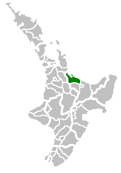
Western Bay of Plenty District is a territorial authority within the Bay of Plenty Region of New Zealand. The district envelops Tauranga City by land, and includes Matakana Island, at the entrance to Tauranga Harbour.
Population
The district's population at the June 2018 census was 50,100,[1] of whom 16% are Maori. Of these, 1773 live in Waihi Beach, 3579 in Katikati, and 7080 in Te Puke. The district has a land area of 2,120.675 km² (818.797 sq mi).
Local government
The seat of the Western Bay of Plenty District Council is at Greerton in Tauranga City (which is a separate area that is not part of the district). The district came into being in the local government reorganisation of 1989; with minor modifications to the boundaries, it merged the old Tauranga County and Te Puke Borough. The greatest changes were in the northwest, with Waihi Beach being transferred to the district from the old Ohinemuri County, and in the vicinity of Tauranga City, where some of the hinterland, formerly in the county, was transferred to the city.
The wards (for the purposes of electing district councillors) are the following:
- Waihi Beach-Katikati Ward: (seat at Katikati)
- Waihi Beach Sub-Division
- Katikati Sub-Division
- Kaimai Ward: (seat at Omokoroa)
- Te Puke-Maketu Ward: (seat at Te Puke)
References
- 1 2 "Subnational Population Estimates: At 30 June 2018 (provisional)". Statistics New Zealand. 23 October 2018. Retrieved 23 October 2018. For urban areas, "Subnational population estimates (UA, AU), by age and sex, at 30 June 1996, 2001, 2006-18 (2018 boundary)". Statistics New Zealand. 23 October 2018. Retrieved 23 October 2018.