Tōhoku Expressway
| |
|---|---|
|
東北自動車道 | |
 | |
| Route information | |
| Length | 679.5 km[1] (422.2 mi) |
| Existed | 1972[2]–present |
| Major junctions | |
| From |
Kawaguchi Junction in Kawaguchi, Saitama |
| To |
Aomori Interchange in Aomori, Aomori |
| Location | |
| Major cities | Saitama, Tatebayashi, Utsunomiya, Kōriyama, Fukushima, Sendai, Morioka, Kazuno, Hirosaki |
| Highway system | |
|
National highways of Japan Expressways of Japan | |

The Tōhoku Expressway (東北自動車道 Tōhoku Jidōsha-dō) is a national expressway in Japan. It is owned by Japan Expressway Holding and Debt Repayment Agency and operated by East Nippon Expressway Company. The expressway is signed E4 under the "2016 Proposal for Realization of Expressway Numbering", because it roughly parallels National Route 4.[3]
Naming
Tōhoku refers to the Tōhoku region, the northernmost region on the island of Honshū.
Officially the expressway is designated as the Tōhoku Jūkan Expressway Hirosaki Route. It is also concurrent with the Tōhoku Jūkan Expressway Hachinohe Route until Ashiro Junction, where it diverges from the Tōhoku Expressway to become the Hachinohe Expressway. [4]
Overview
The expressway links the Tōhoku region with the Kantō region and the greater Tokyo urban area. It is also the longest expressway among all expressways operated by East Nippon Expressway Company.[1]
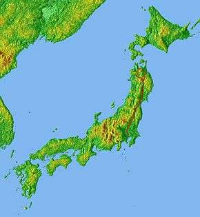
Starting at a junction with the Tokyo Gaikan Expressway to the north of Tokyo, the expressway follows a northerly course through the plains of Saitama Prefecture and Tochigi Prefecture before entering the mountainous interior of the Tōhoku region. Passing through central Fukushima Prefecture, the expressway then enters Miyagi Prefecture and passes to the west of Sendai, the largest city in the Tōhoku region. The expressway continues north into Iwate Prefecture, passing the prefectural capital Morioka. In the northern part of Iwate, the expressway veers to the northwest, while the Hachinohe Expressway branches off to the northeast. The Tōhoku Expressway continues into central Aomori Prefecture. Before terminating in the city of Aomori,the Aomori Expressway begins, continuing east as an extension of the expressway towards Hachinohe by a series of toll roads and expressways.[5]
The route parallels the Tōhoku Shinkansen and Tōhoku Main Line of East Japan Railway Company as well as National Route 4 from its origin in Tokyo to the city of Morioka. North of Morioka, the route diverges to the northwest and parallels the Ōu Main Line and National Route 7. It follows this path winding through the Ōu Mountains to its northern terminus in Aomori at National Route 7 about a kilometer south of the Tōhoku Shinkansen's northern terminus at Shin-Aomori Station.
The expressway is 6 lanes from Kawaguchi Junction to Utsunomiya Interchange, and 4 lanes from Utsunomiya to the terminus in Aomori.
Many sections of the expressway were damaged on 11 March 2011 during the 2011 Tōhoku earthquake and tsunami. The expressway reopened on 24 March 2011.[6]
List of interchanges and features
- IC - interchange, SIC - smart interchange, JCT - junction, SA - service area, PA - parking area, BS - bus stop, TN - tunnel, BR - bridge, TB - toll gate, CB - snow chains
Kawaguchi JCT - Sendai-Miyagi IC
| No. | Name | Connections | Dist. from Origin |
Dist. from Terminus |
Bus Stop | Notes | Speed Limit | Location | |
|---|---|---|---|---|---|---|---|---|---|
| Through to | |||||||||
| 1 | Kawaguchi JCT | 0.0 | 679.5 | 80 km/h | Kawaguchi | Saitama | |||
| 2 | Urawa IC | 3.2 | 676.3 | Aomori-bound exit, Kawaguchi-bound entrance only | Midori-ku, Saitama | ||||
| 4.8 | 674.7 | Kawaguchi-bound exit, Aomori-bound entrance only | |||||||
| TB | Urawa Toll Gate | ||||||||
| 100 km/h | |||||||||
| 3 | Iwatsuki IC | 10.5 | 669.0 | Iwatsuki-ku, Saitama | |||||
| SA | Hasuda SA | 18.2 | 661.3 | Hasuda | |||||
| BS | Shiraoka Bus Stop | 20.5 | 659.0 | X | Closed | Shiraoka | |||
| <3-1> | Kuki-Shiraoka JCT | 24.1 | 655.4 | Kuki | |||||
| 4 | Kuki IC | Pref. Route 3 (Saitama Kurihashi Route) | 25.5 | 654.0 | |||||
| 5 | Kazo IC | 33.4 | 646.1 | Kazo | |||||
| 5-1 | Hanyū IC | Pref. Route 84 (Hanyū Kurihashi Route) | 39.4 | 640.1 | Hanyū | ||||
| PA | Hanyū PA | 40.6 | 638.9 | ||||||
| BR | Tonegawa Bridge | ↓ | ↑ | Tone River crossing | |||||
| Meiwa | Gunma | ||||||||
| 6 | Tatebayashi IC | 46.0 | 633.5 | Tatebayashi | |||||
| BR | Watarasegawa Bridge | ↓ | ↑ | Length - 400 m | Itakura | ||||
| Sano | Tochigi | ||||||||
| 7 | Sano-Fujioka IC | 55.0 | 624.5 | Tochigi | |||||
| Sano | |||||||||
| SA | Sano SA | 58.0 | 621.5 | X | Bus Stop closed | ||||
| <7-1> | Iwafune JCT | 61.8 | 617.7 | Southern terminus of concurrency with Kita-Kantō Expressway | Tochigi | ||||
| BS/CB | Iwafune BS/CB | 63.6 | 615.9 | X | Bus Stop closed | ||||
| 8 | Tochigi IC | Pref. Route 32 (Tochigi Kashiwao Route) | 72.7 | 606.8 | |||||
| 8-1 | Tochigi-Tsuga JCT | 75.4 | 604.1 | Northern terminus of concurrency with Kita-Kantō Expressway | |||||
| PA | Tsuganishikata PA | 79.3 | 600.2 | ||||||
| BR | Omoigawa Bridge | ↓ | ↑ | ||||||
| Kanuma | |||||||||
| BS/CB | Isomachi BS/CB | 84.8 | 594.7 | X | Bus Stop closed | ||||
| 9 | Kanuma IC | 91.5 | 588.0 | X | Bus Stop closed | ||||
| PA | Ōya PA | 99.3 | 580.2 | Utsunomiya | |||||
| 10 | Utsunomiya IC | 103.0 | 576.5 | ||||||
| SA | Kamikawachi SA/ SIC |
110.6 | 568.9 | SIC: Aomori-bound exit, Kawaguchi-bound entrance only | |||||
| BR | Kinugawa Bridge | ↓ | ↑ | Length - 600 m | |||||
| Sakura | |||||||||
| 11 | Yaita IC | Pref. Route 30 (Yaita Nasu Route) |
120.2 | 559.3 | Yaita | ||||
| PA | Yaita-kita PA | 127.5 | 552.0 | ||||||
| BS/CB | Tanohara BS/CB | ↓ | ↑ | X | Bus Stop closed | ||||
| BR | Hōkigawa Bridge | ↓ | ↑ | Length - 192 m | Nasushiobara | ||||
| 12 | Nishinasuno- Shiobara IC |
139.1 | 540.4 | ||||||
| <12-1> | Kuroiso IC | Pref. Route 53 (Ōtawara Takabayashi Route) | 145.5 | 534.0 | |||||
| PA | Kuroiso PA | ||||||||
| BR | Nakagawa Bridge | ↓ | ↑ | Naka River crossing | |||||
| Nasu | |||||||||
| 13 | Nasu IC | Pref. Route 17 (Nasukōgen Route) | 152.5 | 527.0 | |||||
| SA | Nasukōgen SA/ SIC |
160.5 | 519.0 | SIC: Aomori-bound exit, Kawaguchi-bound entrance only | |||||
| 14 | Shirakawa IC | 169.7 | 509.8 | Nishigō | Fukushima | ||||
| BS | Nishigō Bus Stop | 171.1 | 508.4 | ○ | |||||
| BR | Abukumagawa Bridge | ↓ | ↑ | Abukuma River crossing Length - 130 m | |||||
| PA | Abukuma PA | 178.7 | 500.8 | Shirakawa | |||||
| 15 | Yabuki IC | 186.3 | 493.2 | Yabuki | |||||
| PA | Kagamiishi PA | 193.9 | 485.6 | Kagamiishi | |||||
| 16 | Sukagawa IC | Pref. Route 67 (Nakano Sukagawa Route) | 198.2 | 481.3 | Sukagawa | ||||
| PA | Asaka PA | 206.0 | 473.5 | Kōriyama | |||||
| 17 | Kōriyama-minami IC | Pref. Route 47 (Kōriyama Naganuma Route) | 207.7 | 471.8 | |||||
| 18 | Kōriyama IC | 216.4 | 463.1 | ||||||
| 18-1 | Kōriyama JCT | 220.2 | 459.3 | ||||||
| 19 | Motomiya IC | 223.1 | 456.4 | Motomiya | |||||
| SA | Adatara SA | 226.3 | 453.2 | ||||||
| BS/CB | Ōtama BS/CB | ↓ | ↑ | X | Bus Stop closed | Ōtama | |||
| 20 | Nihonmatsu IC | Pref. Route 355 (Sukagawa Nihonmatsu Route) |
236.0 | 443.5 | X | Bus Stop closed | Nihonmatsu | ||
| PA | Fukushima- Matsukawa PA/SIC |
244.7 | 434.8 | X | Bus Stop closed | Fukushima | |||
| TN | Fukushima Tunnel | 247.5 | 432.0 | Kawaguchi-bound - 880 m Aomori-bound - 910 m | |||||
| 21 | Fukushima-nishi IC | 254.9 | 424.6 | ○ | |||||
| BR | Arakawa Bridge | ↓ | ↑ | Length - 188 m | |||||
| PA | Azuma PA | 257.7 | 421.8 | ||||||
| <21-1> | Fukushima JCT | 261.7 | 417.8 | ||||||
| 22 | Fukushima-Iizaka IC | 264.9 | 414.6 | ||||||
| <22-1> | Fukushima-kita JCT | 269.4 | 410.1 | Opening is planned for 2020 | Koori | ||||
| BS | Kōri Bus Stop | ↓ | ↑ | X | Closed | ||||
| 23 | Kunimi IC | Pref. Route 46 (Shiroishi Kunimi Route) | 276.0 | 403.5 | Kunimi | ||||
| SA | Kunimi SA | 281.9 | 397.6 | ||||||
| BS/CB | Kosugō BS/CB | ↓ | ↑ | X | Bus Stop closed | Shiroishi | Miyagi | ||
| BS/CB | Shiroishi-nishi BS/CB | 295.0 | 384.5 | X | Bus Stop closed | ||||
| BR | Shiroishigawa Bridge | ↓ | ↑ | Length - 373 m | |||||
| 24 | Shiroishi IC | 299.5 | 380.0 | ||||||
| PA | Zaō PA | 304.1 | 375.4 | Zaō | |||||
| 80 km/h | |||||||||
| 25 | Murata IC | Pref. Route 14 (Watari Ōgawara Kawasaki Route) | 311.8 | 367.7 | Murata | ||||
| 26 | Murata JCT | 314.5 | 365.0 | ||||||
| PA | Sugō PA | 319.6 | 359.9 | ||||||
| 27 | Sendai-minami IC/ JCT |
326.8 | 352.7 | Taihaku-ku, Sendai | |||||
| 28 | Sendai-Miyagi IC | 332.4 | 347.1 | Aoba-ku, Sendai | |||||
1.000 mi = 1.609 km; 1.000 km = 0.621 mi
| |||||||||
Sendai-Miyagi IC - Aomori IC
| No. | Name | Connections | Dist. from Origin |
Dist. from Terminus |
Bus Stop | Notes | Speed Limit | Location | |
|---|---|---|---|---|---|---|---|---|---|
| 28 | Sendai-Miyagi IC | 332.4 | 347.1 | 80 km/h | Aoba-ku, Sendai | Miyagi | |||
| BR | Hirosegawa Bridge | ↓ | ↑ | Length - 320 m | |||||
| PA | Izumi PA/SIC | 342.6 | 336.9 | Izumi-ku, Sendai | |||||
| 29 | Izumi IC | 346.1 | 333.4 | ||||||
| 100 km/h | |||||||||
| 30 | Tomiya JCT | 349.3 | 330.2 | Tomiya | |||||
| PA | Tsurusu PA | 354.4 | 325.1 | Taiwa | |||||
| 30 | Taiwa IC | Pref. Route 3 (Shiogama Yoshioka Route) | 357.1 | 322.4 | |||||
| PA | Sanbongi PA | 366.8 | 312.7 | ○ | Ōsaki | ||||
| BR | Narusegawa Bridge | ↓ | ↑ | ||||||
| 31 | Furukawa IC | 375.1 | 304.4 | ||||||
| SA | Chōjahara SA/ SIC |
381.0 | 298.5 | ||||||
| BS | Takashimizu Bus Stop | ↓ | ↑ | X | Closed | Kurihara | |||
| 32 | Tsukidate IC | 391.2 | 288.3 | ||||||
| BS | Tsukidate Bus Stop | ↓ | ↑ | X | Closed | ||||
| PA | Shiwahime PA | 396.8 | 282.7 | ||||||
| 33 | Wakayanagi-Kannari IC | Pref. Route 4 (Nakada Kurikoma Route) | 403.0 | 276.5 | |||||
| PA | Kannari PA | 408.8 | 270.7 | ||||||
| 34 | Ichinoseki IC | 420.3 | 259.2 | Ichinoseki | Iwate | ||||
| 80 km/h | |||||||||
| TN | Ichinoseki Tunnel | 421.0 | 258.5 | ||||||
| PA | Chūsonji PA | 423.3 | 256.2 | ||||||
| Hiraizumi | |||||||||
| TN | Hiraizumi Tunnel | 428.0 | 251.5 | ||||||
| 35 | Hiraizumi-Maesawa IC | 431.8 | 247.7 | ||||||
| SA | Maesawa SA | 437.5 | 242.0 | Ōshū | |||||
| 100 km/h | |||||||||
| 36 | Mizusawa IC | 449.3 | 230.2 | ||||||
| 36-1 | Kitakami-Kanegasaki IC/ PA |
Pref. Route 50 (Kitakami-Kanegasaki Inter Route) | 458.0 | 221.5 | Kitakami | ||||
| 37 | Kitakami JCT | 461.8 | 217.7 | Begin concurrency with | |||||
| 38 | Kitakami-Ezuriko IC | 464.7 | 214.8 | ||||||
| PA | Hanamaki PA | 472.6 | 206.9 | Hanamaki | |||||
| 38-1 | Hanamaki-minami IC | Pref. Route 12 (Hanamaki Ōmagari Route) | 474.5 | 205.0 | |||||
| 38-2 | Hanamaki JCT | 478.6 | 200.9 | End concurrency with | |||||
| 39 | Hanamaki IC | Pref. Route 37 (Hanamaki Koromogawa Route) | 481.3 | 198.2 | |||||
| SA | Shiwa SA | 489.2 | 190.3 | Shiwa | |||||
| 40 | Shiwa IC | Pref. Route 46 (Shiwa Inter Route) | 494.1 | 185.4 | |||||
| PA | Yahaba PA | 501.3 | 178.2 | Yahaba | |||||
| 41 | Morioka-minami IC | Pref. Route 36 (Kamiyonai Yuzawa Route) | 505.1 | 174.4 | Morioka | ||||
| BR | Shizukuishigawa Bridge | ↓ | ↑ | Length - 470 m | |||||
| 42 | Morioka IC | 512.1 | 167.4 | ||||||
| PA | Takizawa PA | 520.1 | 159.4 | Takizawa | |||||
| 43 | Takizawa IC | 522.1 | 157.4 | ||||||
| 44 | Nishine IC | 532.2 | 147.3 | Hachimantai | |||||
| 80 km/h | |||||||||
| SA | Iwatesan SA | 537.3 | 142.2 | ||||||
| 45 | Matsuo-Hachimantai IC | Pref. Route 45 (Kashiwadai Matsuo Route) | 541.7 | 137.8 | |||||
| PA | Maemoriyama PA | 544.2 | 135.3 | ||||||
| TN | Ryūgamori Tunnel | ↓ | ↑ | ||||||
| PA | Hata PA | 556.6 | 122.9 | ||||||
| 46 | Ashiro JCT | 563.3 | 116.2 | ||||||
| 47 | Ashiro IC | 564.6 | 114.9 | ○ | |||||
| PA | Tayama PA | 573.2 | 106.3 | ○ | |||||
| TN | Tayama Tunnel | ↓ | ↑ | ||||||
| BR | Origumai Bridge | ↓ | ↑ | Length - 444 m | Kazuno | Akita | |||
| PA | Yuze PA | 585.2 | 94.3 | ○ | |||||
| BR | Sasanowatari Bridge | ↓ | ↑ | Length - 239 m | |||||
| BR | Keikoku Bridge | ↓ | ↑ | Length - 146 m | |||||
| BR | Tengu Bridge | ↓ | ↑ | Length - 171 m | |||||
| BR | Hachimantai Bridge | ↓ | ↑ | Length - 408 m | |||||
| 48 | Kazuno-Hachimantai IC | 590.7 | 88.8 | ||||||
| SA | Hanawa SA | 593.7 | 85.8 | ○ | |||||
| 49 | Towada IC | 602.6 | 76.9 | ○ | |||||
| TN | Kamedayama Tunnel | ↓ | ↑ | Kosaka | |||||
| 49-1 | Kosaka IC | Pref. Route 2 (Ōdate Towadako Route) | 610.7 | 68.8 | ○ | ||||
| PA | Kosaka PA | 613.5 | 66.0 | ||||||
| <49-2> | Kosaka JCT | 617.0 | 62.5 | ||||||
| TN | Sakanashi Tunnel | ↓ | ↑ | Length - 4265 m | 70 km/h | ||||
| Hirakawa | Aomori | ||||||||
| TN | Ikarigaseki Tunnel | ↓ | ↑ | 80 km/h | |||||
| 50 | Ikarigaseki IC | 630.7 | 48.8 | ○ | |||||
| PA | Ajara PA | 635.8 | 43.7 | Ōwani | |||||
| BS | Ōwani Bus Stop | 640.0 | 39.5 | ○ | |||||
| 51 | Ōwani-Hirosaki IC | 643.7 | 35.8 | ||||||
| 100 km/h | |||||||||
| SA | Tsugaru SA | 646.5 | 33.0 | Hirakawa | |||||
| 52 | Kuroishi IC | 653.6 | 25.9 | Kuroishi | |||||
| BS | Botandaira Bus Stop | 654.9 | 24.6 | ○ | |||||
| PA | Takadate PA | 660.8 | 18.7 | ||||||
| BS | Hagurotai Bus Stop | 665.5 | 14.0 | ○ | Aomori | ||||
| 53 | Namioka IC/ JCT |
Pref. Route 285 (Namioka Fujisaki Route) |
667.6 | 11.9 | |||||
| 54 | Aomori IC | 679.5 | 0.0 | Route 7 ←→ Aomori Expwy: No access | |||||
| Through to | |||||||||
1.000 mi = 1.609 km; 1.000 km = 0.621 mi
| |||||||||
References
- 1 2 "E-NEXCO Expressway Data". Retrieved 13 April 2008.
- ↑ "Expressway Opening Dates". Retrieved 16 April 2008.
- ↑ "Japan's Expressway Numbering System". www.mlit.go.jp. Retrieved 9 March 2018.
- ↑ Ministry of Land, Infrastructure, Transport and Tourism. "High Standard Trunk Road Map" (PDF). Ministry of Land, Infrastructure, Transport and Tourism. Archived from the original (PDF) on 27 September 2011. Retrieved 9 March 2018.
- ↑ "第四次全国総合開発計画" [Fourth National Comprehensive Development Plan] (PDF). www.mlit.go.jp (in Japanese). Retrieved 9 March 2018.
- ↑ NHK World, "Tohoku Expressway Reopened To All Traffic", 24 March 2011.
External links
| Wikimedia Commons has media related to Tōhoku Expressway. |
- (in Japanese) East Nippon Expressway Company
Route map: