Iwatsuki-ku, Saitama
| Iwatsuki-ku, Saitama 岩槻区 | |
|---|---|
| Ward | |
| Iwatsuki Ward | |
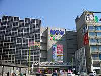 Iwatsuki Watsu shopping center, Saitama City | |
 Location of Iwatsuki-ku in Saitama | |
 Iwatsuki-ku, Saitama | |
| Coordinates: 35°56′59.9″N 139°41′39.5″E / 35.949972°N 139.694306°ECoordinates: 35°56′59.9″N 139°41′39.5″E / 35.949972°N 139.694306°E | |
| Country | Japan |
| Region | Kantō |
| Prefecture | Saitama |
| City | Saitama |
| Area | |
| • Total | 49.17 km2 (18.98 sq mi) |
| Population (February 2016) | |
| • Total | 109,901 |
| • Density | 2,240/km2 (5,800/sq mi) |
| Time zone | UTC+9 (Japan Standard Time) |
| -Flower | Kerria japonica |
| Phone number | 048-835-3156 |
| Address |
3-2-5 Honcho, Iwatsuki-ku, Saitama-shi, Saitama-ken 339-8585 |
| Website |
www |
Iwatsuki-ku (岩槻区 Iwatsuki-ku) is one of ten wards of the city of Saitama, in Saitama Prefecture, Japan, and is located in the northeastern part of the city. As of 1 February 2016, the ward had an estimated population of 109,901 and a population density of 2,240 persons per km². Its total area was 49.17 square kilometres (18.98 sq mi).
Geography
Iwasuki Ward is within the Kantō Plain, in the northeast portion of Saitama City.
Neighboring Municipalities
Iwatsuki-ku is surrounded by Minuma-ku (west), Midori-ku (southwest), and the cities of Kawaguchi (south), Koshigaya (southeast), Kasukabe (northeast), Shiraoka (north), and Hasuda (northwest).
History
Iwatsuki developed from the Muromachi period as a castle town next to Iwatsuki Castle and the center of Iwatsuki Domain under the Edo period Tokugawa shogunate. It was also a post town on the Nikkō Onari Kaidō connecting Edo with Nikko.
The modern town of Iwatsuki created within Minamisaitama District, Saitama with the establishment of the municipalities system on April 1, 1889. On May 3, 1954 Iwatsuki merged with the neighboring villages of Niiwa, Wado, Kawadori, Kashiwazaki, Kawai and Jionji and was elevated to city status on July 1 1954. On April 1, 2005 Iwatsuki merged with the city of Saitama, becoming Iwatsuki Ward.[1] Iwatsuki is known as the "City of Dolls" (人形のまち Ningyō no Machi) due to a history of doll-making that dates back to the 17th century.[2]
Education
- Mejiro University – Saitama campus
- University of Human Arts and Sciences
- Iwatsuki-ku has 15 elementary schools, eight middle schools, and four high schools, and one special education school.
Transportation
Railway
Highway
Sister cities

Local attractions
Noted people from Iwatsuki
- Takeru Satoh, actor
References
- ↑ "Saitama City" (pdf). International City Planning Association for Technical Exchanges. INEX. p. 27. Retrieved 5 November 2016.
- ↑ "Iwatsuki Area". Japan: The Official Guide. Japan National Tourism Organization. Retrieved 5 November 2016.
- ↑ "International Exchange". List of Affiliation Partners within Prefectures. Council of Local Authorities for International Relations (CLAIR). Archived from the original on 4 January 2016. Retrieved 21 November 2015.
External links
| Wikimedia Commons has media related to Iwatsuki-ku, Saitama. |
- Official website (in Japanese)