Yaita, Tochigi
| Yaita 矢板市 | |||
|---|---|---|---|
| City | |||
 Yaita City Hall | |||
| |||
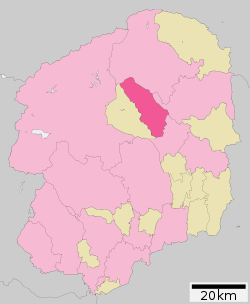 Location of Yaita in Tochigi Prefecture | |||
 Yaita | |||
| Coordinates: 36°48′24.2″N 139°55′26.8″E / 36.806722°N 139.924111°ECoordinates: 36°48′24.2″N 139°55′26.8″E / 36.806722°N 139.924111°E | |||
| Country | Japan | ||
| Region | Kantō | ||
| Prefecture | Tochigi Prefecture | ||
| Government | |||
| • Mayor | Jyunichiro Saito <齋藤淳一郎> (from April 2016) | ||
| Area | |||
| • Total | 170.46 km2 (65.81 sq mi) | ||
| Population (May 2015) | |||
| • Total | 33,542 | ||
| • Density | 197/km2 (510/sq mi) | ||
| Time zone | UTC+9 (Japan Standard Time) | ||
| - Tree | Japanese stuartia | ||
| - Flower | Japanese azalea | ||
| - Bird | Oriental turtle dove | ||
| Phone number | 0287-43-1111 | ||
| Address | 5-4 Honcho, Yaita-shi, Tochigi-ken 329-2192 | ||
| Website | http://www.city.yaita.tochigi.jp/ | ||


Yaita (矢板市 Yaita-shi) is a city located in Tochigi Prefecture, Japan. As of May 2015, the city had an estimated population of 33,524, and a population density of 297 persons per km². Its total area is 170.46 square kilometres (65.81 sq mi).
Geography
Yaita is located in north-central Tochigi Prefecture in the foothills of the Nasu region. The area is well watered, with numerous springs and rivers.
Surrounding municipalities
History
Yaita, Izumi and Kataoka villages were created within Shioya District on April 1, 1889 with the creation of the municipalities system. Yaita was elevated to town status on June 25, 1895. Yaita annexed Izumi and Kataoka on January 1, 1955. It was elevated to city status on November 1, 1958.
Economy
Agriculture (primarily rice) and forestry are mainstays of the local economy. The consumer electronics company Sharp has a large factory in Yaita.
Education
Yaita has nine primary schools, three middle schools and three high schools.
Transportation
Railway
Highway
- Tohoku Expressway – Yaita IC, Yaita-Kita PA
- Japan National Route 4
- Japan National Route 461
Local attractions
- Yamagata Aritomo Memorial House
- Yaita onsen
External links
![]()
- Official Website (in Japanese)
| Core city | ||
|---|---|---|
| Cities | ||
| Districts | ||
♯