Ōtama, Fukushima
| Ōtama 大玉村 | |||
|---|---|---|---|
| Village | |||
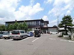 Ōtama Village Hall | |||
| |||
|
Location of Ōtama in Fukushima Prefecture | |||
 Ōtama | |||
| Coordinates: 37°32′04″N 140°22′16″E / 37.53444°N 140.37111°ECoordinates: 37°32′04″N 140°22′16″E / 37.53444°N 140.37111°E | |||
| Country | Japan | ||
| Region | Tōhoku | ||
| Prefecture | Fukushima | ||
| District | Adachi | ||
| Area | |||
| • Total | 79.44 km2 (30.67 sq mi) | ||
| Population (March 2018) | |||
| • Total | 8,670 | ||
| • Density | 110/km2 (280/sq mi) | ||
| Time zone | UTC+9 (Japan Standard Time) | ||
| City symbols | |||
| • Tree | Pinus densiflora | ||
| • Flower | Sakura | ||
| • Bird | Green pheasant | ||
| Phone number | 0243-48-3131 | ||
| Address | Tamai Hoshinai 70 Ōtama-mura, Adachi-gun, Fukushima-ken 969-1392 | ||
| Website | Official website | ||
Ōtama (大玉村 Ōtama-mura) is a village located in Fukushima Prefecture, Japan. As of 1 March 2018, the village had an estimated population of 8,670, and a population density of 110 persons per km2 in 2100 households.[1] The total area of the village was 79.44 square kilometres (30.67 sq mi). In 2016, Ōtama was selected as one of The Most Beautiful Villages in Japan.[2]
Geography
Ōtama is located in north-central Fukushima prefecture, sandwiched between the cities of Kōriyama and Nihonmatsu. Ōtama has a humid continental climate (Köppen Cfa) characterized by mild summers and cold winters with heavy snowfall. The average annual temperature in Ōtama is 10.8 °C. The average annual rainfall is 1288 mm with September as the wettest month.The temperatures are highest on average in August, at around 24.0 °C, and lowest in January, at around -1.2 °C.[3]
- Lakes: Miharu Dam
- Mountains: Mount Adatara (1728m)
- Rivers: Abukuma River
Neighboring municipalities
- Fukushima Prefecture
Demographics
Per Japanese census data,[4] the population of Ōtama has increased over the past 20 years.
| Census Year | Population |
|---|---|
| 1970 | 7,788 |
| 1980 | 7,837 |
| 1990 | 8,163 |
| 2000 | 8,407 |
| 2010 | 8,574 |
History
The area of present-day Ōtama was part of ancient Mutsu Province and the area has many burial mounds from the Kofun period. The area formed part of the holdings of Nihonmatsu Domain during the Edo period. After the Meiji Restoration, it was organized as part of Nakadōri region of Iwaki Province, administratively within Adachi District.
Ōtama Village was formed on March 31, 1955 with the merger of the villages of Oyama and Tamanoi, both in Adachi District.
Economy
The economy of Ōtama is primarily agricultural.
Education
Ōtama has two public elementary schools and one public junior high school operated by the village government. The village does not have a high school.
- Ōtama Middle School
- Ōtama Oyama Elementary School
- Ōtama Tamanoi Elementary School
Transportation
Railway
- The Tohoku Main Line passes through the village, but is not served by any passenger train stations.
Highway
International relations

References
- ↑ >"Ōtama Village Population & Households" (in Japanese). Official Ōtama village statistics. Retrieved 11 April 2018.
- ↑ > お知らせ > 新たに4つの町村・地域の正式加盟が承認されました
- ↑ Ōtama climate data
- ↑ Ōtama population statistics
External links
![]()
- Official website(in Japanese)