Kanuma, Tochigi
| Kanuma 鹿沼市 | |||
|---|---|---|---|
| City | |||
 Kanuma City Hall | |||
| |||
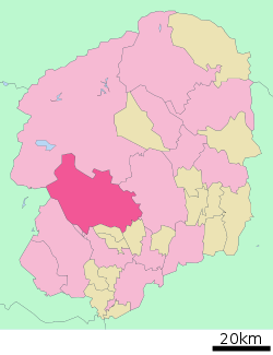 Location of Kanuma in Tochigi Prefecture | |||
 Kanuma | |||
| Coordinates: 36°34′1.5″N 139°44′42.2″E / 36.567083°N 139.745056°ECoordinates: 36°34′1.5″N 139°44′42.2″E / 36.567083°N 139.745056°E | |||
| Country | Japan | ||
| Region | Kantō | ||
| Prefecture | Tochigi Prefecture | ||
| Area | |||
| • Total | 490.64 km2 (189.44 sq mi) | ||
| Population (May 2015) | |||
| • Total | 98,883 | ||
| • Density | 202/km2 (520/sq mi) | ||
| Time zone | UTC+9 (Japan Standard Time) | ||
| - Tree | Cryptomeria | ||
| - Flower | Satsuki azalea | ||
| Phone number | 0289-64-2111 | ||
| Address | 1688-1 Imamiyachō, Kanuma-shi, Tochigi-ken 322-0068 | ||
| Website | http://www.city.kanuma.tochigi.jp/ | ||


Kanuma (鹿沼市 Kanuma-shi) is a city located in Tochigi Prefecture, Japan. As of May 2015, the city had an estimated population of 98,883, and a population density of 202 persons per km². Its total area is 490.64 km2 (189.44 sq mi).
Geography
Kanuma is located in central Tochigi Prefecture.
Surrounding municipalities
History
Kanuma was the castle town for a 25,000 koku feudal domain in the early Edo period. Even after the domain was suppressed by the Tokugawa shogunate, the area continued to prosper from its location with a number of post stations on the Nikkō Reiheishi Kaidō.
The modern city was founded on October 10, 1948. On January 1, 2006, the town of Awano (from Kamitsuga District) was merged into Kanuma.
Education
Kanuma has 28 primary schools, ten middle schools and five high schools.
Transportation
Railway
Highway
External relations


Noted people
- Guts Ishimatsu, boxer
- Hisae Watanabe, mixed martial arts fighter
- Hisashi Kurosaki, football player
- Manabu Wakabayashi, football player
- Sayaka Hirano, table tennis player
- Takeji Nara, Imperial Japanese Army general
- Tosio Kato, mathematician
- Michio Yuzawa, politician and cabinet minister
References
- ↑ Bakken, Ryan (2003-10-21). "Japanese Residents Will Dedicate New Garden". Grand Forks Herald.
External links
![]()
- Official Website (in Japanese)
| Core city | ||
|---|---|---|
| Cities | ||
| Districts | ||