Øvre Eiker
| Øvre Eiker kommune | |||
|---|---|---|---|
| Municipality | |||
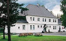
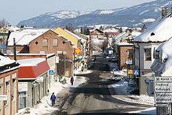 View of the village of Vestfossen | |||
| |||
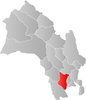 Øvre Eiker within Buskerud | |||
| Coordinates: 59°46′19″N 9°50′10″E / 59.77194°N 9.83611°ECoordinates: 59°46′19″N 9°50′10″E / 59.77194°N 9.83611°E | |||
| Country | Norway | ||
| County | Buskerud | ||
| District | Eiker, Lower Buskerud | ||
| Administrative centre | Hokksund | ||
| Government | |||
| • Mayor (2009) | Ann Sire Fjerdingstad (H) | ||
| Area | |||
| • Total | 457 km2 (176 sq mi) | ||
| • Land | 418 km2 (161 sq mi) | ||
| Area rank | #223 in Norway | ||
| Population (2005) | |||
| • Total | 15,633 | ||
| • Rank | #62 in Norway | ||
| • Density | 37/km2 (100/sq mi) | ||
| • Change (10 years) | 4.3% | ||
| Demonym(s) | Eikværing[1] | ||
| Time zone | UTC+01:00 (CET) | ||
| • Summer (DST) | UTC+02:00 (CEST) | ||
| ISO 3166 code | NO-0624 | ||
| Official language form | Bokmål | ||
| Website |
www | ||

Øvre Eiker is a municipality in Buskerud county, Norway. It is part of the traditional region of Eiker. The administrative centre of the municipality is the village of Hokksund. The old municipality of Eiker was divided into Øvre Eiker (upper Eiker) and Nedre Eiker (lower) on 1 July 1885.
General information
Name
The Old Norse form of the name was Eikjar. The name is the plural form of eiki which means "oak wood". The meaning of Øvre Eiker is "(the) upper (part of) Eiker". (The municipality of Eiker was divided in 1885.)
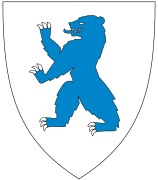
Coat-of-arms
The coat-of-arms is from modern times. They were granted on 24 October 1981. The arms show three silver oak leaves and two acorns on a blue background. The oak is a canting element, since Eik means oak in the Norwegian language.[2]
(See also coat-of-arms of Eigersund, Nedre Eiker, Songdalen and Tingvoll)
| Ancestry | Number |
|---|---|
| 611 | |
| 267 | |
| 110 | |
| 101 | |
| 96 | |
| 87 | |
| 84 | |
| 75 | |
| 70 | |
| 67 |


Geography
The municipality is located in the southern part of Buskerud county and is bordered by the municipalities of Kongsberg, Flesberg, Sigdal, Modum, Lier, Nedre Eiker, and Hof.
The administrative center of Hokksund is the largest town in this municipality, with about 8,000 inhabitants. The remaining 7,000 inhabitants live in the villages of Vestfossen, Skotselv, Ormåsen, and Darbu.
Energy
Hakavik Power Station, startpoint of 55 kV single phase AC grid for traction current.
Notable residents
- Per Olaf Lundteigen (born 1953), politician for the Centre Party
- Jonas Lie (1833–1908), novelist, poet, and playwright
- Christopher Hornsrud (1859–1960), Prime Minister of Norway
- Nikolai Eilertsen (born 1978), Norwegian bassist
International relations
Twin towns — Sister cities
The following cities are twinned with Øvre Eiker:
Gallery
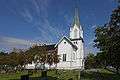 Bakke Church
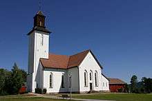 Fiskum Church
 Haug Church in Hokksund
 Øksnevann Dam
 Darbu Station
References
- ↑ "Navn på steder og personer: Innbyggjarnamn" (in Norwegian). Språkrådet. Retrieved 2015-12-01.
- ↑ Norske Kommunevåpen (1990). "Nye kommunevåbener i Norden". Retrieved 2009-01-10.
- ↑ "Immigrants and Norwegian-born to immigrant parents". ssb.no. Archived from the original on 29 July 2017. Retrieved 29 July 2017.
- ↑ "Venskabsbyer" (in Danish). Kerteminde kommune. Retrieved 2009-01-10.
- ↑ "Ystävyyskunnat" (in Finnish). Lempäälä. Retrieved 2009-01-10.
- ↑ "Föreningen Norden" (in Swedish). Ulricehamn kommun. Retrieved 2009-01-10.
External links


- Municipal fact sheet from Statistics Norway