Talence
| Talence | ||
|---|---|---|
| Commune | ||
 | ||
| ||
 Talence Location within Nouvelle-Aquitaine region  Talence | ||
| Coordinates: 44°48′00″N 0°35′02″W / 44.8°N 0.584°WCoordinates: 44°48′00″N 0°35′02″W / 44.8°N 0.584°W | ||
| Country | France | |
| Region | Nouvelle-Aquitaine | |
| Department | Gironde | |
| Arrondissement | Bordeaux | |
| Canton | Talence | |
| Intercommunality | Bordeaux | |
| Government | ||
| • Mayor (2008–2014) | Alain Cazabonne | |
| Area1 | 8.35 km2 (3.22 sq mi) | |
| Population (2008)2 | 40,576 | |
| • Density | 4,900/km2 (13,000/sq mi) | |
| Time zone | UTC+1 (CET) | |
| • Summer (DST) | UTC+2 (CEST) | |
| INSEE/Postal code | 33522 /33400 | |
| Elevation |
2–29 m (6.6–95.1 ft) (avg. 15 m or 49 ft) | |
|
1 French Land Register data, which excludes lakes, ponds, glaciers > 1 km2 (0.386 sq mi or 247 acres) and river estuaries. 2 Population without double counting: residents of multiple communes (e.g., students and military personnel) only counted once. | ||
.svg.png)
Talence is a commune in the Gironde department in Nouvelle-Aquitaine in southwestern France.
It is the third-largest suburb of the city of Bordeaux, and is adjacent to it on the south side. It is a member of the metropolitan Urban Community of Bordeaux.
Talence is the home of Décastar, a prestigious yearly international decathlon event.
In Talence, there are different universities : Bordeaux University, Architecture School of Bordeaux, Kedge Business School.
Population
| Historical population | ||
|---|---|---|
| Year | Pop. | ±% |
| 1793 | 1,489 | — |
| 1800 | 1,181 | −20.7% |
| 1806 | 1,340 | +13.5% |
| 1821 | 1,194 | −10.9% |
| 1831 | 1,322 | +10.7% |
| 1836 | 1,288 | −2.6% |
| 1841 | 1,232 | −4.3% |
| 1846 | 1,402 | +13.8% |
| 1851 | 1,434 | +2.3% |
| 1856 | 1,693 | +18.1% |
| 1861 | 2,430 | +43.5% |
| 1866 | 2,577 | +6.0% |
| 1872 | 3,604 | +39.9% |
| 1876 | 3,873 | +7.5% |
| 1881 | 4,621 | +19.3% |
| 1886 | 6,642 | +43.7% |
| 1891 | 7,921 | +19.3% |
| 1896 | 9,221 | +16.4% |
| 1901 | 11,227 | +21.8% |
| 1906 | 11,832 | +5.4% |
| 1911 | 13,224 | +11.8% |
| 1921 | 15,823 | +19.7% |
| 1926 | 17,130 | +8.3% |
| 1931 | 18,944 | +10.6% |
| 1936 | 20,380 | +7.6% |
| 1946 | 21,650 | +6.2% |
| 1954 | 22,695 | +4.8% |
| 1962 | 25,874 | +14.0% |
| 1968 | 29,161 | +12.7% |
| 1975 | 34,127 | +17.0% |
| 1982 | 34,692 | +1.7% |
| 1990 | 34,485 | −0.6% |
| 1999 | 37,210 | +7.9% |
| 2008 | 40,576 | +9.0% |
Geography
Talence is situated with Bordeaux to the North, Bègles to the East, Villenave-d'Ornon to the South-East, Gradignan to the South-West, and Pessac to the West.
Climate
| Climate data for Talence (1981–2010 averages, extremes 1959–present) | |||||||||||||
|---|---|---|---|---|---|---|---|---|---|---|---|---|---|
| Month | Jan | Feb | Mar | Apr | May | Jun | Jul | Aug | Sep | Oct | Nov | Dec | Year |
| Record high °C (°F) | 21.0 (69.8) |
25.0 (77) |
28.0 (82.4) |
30.5 (86.9) |
35.0 (95) |
39.0 (102.2) |
39.0 (102.2) |
39.5 (103.1) |
36.8 (98.2) |
32.0 (89.6) |
26.0 (78.8) |
22.6 (72.7) |
39.5 (103.1) |
| Average high °C (°F) | 10.4 (50.7) |
12.1 (53.8) |
15.4 (59.7) |
17.8 (64) |
21.8 (71.2) |
25.0 (77) |
27.4 (81.3) |
27.3 (81.1) |
24.5 (76.1) |
19.9 (67.8) |
13.8 (56.8) |
10.6 (51.1) |
18.9 (66) |
| Daily mean °C (°F) | 6.7 (44.1) |
7.7 (45.9) |
10.4 (50.7) |
12.5 (54.5) |
16.4 (61.5) |
19.5 (67.1) |
21.7 (71.1) |
21.5 (70.7) |
18.7 (65.7) |
15.0 (59) |
9.8 (49.6) |
7.0 (44.6) |
13.9 (57) |
| Average low °C (°F) | 3.0 (37.4) |
3.3 (37.9) |
5.4 (41.7) |
7.2 (45) |
11.0 (51.8) |
14.0 (57.2) |
15.9 (60.6) |
15.8 (60.4) |
12.8 (55) |
10.2 (50.4) |
5.8 (42.4) |
3.5 (38.3) |
9.0 (48.2) |
| Record low °C (°F) | −14.6 (5.7) |
−12.0 (10.4) |
−6.8 (19.8) |
−2.2 (28) |
1.1 (34) |
5.1 (41.2) |
7.5 (45.5) |
6.0 (42.8) |
4.0 (39.2) |
−2.0 (28.4) |
−6.5 (20.3) |
−11.4 (11.5) |
−14.6 (5.7) |
| Average precipitation mm (inches) | 81.5 (3.209) |
68.8 (2.709) |
63.6 (2.504) |
79.0 (3.11) |
70.1 (2.76) |
57.3 (2.256) |
47.4 (1.866) |
52.6 (2.071) |
75.6 (2.976) |
81.2 (3.197) |
98.0 (3.858) |
98.4 (3.874) |
873.5 (34.39) |
| Average precipitation days (≥ 1.0 mm) | 12.3 | 10.3 | 11.1 | 11.7 | 10.9 | 8.2 | 7.3 | 7.4 | 9.4 | 10.7 | 12.3 | 12.1 | 123.7 |
| Source: Météo France[1] | |||||||||||||
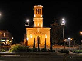
Sights
Personalities
- Romain Brégerie, footballer
- Mireille Bousquet-Mélou, mathematician
- José Bové, radical activist
- Jérôme Cahuzac, politician
- Jules Carvallo, engineer
- Gérald Cid, footballer
- Émile Durkheim, sociologist, lived from 1887 to 1897 in Talence
- Henrik, Prince Consort of Denmark
- Florian Marange, professional footballer. He plays for the left side defender at SC Bastia
- Thierry Meyssan, writer
- Ed Tourriol, cartoonist
International relations
Talence is twinned with:
See also
References
- ↑ "Talence (33)" (PDF). Fiche Climatologique: Statistiques 1981–2010 et records (in French). Meteo France. Archived from the original (PDF) on 29 March 2018. Retrieved 29 March 2018.
External links
| Wikimedia Commons has media related to Talence. |
- Official website (in French)

| Authority control |
|---|