Le Tuzan
| Le Tuzan | |
|---|---|
| Commune | |
 | |
 Le Tuzan Location within Nouvelle-Aquitaine region  Le Tuzan | |
| Coordinates: 44°27′02″N 0°34′30″W / 44.4506°N 0.575°WCoordinates: 44°27′02″N 0°34′30″W / 44.4506°N 0.575°W | |
| Country | France |
| Region | Nouvelle-Aquitaine |
| Department | Gironde |
| Arrondissement | Langon |
| Canton | Les Landes des Graves |
| Intercommunality | Pays Paroupian |
| Government | |
| • Mayor (2008–2014) | Daniel Palseur |
| Area1 | 18 km2 (7 sq mi) |
| Population (2008)2 | 212 |
| • Density | 12/km2 (31/sq mi) |
| Time zone | UTC+1 (CET) |
| • Summer (DST) | UTC+2 (CEST) |
| INSEE/Postal code | 33536 /33125 |
| Elevation |
66–87 m (217–285 ft) (avg. 85 m or 279 ft) |
|
1 French Land Register data, which excludes lakes, ponds, glaciers > 1 km2 (0.386 sq mi or 247 acres) and river estuaries. 2 Population without double counting: residents of multiple communes (e.g., students and military personnel) only counted once. | |
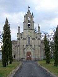
Le Tuzan is a commune in the Gironde department in Nouvelle-Aquitaine in southwestern France.
Population
| Historical population | ||
|---|---|---|
| Year | Pop. | ±% |
| 1962 | 104 | — |
| 1968 | 116 | +11.5% |
| 1975 | 127 | +9.5% |
| 1982 | 127 | +0.0% |
| 1990 | 153 | +20.5% |
| 1999 | 161 | +5.2% |
| 2008 | 212 | +31.7% |
See also
References
| Wikimedia Commons has media related to Le Tuzan. |
| Authority control |
|---|
This article is issued from
Wikipedia.
The text is licensed under Creative Commons - Attribution - Sharealike.
Additional terms may apply for the media files.