Mazères, Gironde
| Mazères | |
|---|---|
| Commune | |
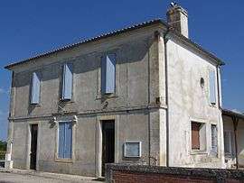 Town hall | |
 Mazères Location within Nouvelle-Aquitaine region  Mazères | |
| Coordinates: 44°29′46″N 0°15′26″W / 44.4961°N 0.2572°WCoordinates: 44°29′46″N 0°15′26″W / 44.4961°N 0.2572°W | |
| Country | France |
| Region | Nouvelle-Aquitaine |
| Department | Gironde |
| Arrondissement | Langon |
| Canton | Le Sud-Gironde |
| Intercommunality | Pays de Langon |
| Government | |
| • Mayor (2008–2014) | Michel Armand |
| Area1 | 13.14 km2 (5.07 sq mi) |
| Population (2008)2 | 638 |
| • Density | 49/km2 (130/sq mi) |
| Time zone | UTC+1 (CET) |
| • Summer (DST) | UTC+2 (CEST) |
| INSEE/Postal code | 33279 /33210 |
| Elevation |
19–124 m (62–407 ft) (avg. 84 m or 276 ft) |
|
1 French Land Register data, which excludes lakes, ponds, glaciers > 1 km2 (0.386 sq mi or 247 acres) and river estuaries. 2 Population without double counting: residents of multiple communes (e.g., students and military personnel) only counted once. | |
Mazères is a commune in the Gironde department in Nouvelle-Aquitaine in southwestern France.
Population
| Historical population | ||
|---|---|---|
| Year | Pop. | ±% |
| 1962 | 435 | — |
| 1968 | 453 | +4.1% |
| 1975 | 406 | −10.4% |
| 1982 | 383 | −5.7% |
| 1990 | 453 | +18.3% |
| 1999 | 547 | +20.8% |
| 2008 | 638 | +16.6% |
See also
References
| Wikimedia Commons has media related to Mazères (Gironde). |
This article is issued from
Wikipedia.
The text is licensed under Creative Commons - Attribution - Sharealike.
Additional terms may apply for the media files.