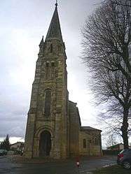
Prignac-et-Marcamps
| Prignac-et-Marcamps | ||
|---|---|---|
| Commune | ||
 | ||
| ||
 Prignac-et-Marcamps Location within Nouvelle-Aquitaine region  Prignac-et-Marcamps | ||
| Coordinates: 45°02′00″N 0°29′32″W / 45.0333°N 0.4922°WCoordinates: 45°02′00″N 0°29′32″W / 45.0333°N 0.4922°W | ||
| Country | France | |
| Region | Nouvelle-Aquitaine | |
| Department | Gironde | |
| Arrondissement | Blaye | |
| Canton | L'Estuaire | |
| Intercommunality | Canton de Bourg | |
| Government | ||
| • Mayor (2008–2014) | Max Jean-Jean | |
| Area1 | 9.66 km2 (3.73 sq mi) | |
| Population (2008)2 | 1,351 | |
| • Density | 140/km2 (360/sq mi) | |
| Time zone | UTC+1 (CET) | |
| • Summer (DST) | UTC+2 (CEST) | |
| INSEE/Postal code | 33339 /33710 | |
| Elevation |
2–42 m (6.6–137.8 ft) (avg. 22 m or 72 ft) | |
|
1 French Land Register data, which excludes lakes, ponds, glaciers > 1 km2 (0.386 sq mi or 247 acres) and river estuaries. 2 Population without double counting: residents of multiple communes (e.g., students and military personnel) only counted once. | ||
.svg.png)
Prignac-et-Marcamps is a commune in the Gironde department in Nouvelle-Aquitaine in southwestern France.
Population
| Historical population | ||
|---|---|---|
| Year | Pop. | ±% |
| 1962 | 806 | — |
| 1968 | 812 | +0.7% |
| 1975 | 1,069 | +31.7% |
| 1982 | 1,262 | +18.1% |
| 1990 | 1,268 | +0.5% |
| 1999 | 1,286 | +1.4% |
| 2008 | 1,351 | +5.1% |
See also
References
| Wikimedia Commons has media related to Prignac-et-Marcamps. |
This article is issued from
Wikipedia.
The text is licensed under Creative Commons - Attribution - Sharealike.
Additional terms may apply for the media files.