Bruges, Gironde
| Bruges | ||
|---|---|---|
| Commune | ||
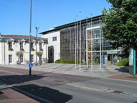 Town hall | ||
| ||
 Bruges Location within Nouvelle-Aquitaine region  Bruges | ||
| Coordinates: 44°53′01″N 0°36′41″W / 44.8836°N 0.6114°WCoordinates: 44°53′01″N 0°36′41″W / 44.8836°N 0.6114°W | ||
| Country | France | |
| Region | Nouvelle-Aquitaine | |
| Department | Gironde | |
| Arrondissement | Bordeaux | |
| Canton | Le Bouscat | |
| Intercommunality | Bordeaux | |
| Government | ||
| • Mayor (2008–2014) | Bernard Seurot | |
| Area1 | 14.22 km2 (5.49 sq mi) | |
| Population (2008)2 | 14,058 | |
| • Density | 990/km2 (2,600/sq mi) | |
| Time zone | UTC+1 (CET) | |
| • Summer (DST) | UTC+2 (CEST) | |
| INSEE/Postal code | 33075 /33520 | |
| Elevation |
1–31 m (3.3–101.7 ft) (avg. 10 m or 33 ft) | |
|
1 French Land Register data, which excludes lakes, ponds, glaciers > 1 km2 (0.386 sq mi or 247 acres) and river estuaries. 2 Population without double counting: residents of multiple communes (e.g., students and military personnel) only counted once. | ||
.svg.png)
Bruges is a commune in the Gironde department in Nouvelle-Aquitaine in southwestern France, just north of Bordeaux.
Toponymy
The homography with Bruges (Belgium) is purely coincidental. The place-name comes from Gasconic bruche, with a plural -s meaning "bushes", "scrubs".[1]
Population
| Historical population | ||
|---|---|---|
| Year | Pop. | ±% |
| 1962 | 5,349 | — |
| 1968 | 6,612 | +23.6% |
| 1975 | 7,610 | +15.1% |
| 1982 | 7,686 | +1.0% |
| 1990 | 8,753 | +13.9% |
| 1999 | 10,610 | +21.2% |
| 2008 | 14,058 | +32.5% |
Personalities
- Anthony Moura-Komenan footballer
- Mathieu Valbuena footballer
See also
References
| Wikimedia Commons has media related to Bruges (Gironde). |
This article is issued from
Wikipedia.
The text is licensed under Creative Commons - Attribution - Sharealike.
Additional terms may apply for the media files.