Saint-Laurent-du-Bois
| Saint-Laurent-du-Bois | |
|---|---|
| Commune | |
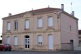 Town hall | |
 Saint-Laurent-du-Bois Location within Nouvelle-Aquitaine region  Saint-Laurent-du-Bois | |
| Coordinates: 44°38′11″N 0°08′03″W / 44.6364°N 0.1342°WCoordinates: 44°38′11″N 0°08′03″W / 44.6364°N 0.1342°W | |
| Country | France |
| Region | Nouvelle-Aquitaine |
| Department | Gironde |
| Arrondissement | Langon |
| Canton | L'Entre-Deux-Mers |
| Intercommunality | Coteaux Macariens |
| Government | |
| • Mayor (2008–2014) | Colette Dubosc |
| Area1 | 7.41 km2 (2.86 sq mi) |
| Population (2008)2 | 229 |
| • Density | 31/km2 (80/sq mi) |
| Time zone | UTC+1 (CET) |
| • Summer (DST) | UTC+2 (CEST) |
| INSEE/Postal code | 33427 /33540 |
| Elevation |
37–97 m (121–318 ft) (avg. 87 m or 285 ft) |
|
1 French Land Register data, which excludes lakes, ponds, glaciers > 1 km2 (0.386 sq mi or 247 acres) and river estuaries. 2 Population without double counting: residents of multiple communes (e.g., students and military personnel) only counted once. | |
Saint-Laurent-du-Bois is a commune in the Gironde department in Nouvelle-Aquitaine in southwestern France.
Population
| Historical population | ||
|---|---|---|
| Year | Pop. | ±% |
| 1962 | 266 | — |
| 1968 | 272 | +2.3% |
| 1975 | 236 | −13.2% |
| 1982 | 205 | −13.1% |
| 1990 | 216 | +5.4% |
| 1999 | 216 | +0.0% |
| 2008 | 229 | +6.0% |
See also
References
| Wikimedia Commons has media related to Saint-Laurent-du-Bois. |
| Authority control |
|---|
This article is issued from
Wikipedia.
The text is licensed under Creative Commons - Attribution - Sharealike.
Additional terms may apply for the media files.