Langoiran
| Langoiran | ||
|---|---|---|
| Commune | ||
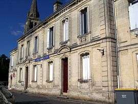 Town hall | ||
| ||
 Langoiran Location within Nouvelle-Aquitaine region  Langoiran | ||
| Coordinates: 44°42′30″N 0°24′00″W / 44.7083°N 0.4°WCoordinates: 44°42′30″N 0°24′00″W / 44.7083°N 0.4°W | ||
| Country | France | |
| Region | Nouvelle-Aquitaine | |
| Department | Gironde | |
| Arrondissement | Langon | |
| Canton | L'Entre-Deux-Mers | |
| Intercommunality | Vallon de l'Artolie | |
| Government | ||
| • Mayor (2008–2014) | Raoul Orsoni | |
| Area1 | 10.14 km2 (3.92 sq mi) | |
| Population (2008)2 | 2,116 | |
| • Density | 210/km2 (540/sq mi) | |
| Time zone | UTC+1 (CET) | |
| • Summer (DST) | UTC+2 (CEST) | |
| INSEE/Postal code | 33226 /33550 | |
| Elevation |
2–101 m (6.6–331.4 ft) (avg. 64 m or 210 ft) | |
|
1 French Land Register data, which excludes lakes, ponds, glaciers > 1 km2 (0.386 sq mi or 247 acres) and river estuaries. 2 Population without double counting: residents of multiple communes (e.g., students and military personnel) only counted once. | ||
.svg.png)
Langoiran is a commune in the Gironde department in Nouvelle-Aquitaine in southwestern France.
Population
| Historical population | ||
|---|---|---|
| Year | Pop. | ±% |
| 1962 | 1,571 | — |
| 1968 | 1,695 | +7.9% |
| 1975 | 1,660 | −2.1% |
| 1982 | 2,007 | +20.9% |
| 1990 | 2,024 | +0.8% |
| 1999 | 1,997 | −1.3% |
| 2008 | 2,116 | +6.0% |
Personalities
It is the birthplace of French footballer Alain Giresse who played in the 1986 World Cup.
See also
References
External links
| Wikimedia Commons has media related to Langoiran. |
This article is issued from
Wikipedia.
The text is licensed under Creative Commons - Attribution - Sharealike.
Additional terms may apply for the media files.