Sauternes, Gironde
| Sauternes | ||
|---|---|---|
| Commune | ||
 | ||
| ||
 Sauternes Location within Nouvelle-Aquitaine region  Sauternes | ||
| Coordinates: 44°31′58″N 0°20′29″W / 44.5328°N 0.3414°WCoordinates: 44°31′58″N 0°20′29″W / 44.5328°N 0.3414°W | ||
| Country | France | |
| Region | Nouvelle-Aquitaine | |
| Department | Gironde | |
| Arrondissement | Langon | |
| Canton | Le Sud-Gironde | |
| Government | ||
| • Mayor (2008–2014) | Jean-Michel Descamps | |
| Area1 | 11.32 km2 (4.37 sq mi) | |
| Population (2008)2 | 706 | |
| • Density | 62/km2 (160/sq mi) | |
| Time zone | UTC+1 (CET) | |
| • Summer (DST) | UTC+2 (CEST) | |
| INSEE/Postal code | 33504 /33210 | |
| Elevation |
13–89 m (43–292 ft) (avg. 80 m or 260 ft) | |
|
1 French Land Register data, which excludes lakes, ponds, glaciers > 1 km2 (0.386 sq mi or 247 acres) and river estuaries. 2 Population without double counting: residents of multiple communes (e.g., students and military personnel) only counted once. | ||
.svg.png)
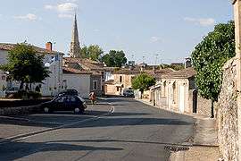
Sauternes is a commune in the Gironde department in Nouvelle-Aquitaine in southwestern France.
It is also a wine region within the Graves portion of Bordeaux that produces sweet white dessert wines, named "Sauternes" after the commune, as well as some dry white wine.
Population
| Historical population | ||
|---|---|---|
| Year | Pop. | ±% |
| 1962 | 524 | — |
| 1968 | 582 | +11.1% |
| 1975 | 580 | −0.3% |
| 1982 | 578 | −0.3% |
| 1990 | 589 | +1.9% |
| 1999 | 587 | −0.3% |
| 2008 | 706 | +20.3% |
See also
References
| Wikimedia Commons has media related to Sauternes. |
This article is issued from
Wikipedia.
The text is licensed under Creative Commons - Attribution - Sharealike.
Additional terms may apply for the media files.