Parempuyre
| Parempuyre | ||
|---|---|---|
| Commune | ||
 | ||
| ||
 Parempuyre Location within Nouvelle-Aquitaine region  Parempuyre | ||
| Coordinates: 44°57′00″N 0°36′14″W / 44.95°N 0.6039°WCoordinates: 44°57′00″N 0°36′14″W / 44.95°N 0.6039°W | ||
| Country | France | |
| Region | Nouvelle-Aquitaine | |
| Department | Gironde | |
| Arrondissement | Bordeaux | |
| Canton | Les Portes du Médoc | |
| Intercommunality | Bordeaux | |
| Government | ||
| • Mayor (2008–2014) | Béatrice De François | |
| Area1 | 21.8 km2 (8.4 sq mi) | |
| Population (2008)2 | 7,409 | |
| • Density | 340/km2 (880/sq mi) | |
| Time zone | UTC+1 (CET) | |
| • Summer (DST) | UTC+2 (CEST) | |
| INSEE/Postal code | 33312 /33290 | |
| Elevation |
0–15 m (0–49 ft) (avg. 7 m or 23 ft) | |
|
1 French Land Register data, which excludes lakes, ponds, glaciers > 1 km2 (0.386 sq mi or 247 acres) and river estuaries. 2 Population without double counting: residents of multiple communes (e.g., students and military personnel) only counted once. | ||
.svg.png)
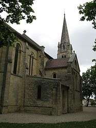
Parempuyre is a commune in the Gironde department in Nouvelle-Aquitaine in southwestern France.
Population
| Historical population | ||
|---|---|---|
| Year | Pop. | ±% |
| 1962 | 1,166 | — |
| 1968 | 1,670 | +43.2% |
| 1975 | 2,148 | +28.6% |
| 1982 | 3,541 | +64.9% |
| 1990 | 5,481 | +54.8% |
| 1999 | 6,613 | +20.7% |
| 2008 | 7,409 | +12.0% |
See also
References
| Wikimedia Commons has media related to Parempuyre. |

This article is issued from
Wikipedia.
The text is licensed under Creative Commons - Attribution - Sharealike.
Additional terms may apply for the media files.