Cours-les-Bains
| Cours-les-Bains | |
|---|---|
| Commune | |
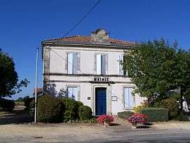 Town hall | |
 Cours-les-Bains Location within Nouvelle-Aquitaine region  Cours-les-Bains | |
| Coordinates: 44°22′53″N 0°01′03″W / 44.3814°N 0.0175°WCoordinates: 44°22′53″N 0°01′03″W / 44.3814°N 0.0175°W | |
| Country | France |
| Region | Nouvelle-Aquitaine |
| Department | Gironde |
| Arrondissement | Langon |
| Canton | Le Sud-Gironde |
| Intercommunality | Captieux-Grignols |
| Government | |
| • Mayor (2008–2014) | Etienne Labardin |
| Area1 | 10.43 km2 (4.03 sq mi) |
| Population (2008)2 | 216 |
| • Density | 21/km2 (54/sq mi) |
| Time zone | UTC+1 (CET) |
| • Summer (DST) | UTC+2 (CEST) |
| INSEE/Postal code | 33137 /33690 |
| Elevation |
85–167 m (279–548 ft) (avg. 148 m or 486 ft) |
|
1 French Land Register data, which excludes lakes, ponds, glaciers > 1 km2 (0.386 sq mi or 247 acres) and river estuaries. 2 Population without double counting: residents of multiple communes (e.g., students and military personnel) only counted once. | |
Cours-les-Bains is a commune in the Gironde department in Nouvelle-Aquitaine in southwestern France.
Population
| Historical population | ||
|---|---|---|
| Year | Pop. | ±% |
| 1962 | 158 | — |
| 1968 | 223 | +41.1% |
| 1975 | 201 | −9.9% |
| 1982 | 175 | −12.9% |
| 1990 | 138 | −21.1% |
| 1999 | 157 | +13.8% |
| 2008 | 216 | +37.6% |
See also
References
| Wikimedia Commons has media related to Cours-les-Bains. |
This article is issued from
Wikipedia.
The text is licensed under Creative Commons - Attribution - Sharealike.
Additional terms may apply for the media files.