Saint-Loubès
| Saint-Loubès | ||
|---|---|---|
| Commune | ||
 | ||
| ||
 Saint-Loubès Location within Nouvelle-Aquitaine region  Saint-Loubès | ||
| Coordinates: 44°55′05″N 0°25′37″W / 44.9181°N 0.4269°WCoordinates: 44°55′05″N 0°25′37″W / 44.9181°N 0.4269°W | ||
| Country | France | |
| Region | Nouvelle-Aquitaine | |
| Department | Gironde | |
| Arrondissement | Bordeaux | |
| Canton | La Presqu'île | |
| Intercommunality | Secteur de Saint-Loubès | |
| Government | ||
| • Mayor (2008–2014) | Pierre Durand | |
| Area1 | 25.07 km2 (9.68 sq mi) | |
| Population (2008)2 | 7,793 | |
| • Density | 310/km2 (810/sq mi) | |
| Time zone | UTC+1 (CET) | |
| • Summer (DST) | UTC+2 (CEST) | |
| INSEE/Postal code | 33433 /33450 | |
| Elevation |
1–57 m (3.3–187.0 ft) (avg. 10 m or 33 ft) | |
|
1 French Land Register data, which excludes lakes, ponds, glaciers > 1 km2 (0.386 sq mi or 247 acres) and river estuaries. 2 Population without double counting: residents of multiple communes (e.g., students and military personnel) only counted once. | ||
.svg.png)
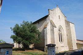
Saint-Loubès is a commune in the Gironde department in Nouvelle-Aquitaine in southwestern France. The Assyriologist René Labat (1904–1974) was born in Saint-Loubès.
Population
| Historical population | ||
|---|---|---|
| Year | Pop. | ±% |
| 1962 | 3,068 | — |
| 1968 | 3,328 | +8.5% |
| 1975 | 4,027 | +21.0% |
| 1982 | 4,956 | +23.1% |
| 1990 | 6,207 | +25.2% |
| 1999 | 7,089 | +14.2% |
| 2008 | 7,793 | +9.9% |
See also
References
| Wikimedia Commons has media related to Saint-Loubès. |
This article is issued from
Wikipedia.
The text is licensed under Creative Commons - Attribution - Sharealike.
Additional terms may apply for the media files.