San Dimas, California
| San Dimas, California | |
|---|---|
| City | |
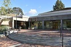 City hall | |
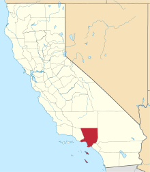
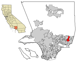 Location within California and Los Angeles County | |
| Coordinates: 34°6′10″N 117°48′58″W / 34.10278°N 117.81611°WCoordinates: 34°6′10″N 117°48′58″W / 34.10278°N 117.81611°W | |
| Country |
|
| State |
|
| County |
|
| Incorporated | August 4, 1960[1] |
| Government | |
| • Type | City council/city manager[2] |
| • Mayor | Curtis W. Morris[3] |
| • City Council[4] |
Denis Bertone Emmett Badar John Ebiner Ryan A. Vienna |
| • City manager | Blaine Michaelis[5] |
| Area[6] | |
| • Total | 15.43 sq mi (39.96 km2) |
| • Land | 15.04 sq mi (38.95 km2) |
| • Water | 0.39 sq mi (1.01 km2) 2.53% |
| Elevation[7] | 955 ft (291 m) |
| Population (2010) | |
| • Total | 33,371 |
| • Estimate (2016)[8] | 34,338 |
| • Density | 2,283.57/sq mi (881.66/km2) |
| Time zone | UTC-8 (PST) |
| • Summer (DST) | UTC-7 (PDT) |
| ZIP code | 91773[9] |
| Area code | 909[10] |
| FIPS code | 06-66070 |
| GNIS feature IDs | 1652785, 2411784 |
| Website | cityofsandimas.com |
San Dimas is a city in the San Gabriel Valley of Los Angeles County, California, United States. As of the 2010 census, the city had a total population of 33,371. The city historically took its name from San Dismas Canyon in the San Gabriel Mountains above the northern section of present-day San Dimas. San Dimas is named in Spanish after Saint Dismas.[11]
History
The first known European exploration of the area was in 1774, when Juan Bautista De Anza passed through on the first overland expedition of Las Californias, from New Spain-Mexico towards Monterey Bay. The area was originally developed in 1837 with the Mexican land grant from Governor Juan Bautista Alvarado to Ygnacio Palomares and Ricardo Vejar for the Rancho San Jose, then in Alta California.[12] It later became known as La Cienega Mud Springs, so named because of local mud springs that created a riparian marsh and healing place. Palomares and Vejar conducted sheep and cattle operations on Rancho San Jose, also growing crops for consumption by the residents of the rancho. In the early 1860s, a severe drought decimated the ranch's population of sheep and cattle. Ygnacio Palomares died in 1864, and his widow began selling the ranch land in 1865. Vejar lost his share by foreclosure to two Los Angeles merchants, Isaac Schlesinger and Hyman Tischler, in 1864. In 1866, Schlesinger and Tischler sold the ranch to Louis Phillips.[13]
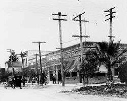
It was the arrival of the Los Angeles and San Gabriel Valley Railroad in 1887, later purchased by Santa Fe Railroad, that led to La Cienega Mud Springs being first mapped.[14][15] The ensuing land boom resulted in the formation of the San Jose Ranch Company, which first laid out streets. Small businesses began to open soon thereafter, and the city took on a new name: San Dimas. Growth was rapid, and San Dimas soon became an agricultural community. Wheat and other Midwestern United States crops were planted first; then orange and lemon groves covered the town and the San Gabriel Valley. At one time, four citrus packing houses and a marmalade factory were located in San Dimas. The Sunkist name originated here, first spelled "Sunkissed."[11] Oranges were the major crop and business in San Dimas until the mid-20th century.
San Dimas incorporated as a city in 1960, and is now known for its western art, small town feel and equestrian qualities.[16][17] In the 1990s San Dimas was also host to the Miss Rodeo California State Pageant,[18] run by A. F. "Shorty" Feldbush and various other city volunteers. The week long pageant was held in conjunction with the city's Western Days and Rodeo, until the pageant moved to its new home in central California.
In 1971, the San Dimas Golf Course was purchased. In 1972, San Dimas Community Hospital opened its 92-bed facility.
In 1981, the San Dimas Swim and Racket Club was built next to San Dimas High School, according to the San Dimas Historical Society. In 1989 San Dimas was the setting for the film Bill & Ted's Excellent Adventure, and then for the 1991 sequel Bill & Ted's Bogus Journey.
Geography
San Dimas is a suburb of Los Angeles nestled along the foothills of the San Gabriel Mountains, about 28 miles (45 km) east/northeast of Downtown Los Angeles and north of the Pacific Ocean. According to the United States Census Bureau, the city has a total area of 15.4 sq. mi.. 15.0 sq mi (39 km2) of it is land and 0.39 sq mi (1.0 km2) of it is water. Cinnamon Creek crosses the city, roughly parallel to the Arrow Highway, before reaching Cinnamon Falls near San Dimas Avenue.
San Dimas runs along and southward from historic U.S. Route 66, another part of its development in the earlier 20th century. Other major arteries include Arrow Highway (east–west) and San Dimas Avenue (north–south). The Foothill Freeway (I-210) connects the town to Pasadena and the San Fernando Valley, with California State Route 57 connecting to Orange County and the beaches.
Climate
This region experiences hot and dry summers, with no average monthly temperatures above 71.6 °F (22.0 °C). According to the Köppen climate classification system, San Dimas has a warm-summer Mediterranean climate, abbreviated "Csb" on climate maps.[19]
Demographics
| Historical population | |||
|---|---|---|---|
| Census | Pop. | %± | |
| 1970 | 15,692 | — | |
| 1980 | 24,014 | 53.0% | |
| 1990 | 32,397 | 34.9% | |
| 2000 | 34,980 | 8.0% | |
| 2010 | 33,371 | −4.6% | |
| Est. 2016 | 34,338 | [8] | 2.9% |
| U.S. Decennial Census[20] | |||
2010 census
The 2010 United States Census[21] reported that San Dimas had a population of 33,371. The population density was 2,163.1 people per square mile (835.2/km²). The racial makeup of San Dimas was 24,038 (72.0%) White with (52.3%) being non-Hispanic white[22] 1,084 (3.2%) African American, 233 (0.7%) Native American, 3,496 (10.5%) Asian, 48 (0.1%) Pacific Islander, 2,828 (8.5%) from other races, and 1,644 (4.9%) from two or more races. Hispanic or Latino of any race were 10,491 persons (31.4%).
The Census reported that 32,831 people (98.4% of the population) lived in households, 320 (1.0%) lived in non-institutionalized group quarters, and 220 (0.7%) were institutionalized.
There were 12,030 households, out of which 3,877 (32.2%) had children under the age of 18 living in them, 6,604 (54.9%) were opposite-sex married couples living together, 1,462 (12.2%) had a female householder with no husband present, 613 (5.1%) had a male householder with no wife present. There were 542 (4.5%) unmarried opposite-sex partnerships, and 91 (0.8%) same-sex married couples or partnerships. 2,668 households (22.2%) were made up of individuals and 1,270 (10.6%) had someone living alone who was 65 years of age or older. The average household size was 2.73. There were 8,679 families (72.1% of all households); the average family size was 3.19.
The population was spread out with 6,989 people (20.9%) under the age of 18, 3,277 people (9.8%) aged 18 to 24, 7,536 people (22.6%) aged 25 to 44, 10,386 people (31.1%) aged 45 to 64, and 5,183 people (15.5%) who were 65 years of age or older. The median age was 42.6 years. For every 100 females, there were 90.5 males. For every 100 females age 18 and over, there were 86.8 males.
There were 12,506 housing units at an average density of 810.6 per square mile (313.0/km²), of which 8,757 (72.8%) were owner-occupied, and 3,273 (27.2%) were occupied by renters. The homeowner vacancy rate was 1.1%; the rental vacancy rate was 5.6%. 24,492 people (73.4% of the population) lived in owner-occupied housing units and 8,339 people (25.0%) lived in rental housing units.
According to the 2010 United States Census, San Dimas had a median household income of $78,685, with 6.6% of the population living below the federal poverty line.[22]
2000 census
As of the census[23] of 2000, there were 34,980 people, 12,163 households, and 8,988 families residing in the city. The population density was 2,255.7 inhabitants per square mile (870.8/km²). There were 12,503 housing units at an average density of 806.3 per square mile (311.2/km²). The racial makeup of the city was 74.66% White, 3.30% African American, 0.69% Native American, 9.39% Asian, 0.21% Pacific Islander, 7.34% from other races, and 4.39% from two or more races. 23.34% of the population were Hispanic or Latino of any race.
There are 12,163 households out of which 35.5% have children under the age of 18 living with them, 57.7% are married couples living together, 11.6% have a female householder with no husband present, and 26.1% are non-families. 21.0% of all households are made up of individuals and 8.7% have someone living alone who is 65 years of age or older. The average household size is 2.78 and the average family size is 3.23.
In the city, the population was spread out with 25.5% under the age of 18, 8.9% from 18 to 24, 28.1% from 25 to 44, 25.5% from 45 to 64, and 11.9% who are 65 years of age or older. The median age is 37 years. For every 100 females, there were 92.2 males. For every 100 females age 18 and over, there were 87.2 males.
The median income for a household in the city was $62,885, and the median income for a family was $72,124. Males had a median income of $53,009 versus $36,057 for females. The per capita income for the city was $28,321. 6.3% of the population and 3.6% of families were below the poverty line. Out of the total population, 5.9% of those under the age of 18 and 11.5% of those 65 and older were living below the poverty line.
Arts and culture
- San Dimas is home to Raging Waters theme park, one of the largest water parks in California.
- Pacific Railroad Museum – museum/library located in the former ATSF San Dimas Depot on Bonita Ave.[24]
- Pacific Railroad Society[25]
- Frank G. Bonelli Regional Park[26]
- Headquarters of Magellan Navigation, a pioneer in the Global Positioning System industry
Government
In the California State Legislature, San Dimas is in the 25th Senate District, represented by Democrat Anthony Portantino, and in the 41st Assembly District, represented by Democrat Chris Holden.[27]
In the United States House of Representatives, San Dimas is in California's 32nd congressional district, represented by Democrat Grace Napolitano.[28]
Education
The majority of the city lies within the Bonita Unified School District and students attend San Dimas High School. Students living in the Via Verde neighborhood south of Puente Ave and along San Dimas Ave. attend South Hills High School in the Covina-Valley Unified School District.[29] Small numbers of students attend school in Charter Oak Unified School District. The city is also home to Life Pacific College, a church-affiliated college that offers undergraduate and graduate degrees.[30]
Infrastructure
Law enforcement
The Los Angeles County Sheriff's Department provides law enforcement services for the city of San Dimas, and operates the San Dimas Station. [31]
Fire department
The Los Angeles County Fire Department provides fire protection services for the city of San Dimas. [32]
Health care
The Los Angeles County Department of Health Services operates the Pomona Health Center in Pomona, serving most of San Dimas.[33] Some portions of San Dimas are served by the Monrovia Health Center in Monrovia.[34]
Notable people
- Ewell Blackwell, baseball player, Cincinnati Reds[35]
- Shannan Click, fashion model
- Bill S. Preston Esq., founding member of rock group Wyld Stallyns.
- Ted Theodore Logan, founding member of rock group Wyld Stallyns.
- Jamie Dantzscher, an Olympic Gymnast in the 2000 Olympics in Sydney for the U.S. Olympic Team, attended San Dimas High School[36]
- Bill Dwyre, columnist for Los Angeles Times, lives in San Dimas
- D.J. Hackett, wide receiver most recently with the Carolina Panthers, attended San Dimas High School[37]
- Christian Jimenez, soccer player, Real Salt Lake of Major League Soccer[38]
- Ian Johnson, football player, Detroit Lions[39]
- Lela Lee, actress, comic book writer
- Alex Morgan, USA Women's Soccer Team
- Wayne Moses, football coach for the St. Louis Rams, USC, UCLA, Washington, Stanford, Pitt, San Diego State and New Mexico[40]
- Chris Pettit, baseball player, Los Angeles Dodgers, attended San Dimas High School
- P. J. Pilittere, Major League Baseball coach
- Jeremy Reed, baseball player, New York Mets[41]
- Horace Jeremiah (Jerry) Voorhis, congressman; founder of Voorhis School for Boys[42]
- Adam Wylie, actor, CBS series Picket Fences[43]
In popular culture
In the 1953 film Hondo, John Wayne's lead character is said to have a ranch just east of San Dimas.
The 1989 film Bill & Ted's Excellent Adventure and the 1991 sequel Bill & Ted's Bogus Journey were set in San Dimas, California, which in the storyline of the movie, is the "Center of the Universe" according to Bill & Ted. In actuality, the bulk of the first film was shot in and around Phoenix, Arizona, while the latter was filmed primarily in the Los Angeles area.
See also
References
- ↑ "California Cities by Incorporation Date". California Association of Local Agency Formation Commissions. Archived from the original (Word) on November 3, 2014. Retrieved August 25, 2014.
- ↑ "City Manager's Office". Retrieved 2 December 2017.
- ↑ "City Council". City of San Dimas. Retrieved December 19, 2014.
- ↑ "http://www.cityofsandimas.com/ps.citycouncil.cfm?ID=2146". External link in
|title=(help) - ↑ "http://www.cityofsandimas.com/ps.administration.cfm?ID=2336". External link in
|title=(help) - ↑ "2016 U.S. Gazetteer Files". United States Census Bureau. Retrieved Jun 28, 2017.
- ↑ "San Dimas". Geographic Names Information System. United States Geological Survey. Retrieved December 19, 2014.
- 1 2 "Population and Housing Unit Estimates". Retrieved June 9, 2017.
- ↑ "USPS – ZIP Code Lookup – Find a ZIP+ 4 Code By City Results". Retrieved 2007-01-18.
- ↑ "Number Administration System – NPA and City/Town Search Results". Retrieved 2007-01-18.
- 1 2 San Dimas Chamber of Commerce (October 2007). "A Brief History of San Dimas". California Historic Route 66 Association. Archived from the original on July 3, 2008.
- ↑ Ogden Hoffman, 1862, Reports of Land Cases Determined in the United States District Court for the Northern District of California, Numa Hubert, San Francisco
- ↑ James Miller Guinn, 1915,A history of California and an extended history of Los Angeles and environs
- ↑ "The Los Angeles and San Gabriel Valley Railroad." by Hoyt, Franklyn., Pacific Historical Review 20 (August 1951): 227–239
- ↑ "Full text of "History of Pomona Valley, California, with biographical sketches of the leading men and women of the valley who have been identified with its growth and development from the early days to the present .."". archive.org.
- ↑ "San Dimas: Community History in Words and Pictures – County of Los Angeles Public Library". colapublib.org.
- ↑ Glauthier, Martha. The History of San Dimas, California. San Dimas, CA: The San Dimas Historical Society, 1997.
- ↑ "Miss Rodeo California". Miss Rodeo California. Retrieved March 23, 2018.
- ↑ "San Dimas, California Köppen Climate Classification (Weatherbase)". Weatherbase.
- ↑ "Census of Population and Housing". Census.gov. Retrieved June 4, 2015.
- ↑ "2010 Census Interactive Population Search: CA – San Dimas city". U.S. Census Bureau. Retrieved July 12, 2014.
- 1 2 "San Dimas (city) QuickFacts from the US Census Bureau". census.gov.
- ↑ "American FactFinder". United States Census Bureau. Retrieved 2008-01-31.
- ↑ J.D. Velasco, San Dimas museum gives visitors a taste of railroad history, Pasadena Star-News, October 20, 2011
- ↑ Pacific Railroad Society, Inc. "Pacific Railroad Society". pacificrailroadsociety.org.
- ↑ "Frank G. Bonelli Regional Park". Bonelli Park Support Foundation. Retrieved April 28, 2013.
- ↑ "Statewide Database". UC Regents. Retrieved November 18, 2014.
- ↑ "California's 32nd Congressional District - Representatives & District Map". Civic Impulse, LLC.
- ↑ "Home – Covina-Valley Unified School District". cvusd.k12.ca.us. Archived from the original on April 3, 2006.
- ↑ "Academics". Life Pacific College. Retrieved December 30, 2014.
- ↑ "City of San Dimas - LA County Sheriff". www.cityofsandimas.com. Retrieved March 23, 2018.
- ↑ "City of San Dimas - LA County Fire". www.cityofsandimas.com. Retrieved March 23, 2018.
- ↑ "Pomona Health Center." Los Angeles County Department of Health Services. Retrieved on March 27, 2010.
- ↑ "Monrovia Health Center." Los Angeles County Department of Health Services. Retrieved on March 27, 2010.
- ↑ Sport Magazine, April 1948, pp. 22–25
- ↑ "UCLA Gymnastics profile". cstv.com. Archived from the original on October 30, 2006. Retrieved March 23, 2018.
- ↑ "D.J. Hackett". NFL.com.
- ↑ "Real Salt Lake player bio". mlsnet.com. Retrieved March 23, 2018.
- ↑ "Ian Johnson". ESPN.com.
- ↑ "UCLA Football profile". cstv.com. Retrieved March 23, 2018.
- ↑ "Jeremy Reed". ESPN.com.
- ↑ "VOORHIS, Horace Jeremiah (Jerry) – Biographical Information". congress.gov.
- ↑ "Yahoo! Adam Wylie profile". yahoo.com. Archived from the original on September 28, 2011.
External links
| Wikimedia Commons has media related to San Dimas, California. |
Places adjacent to San Dimas, California | |
|---|---|