La Verne, California
| La Verne, California | |
|---|---|
| City | |
| City of La Verne | |
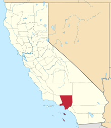
 Location of La Verne in Los Angeles County, California. | |
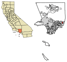
 La Verne, California Location in the United States | |
| Coordinates: 34°6′52″N 117°46′17″W / 34.11444°N 117.77139°WCoordinates: 34°6′52″N 117°46′17″W / 34.11444°N 117.77139°W | |
| Country |
|
| State |
|
| County |
|
| Incorporated | August 20, 1906[1] |
| Government | |
| • Mayor | Don Kendrick[2] |
| Area[3] | |
| • Total | 8.56 sq mi (22.18 km2) |
| • Land | 8.43 sq mi (21.84 km2) |
| • Water | 0.13 sq mi (0.34 km2) 1.54% |
| Elevation[4] | 1,060 ft (323 m) |
| Population (2010)[5] | |
| • Total | 31,063 |
| • Estimate (2016)[6] | 32,389 |
| • Density | 3,841.66/sq mi (1,483.31/km2) |
| Time zone | UTC-8 (PST) |
| • Summer (DST) | UTC-7 (PDT) |
| ZIP code | 91750[7] |
| Area code | 909[8] |
| FIPS code | 06-40830 |
| GNIS feature IDs | 1660868, 2411584 |
| Website |
ci |
La Verne is a small city in Los Angeles County, California, United States. The population was 31,063 at the 2010 census, down from 31,638 at the 2000 census.
History
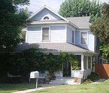
.jpg)
The history of the area dates back to the 1830s when Ygnacio Palomares received the 15,000-acre (61 km2) Rancho San Jose land grant from Governor Juan Bautista Alvarado in 1837. The land included the present day cities Pomona, Claremont, San Dimas, Glendora, and La Verne. The adobe which Palomares built in 1837 is still preserved in Pomona as La Casa Primera de Rancho San Jose (The First House). Palomares soon moved a mile or so northeast and constructed the Ygnacio Palomares Adobe. He ensured that a nephew, Jose Dolores Palomares, secured a tract of land a mile west. In the mid-1880s, entrepreneur Isaac W. Lord purchased a tract of Jose Palomares' land and convinced the Santa Fe Railroad company to run its line across towards Los Angeles. Lord had the land surveyed for building lots and in 1887 had a large land sale, naming the new town 'Lordsburg' after himself. He also had a large Lordsburg Hotel constructed, but the land boom was over by the time it was completed. It sat empty for several years, until sold to four members of the German Baptist Brethren Church, who persuaded others of that denomination that it would be an excellent site for a new institution of higher learning. Lordsburg College was founded in 1891. In 1906 the town was incorporated as "La Verne." Residents grew field crops, then began planting citrus trees, which flourished. Lordsburg became known as the "Heart of the Orange Empire." The city of La Verne flourished as a center of the citrus industry until after World War II, when the citrus industry slowly faded away. Today the last two orange groves are on the grounds of the La Verne Mansion and Heritage Park.
Geography
La Verne is a suburb 30 miles (48 km) east of Los Angeles, located in the San Gabriel Valley below the foothills of the San Gabriel Mountains. According to the United States Census Bureau, the city has a total area of 8.562 square miles (22.18 km2). It is to the east of San Dimas and to the west of Claremont. The city of Pomona lies to the south. California State Route 210 bisects La Verne in an east–west direction, and U.S. Route 66 also passes through the city.
Climate
According to the Köppen Climate Classification system, La Verne has a warm-summer Mediterranean climate, abbreviated "Csb" on climate maps.[9]
Demographics
| Historical population | |||
|---|---|---|---|
| Census | Pop. | %± | |
| 1910 | 954 | — | |
| 1920 | 1,698 | 78.0% | |
| 1930 | 2,860 | 68.4% | |
| 1940 | 3,092 | 8.1% | |
| 1950 | 4,198 | 35.8% | |
| 1960 | 6,516 | 55.2% | |
| 1970 | 12,965 | 99.0% | |
| 1980 | 23,508 | 81.3% | |
| 1990 | 30,897 | 31.4% | |
| 2000 | 31,638 | 2.4% | |
| 2010 | 31,063 | −1.8% | |
| Est. 2016 | 32,389 | [6] | 4.3% |
| U.S. Decennial Census[10] | |||
2010
The 2010 United States Census[11] reported that La Verne had a population of 31,063. The population density was 3,628.0 people per square mile (1,400.8/km²). The racial makeup of La Verne was 23,057 (74.2%) White (55.4% Non-Hispanic White),[12] 1,065 (3.4%) African American, 265 (0.9%) Native American, 2,381 (7.7%) Asian, 61 (0.2%) Pacific Islander, 2,822 (9.1%) from other races, and 1,412 (4.5%) from two or more races. Hispanic or Latino of any race were 9,635 persons (31.0%).
The Census reported that 30,387 people (97.8% of the population) lived in households, 501 (1.6%) lived in non-institutionalized group quarters, and 175 (0.6%) were institutionalized.
There were 11,261 households, out of which 3,582 (31.8%) had children under the age of 18 living in them, 6,286 (55.8%) were married couples living together, 1,438 (12.8%) had a female householder with no husband present, 489 (4.3%) had a male householder with no wife present. There were 420 (3.7%) unmarried couples living together, and 74 (0.7%) homosexuual partners living together. 2,517 households (22.4%) were made up of individuals and 1,429 (12.7%) had someone living alone who was 65 years of age or older. The average household size was 2.70. There were 8,213 families (72.9% of all households); the average family size was 3.16.
The population was spread out with 6,605 people (21.3%) under the age of 18, 3,106 people (10.0%) aged 18 to 24, 6,678 people (21.5%) aged 25 to 44, 9,417 people (30.3%) aged 45 to 64, and 5,257 people (16.9%) who were 65 years of age or older. The median age was 42.9 years. For every 100 females, there were 89.9 males. For every 100 females age 18 and over, there were 87.2 males.
There were 11,686 housing units at an average density of 1,364.9 per square mile (527.0/km²), of which 8,388 (74.5%) were owner-occupied, and 2,873 (25.5%) were occupied by renters. The homeowner vacancy rate was 1.7%; the rental vacancy rate was 5.4%. 22,995 people (74.0% of the population) lived in owner-occupied housing units and 7,392 people (23.8%) lived in rental housing units.
During 2009–2013, La Verne had a median household income of $77,040, with 7.9% of the population living below the federal poverty line.[5]
2000
As of the census[13] of 2000, there were 31,638 people, 11,070 households, and 8,346 families residing in the city. The population density was 3,805.8 inhabitants per square mile (1,470.0/km²). There were 11,286 housing units at an average density of 1,357.6 per square mile (524.4/km²). The racial makeup of the city was 77.06% White, 3.21% African American, 0.64% Native American, 7.20% Asian, 0.17% Pacific Islander, 7.42% from other races, and 4.30% from two or more races. Hispanic or Latino of any race were 23.12% of the population.
There were 11,070 households out of which 35.5% had children under the age of 18 living with them, 60.0% were married couples living together, 11.5% had a female householder with no husband present, and 24.6% were non-families. 19.6% of all households were made up of individuals and 9.6% had someone living alone who was 65 years of age or older. The average household size was 2.79 and the average family size was 3.23.
In the city, the population was spread out with 25.2% under the age of 18, 9.7% from 18 to 24, 27.4% from 25 to 44, 24.5% from 45 to 64, and 13.1% who were 65 years of age or older. The median age was 38 years. For every 100 females, there were 92.7 males. For every 100 females age 18 and over, there were 89.0 males.
As of 2007, the median income for a household in the city was $75,444, and the median income for a family was $87,915.[14] The per capita income for the city was $31,689. About 2.5% of families and 4.7% of the population were below the poverty line, including 3.6% of those under age 18 and 4.1% of those age 65 or over.
Government and infrastructure
La Verne is located in the 5th district of Los Angeles County, and is represented by supervisor Michael D. Antonovich.
In the state legislature, La Verne is in the 25th Senate District, represented by Democrat Anthony Portantino, and in the 41st Assembly District, represented by Democrat Chris Holden.[15]
In the United States House of Representatives, La Verne is in California's 32nd congressional district, represented by Democrat Grace Napolitano.[16]
The Los Angeles County Department of Health Services operates the Pomona Health Centre in Pomona, serving La Verne.[17]
Education
The University of La Verne is located on 3rd Street in La Verne.
The Bonita Unified School District serves the city. Bonita High School is located on D Street.
Lutheran High School is located on Fruit Street. Damien High School is a Catholic boys' school located at the intersection of Damien and Bonita Avenues. Calvary Baptist Schools is located at the intersection of Damien Avenue and Forestdale Street.
In popular culture
In the 1967 film The Graduate, the finale wedding scene was shot in La Verne (not Santa Barbara as presented in the movie) at the United Methodist Church of La Verne. There, Ben creates the well-known outburst, convincing Elaine to escape both the church and the life her parents planned for her. They run off onto a nearby bus (which travels southbound on D Street), not sure what they are going to do next.[18]
The wedding scene in Wayne's World 2 was filmed at the United Methodist Church of La Verne.
Law enforcement
The La Verne Police Department provides law enforcement services for the city of La Verne. [19]
In 2018, the La Verne Police Department appointed their first woman captain, Colleen Flores.[20]
Nick Paz is the current Chief of Police.[21]
Fire Department
The La Verne Fire Department provides fire protection services for the city of La Verne. [22]
Notable people
- Ewell Blackwell - Major League Baseball pitcher, Bonita High School alumnus
- Freddie Brown - National Football League wide receiver
- Noah Clarke - professional hockey player
- Glenn Davis - football player, Heisman Trophy winner, Bonita High School alumnus, class of 1943
- Jason David Frank - MMA fighter, Bonita High School alumnus
- Jeffrey Garcia - comedian, voice actor, radio DJ, has a house in La Verne
- Erin Gruwell - author of Freedom Writers, Bonita High School alumnus
- Sugar Shane Mosley - professional boxer, lives in La Verne
- Paula Jean Myers-Pope - diver, four-time Olympic medalist[23]
References
- ↑ "California Cities by Incorporation Date". California Association of Local Agency Formation Commissions. Archived from the original (Word) on November 3, 2014. Retrieved August 25, 2014.
- ↑ "City Council". City of La Verne. Retrieved January 8, 2015.
- ↑ "2016 U.S. Gazetteer Files". United States Census Bureau. Retrieved Jul 19, 2017.
- ↑ "La Verne". Geographic Names Information System. United States Geological Survey. Retrieved October 19, 2014.
- 1 2 "La Verne (city) QuickFacts". United States Census Bureau. Retrieved February 26, 2015.
- 1 2 "Population and Housing Unit Estimates". Retrieved June 9, 2017.
- ↑ "USPS - ZIP Code Lookup - Find a ZIP+ 4 Code By City Results". Retrieved 2007-01-18.
- ↑ "Number Administration System - NPA and City/Town Search Results". Archived from the original on 2007-09-26. Retrieved 2007-01-18.
- ↑ "La Verne, California Köppen Climate Classification (Weatherbase)". Weatherbase.
- ↑ "Census of Population and Housing". Census.gov. Retrieved June 4, 2015.
- ↑ "2010 Census Interactive Population Search: CA - La Verne city". U.S. Census Bureau. Retrieved July 12, 2014.
- ↑ "Census data". quickfacts.census.gov.
- ↑ "American FactFinder". United States Census Bureau. Retrieved 2008-01-31.
- ↑ Bureau, U.S. Census. "American FactFinder - Community Facts". factfinder.census.gov.
- ↑ "Statewide Database". UC Regents. Retrieved November 21, 2014.
- ↑ "California's 32nd Congressional District - Representatives & District Map". Civic Impulse, LLC.
- ↑ "Pomona Health Centre." Los Angeles County Department of Health Services. Retrieved on March 27, 2010.
- ↑ news.moviefone.com http://news.moviefone.com/2010/05/05/famous-movie-locations-church-from-the-graduate-la-verne-california/. Retrieved 2014-10-19. Missing or empty
|title=(help) - ↑ "City of La Verne - Police". www.ci.la-verne.ca.us.
- ↑ "LVPD appoints first woman captain | Campus Times". lvcampustimes.org. Retrieved 2018-05-23.
- ↑ "City of LaVerne Police Department - La Verne Police Department". La Verne Police Department. Retrieved 2018-05-23.
- ↑ "City of La Verne - Fire". www.ci.la-verne.ca.us.
- ↑ "Paula Jean Myers Pope; Olympic Medalist". Los Angeles Times. June 13, 1995.
External links
![]()
Places adjacent to La Verne, California | |
|---|---|