Aurant, California
| Aurant | |
|---|---|
| Unincorporated community | |
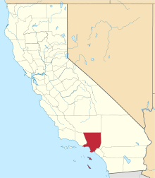
 Aurant Location in California  Aurant Aurant (the US) | |
| Coordinates: 34°04′41″N 118°09′51″W / 34.07806°N 118.16417°WCoordinates: 34°04′41″N 118°09′51″W / 34.07806°N 118.16417°W | |
| Country | United States |
| State | California |
| County | Los Angeles County |
| Elevation[1] | 433 ft (132 m) |
| GNIS feature ID | 1660282 |
Aurant is an unincorporated community adjacent to Alhambra in the Eastside Los Angeles region of Los Angeles County, California.[1]
Geography
The area is between Alhambra Avenue and the northern terminus of the Long Beach Freeway at Valley Boulevard.
It lies at an elevation of 433 feet (132 m).[1]
References
This article is issued from
Wikipedia.
The text is licensed under Creative Commons - Attribution - Sharealike.
Additional terms may apply for the media files.